
Size of this preview:
600 × 600 pixels. Other resolutions:
240 × 240 pixels |
480 × 480 pixels |
900 × 900 pixels.
Original file (900 × 900 pixels, file size: 1.32 MB, MIME type: image/png)
| This is a file from the
Wikimedia Commons. Information from its
description page there is shown below. Commons is a freely licensed media file repository. You can help. |
Summary
| Description |
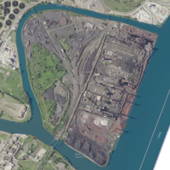
English: Absurdres stitch of USGS aerial imagery of part of the
Detroit River. |
|||
| Source | NASA tool at worldwind.earth, USGS Topo Imagery map layer | |||
| Author | USGS, self | |||
| Permission ( Reusing this file) |
|
|||
| Other versions |

Licensing
This file is licensed under the
Creative Commons
Attribution-Share Alike 4.0 International license.
- You are free:
- to share – to copy, distribute and transmit the work
- to remix – to adapt the work
- Under the following conditions:
- attribution – You must give appropriate credit, provide a link to the license, and indicate if changes were made. You may do so in any reasonable manner, but not in any way that suggests the licensor endorses you or your use.
- share alike – If you remix, transform, or build upon the material, you must distribute your contributions under the same or compatible license as the original.
File history
Click on a date/time to view the file as it appeared at that time.
| Date/Time | Thumbnail | Dimensions | User | Comment | |
|---|---|---|---|---|---|
| current | 00:07, 7 April 2021 |
| 900 × 900 (1.32 MB) | JPxG | File:NASA Worldwind, USGS imagery map, Fordson Island, Michigan.png cropped 66 % horizontally, 67 % vertically using CropTool with precise mode. |
File usage
The following pages on the English Wikipedia use this file (pages on other projects are not listed):
Global file usage
The following other wikis use this file:
- Usage on ceb.wikipedia.org
- Usage on es.wikipedia.org
- Usage on www.wikidata.org