
Size of this PNG preview of this SVG file:
590 × 599 pixels. Other resolutions:
236 × 240 pixels |
472 × 480 pixels |
756 × 768 pixels |
1,008 × 1,024 pixels |
2,016 × 2,048 pixels |
1,007 × 1,023 pixels.
Original file (SVG file, nominally 1,007 × 1,023 pixels, file size: 365 KB)
| This is a file from the
Wikimedia Commons. Information from its
description page there is shown below. Commons is a freely licensed media file repository. You can help. |
Summary
| Description |
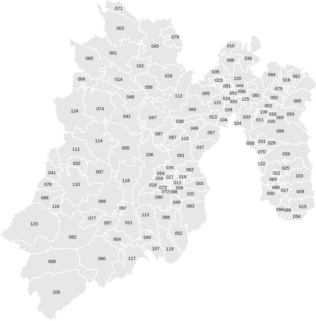
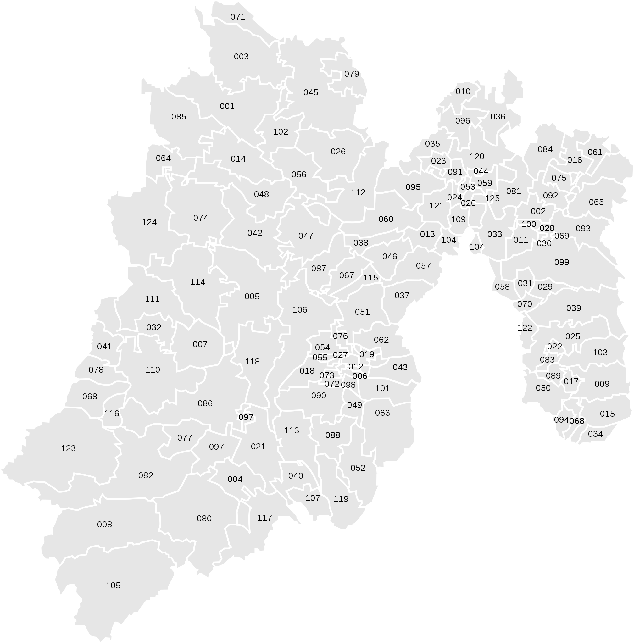
Español: Mapa de los municipios del estado de México, México.
English: Map of the Municipalties of the State of México, México. |
| Date | |
| Source | Own work |
| Author | Mircalla22 |
| Other versions | Derivative works of this file: Mapa ubicacion los reyes la paz.svg |
Licensing
I, the copyright holder of this work, hereby publish it under the following licenses:
This file is licensed under the
Creative Commons
Attribution-Share Alike 3.0 Unported license.
- You are free:
- to share – to copy, distribute and transmit the work
- to remix – to adapt the work
- Under the following conditions:
- attribution – You must give appropriate credit, provide a link to the license, and indicate if changes were made. You may do so in any reasonable manner, but not in any way that suggests the licensor endorses you or your use.
- share alike – If you remix, transform, or build upon the material, you must distribute your contributions under the same or compatible license as the original.

|
Permission is granted to copy, distribute and/or modify this document under the terms of the GNU Free Documentation License, Version 1.2 or any later version published by the Free Software Foundation; with no Invariant Sections, no Front-Cover Texts, and no Back-Cover Texts. A copy of the license is included in the section entitled GNU Free Documentation License. |
You may select the license of your choice.
File history
Click on a date/time to view the file as it appeared at that time.
| Date/Time | Thumbnail | Dimensions | User | Comment | |
|---|---|---|---|---|---|
| current | 06:18, 14 July 2009 |
| 1,007 × 1,023 (365 KB) | Mircalla22 | arregla recuadro negro. |
| 06:16, 14 July 2009 |
 | 1,007 × 1,023 (365 KB) | Mircalla22 | Reverted to version as of 23:44, 13 July 2009 | |
| 06:15, 14 July 2009 |
 | 1,007 × 1,023 (365 KB) | Mircalla22 | Fix black square. Arregla el recuadro negro. | |
| 23:44, 13 July 2009 |
 | 1,007 × 1,023 (365 KB) | Mircalla22 | {{Information |Description=*{{es icon}} Mapa de los municipios del estado de México, México. *{{en icon}} Map of the Municipalties of the State of México, México. |Source=self-made. |Date=2009-07-13 |Author= Mircalla22 |Permission |
File usage
The following pages on the English Wikipedia use this file (pages on other projects are not listed):
Global file usage
The following other wikis use this file:
- Usage on vi.wikipedia.org