
Size of this preview:
800 × 532 pixels. Other resolutions:
320 × 213 pixels |
640 × 426 pixels |
1,024 × 681 pixels |
1,280 × 851 pixels |
3,008 × 2,000 pixels.
Original file (3,008 × 2,000 pixels, file size: 5.04 MB, MIME type: image/jpeg)
| This is a file from the
Wikimedia Commons. Information from its
description page there is shown below. Commons is a freely licensed media file repository. You can help. |
Summary
|
This is an image of a place or building that is listed on the
National Register of Historic Places in the
United States of America. Its reference number is
97000344. |
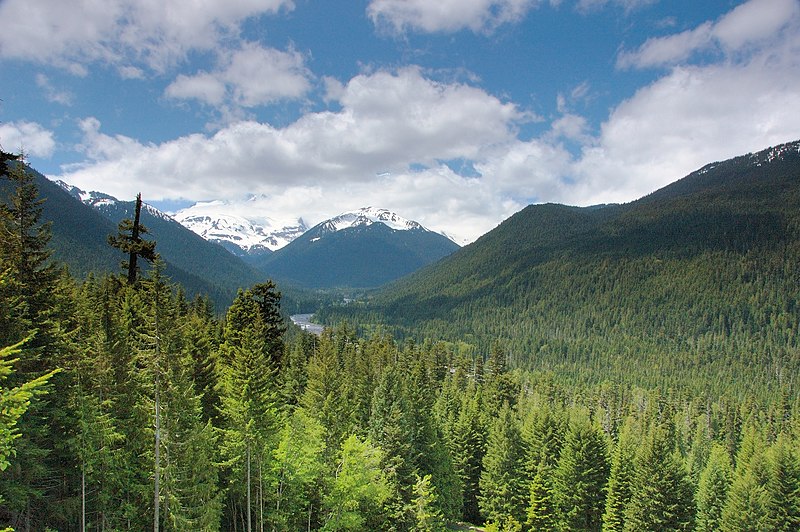
| Description | Mount Rainier National Park; view from east up the White River Valley, Frying Pan Glacier (left), Goat Island Mountain (end of valley). |
| Date | Taken on 19 June 2006 |
| Source | https://www.flickr.com/photos/vs/186075406/ |
| Author | Victor Szalvay |
| Permission ( Reusing this file) |
CC-BY-SA-2.0. |
| Object location |
| View this and other nearby images on: OpenStreetMap |
|
|---|
Licensing
This file is licensed under the
Creative Commons
Attribution-Share Alike 2.0 Generic license.
- You are free:
- to share – to copy, distribute and transmit the work
- to remix – to adapt the work
- Under the following conditions:
- attribution – You must give appropriate credit, provide a link to the license, and indicate if changes were made. You may do so in any reasonable manner, but not in any way that suggests the licensor endorses you or your use.
- share alike – If you remix, transform, or build upon the material, you must distribute your contributions under the same or compatible license as the original.
| This image was originally posted to Flickr by vsz at https://www.flickr.com/photos/55502991@N00/186075406. It was reviewed on 1 April 2008 by FlickreviewR and was confirmed to be licensed under the terms of the cc-by-sa-2.0. |
Original upload log
Transferred from en.wikipedia to Commons by Hike395.
The original description page was
here. All following user names refer to en.wikipedia.
- 2006-09-10 17:17 Arad 1024×681×8 (493504 bytes) Mount Rainier National Park * By: Victor Szalvay {{cc-by-sa-2.5}}
File history
Click on a date/time to view the file as it appeared at that time.
| Date/Time | Thumbnail | Dimensions | User | Comment | |
|---|---|---|---|---|---|
| current | 09:28, 22 November 2018 |
| 3,008 × 2,000 (5.04 MB) | Kyykaarme | Original size from Flickr |
| 03:35, 3 May 2007 |
 | 1,024 × 681 (482 KB) | Hike395 | {{Information |Description=Mount Rainier National Park; view from east up the White River Valley, Frying Pan Glacier (left), Goat Island Mountain (end of valley). * By: Victor Szalvay [http://www.flickr.com/photos/vs/186075406/] |Source=Originally from [h |
File usage
The following pages on the English Wikipedia use this file (pages on other projects are not listed):
- National Register of Historic Places listings in Lewis County, Washington
- National Register of Historic Places listings in Mount Rainier National Park
- National Register of Historic Places listings in Pierce County, Washington
- User:Arad
- Wikipedia:Featured picture candidates/Image:Mt. Rainier.jpg
- Wikipedia:Featured picture candidates/September-2006
Global file usage
The following other wikis use this file:
- Usage on de.wikipedia.org
- Usage on lt.wikipedia.org