
Size of this preview:
800 × 600 pixels. Other resolutions:
320 × 240 pixels |
640 × 480 pixels |
1,024 × 768 pixels |
1,280 × 960 pixels |
2,560 × 1,920 pixels |
4,000 × 3,000 pixels.
Original file (4,000 × 3,000 pixels, file size: 5.07 MB, MIME type: image/jpeg)
| This is a file from the
Wikimedia Commons. Information from its
description page there is shown below. Commons is a freely licensed media file repository. You can help. |
.jpg)
Summary
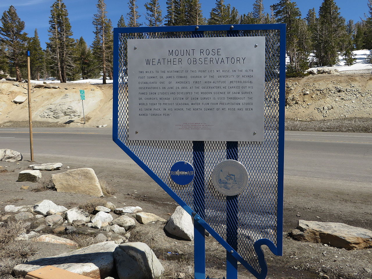
| Description | Two miles northwest of this point lies Mt. Rose, on the 10,778 foot summit. Dr. James Edward Church of the University of Nevada established one of America's first high-altitude meteorological observatories on June 29, 1905. At the observatory, he carried out his famed snow studies and developed the modern science of snow survey. Dr. Church's Nevada system of snow survey is used throughout the world today to predict seasonal water flow from precipitation stored as snow pack. In his honor, the north summit of Mt. Rose has been named "Church Peak." |
| Date | |
| Source | Mount Rose Weather Observatory, Nevada Historical Marker No. 230, Mount Rose Summit, Nevada Route 431, Nevada |
| Author | Ken Lund from Reno, Nevada, USA |
| Camera location |
| View this and other nearby images on: OpenStreetMap |
|
|---|
.jpg¶ms=039.312647_N_-119.897303_E_globe:Earth_type:camera_source:Flickr_&language=en)
Licensing
This file is licensed under the
Creative Commons
Attribution-Share Alike 2.0 Generic license.
- You are free:
- to share – to copy, distribute and transmit the work
- to remix – to adapt the work
- Under the following conditions:
- attribution – You must give appropriate credit, provide a link to the license, and indicate if changes were made. You may do so in any reasonable manner, but not in any way that suggests the licensor endorses you or your use.
- share alike – If you remix, transform, or build upon the material, you must distribute your contributions under the same or compatible license as the original.
| This image was originally posted to Flickr by Ken Lund at https://flickr.com/photos/75683070@N00/16340363263. It was reviewed on 5 December 2015 by FlickreviewR and was confirmed to be licensed under the terms of the cc-by-sa-2.0. |
File history
Click on a date/time to view the file as it appeared at that time.
| Date/Time | Thumbnail | Dimensions | User | Comment | |
|---|---|---|---|---|---|
| current | 22:09, 5 December 2015 |
| 4,000 × 3,000 (5.07 MB) | INeverCry | Transferred from Flickr via Flickr2Commons |
File usage
The following pages on the English Wikipedia use this file (pages on other projects are not listed):
.jpg)