Size of this preview:
800 × 534 pixels. Other resolutions:
320 × 214 pixels |
640 × 428 pixels |
1,024 × 684 pixels.
Original file (1,024 × 684 pixels, file size: 151 KB, MIME type: image/jpeg)
| This is a file from the
Wikimedia Commons. Information from its
description page there is shown below. Commons is a freely licensed media file repository. You can help. |
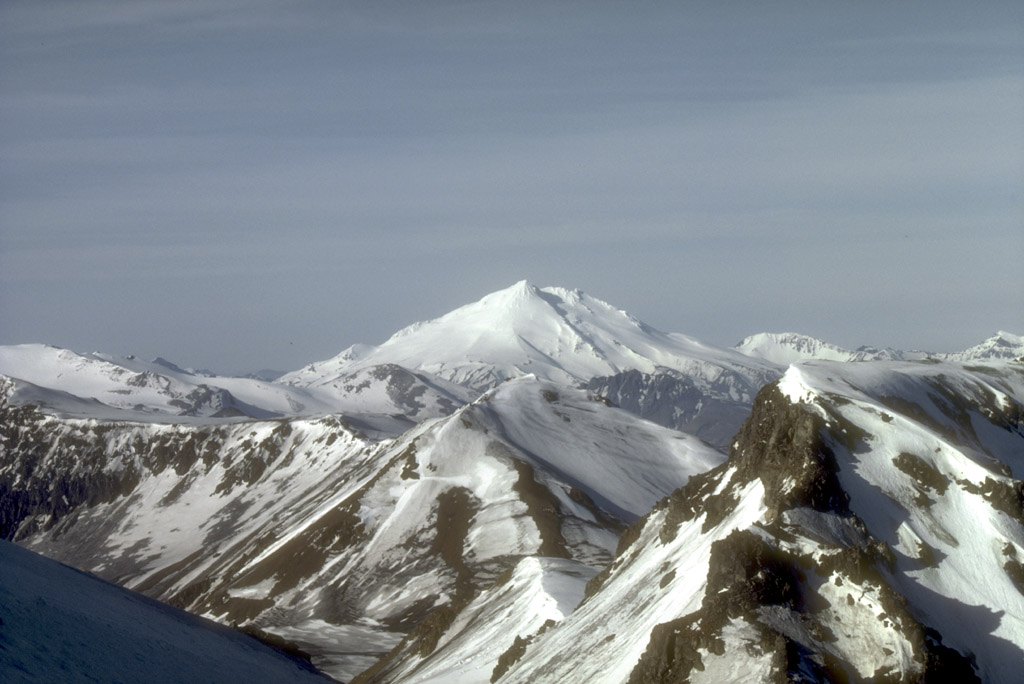
Mount Dutton, a 1,506-m (4,941 ft)-high stratovolcano, lies 14 km (9 mi) north of the community of King Cove on the Alaska Peninsula. The summit of Mount Dutton is composed of a cluster of lava domes. Mount Dutton has had no historical eruptions. However, seismic swarms beneath the volcano were recorded in 1984 to 1985 and again in 1989. View is to the southwest.
Photograph by M.E. Yount, U.S. Geological Survey, July, 1986.
Source:
http://geopubs.wr.usgs.gov/dds/dds-40/
This image is in the
public domain in the United States because it only contains materials that originally came from the
United States Geological Survey, an agency of the
United States Department of the Interior. For more information, see
the official USGS copyright policy.
|
File history
Click on a date/time to view the file as it appeared at that time.
| Date/Time | Thumbnail | Dimensions | User | Comment | |
|---|---|---|---|---|---|
| current | 09:21, 27 January 2005 |
| 1,024 × 684 (151 KB) | GarciaB~commonswiki | Mount Dutton, Alaska |
File usage
The following pages on the English Wikipedia use this file (pages on other projects are not listed):
Global file usage
The following other wikis use this file:
- Usage on arz.wikipedia.org
- Usage on ceb.wikipedia.org
- Usage on cs.wikipedia.org
- Usage on de.wikipedia.org
- Usage on lld.wikipedia.org
- Usage on ms.wikipedia.org
- Usage on no.wikipedia.org
- Usage on ru.wikipedia.org
- Usage on ur.wikipedia.org
- Usage on www.wikidata.org
- Usage on zh.wikipedia.org