Original file (3,008 × 2,000 pixels, file size: 2.57 MB, MIME type: image/jpeg)
| This is a file from the
Wikimedia Commons. Information from its
description page there is shown below. Commons is a freely licensed media file repository. You can help. |
Summary
| Camera location |
| View this and other nearby images on: OpenStreetMap |
|
|---|
| Description |
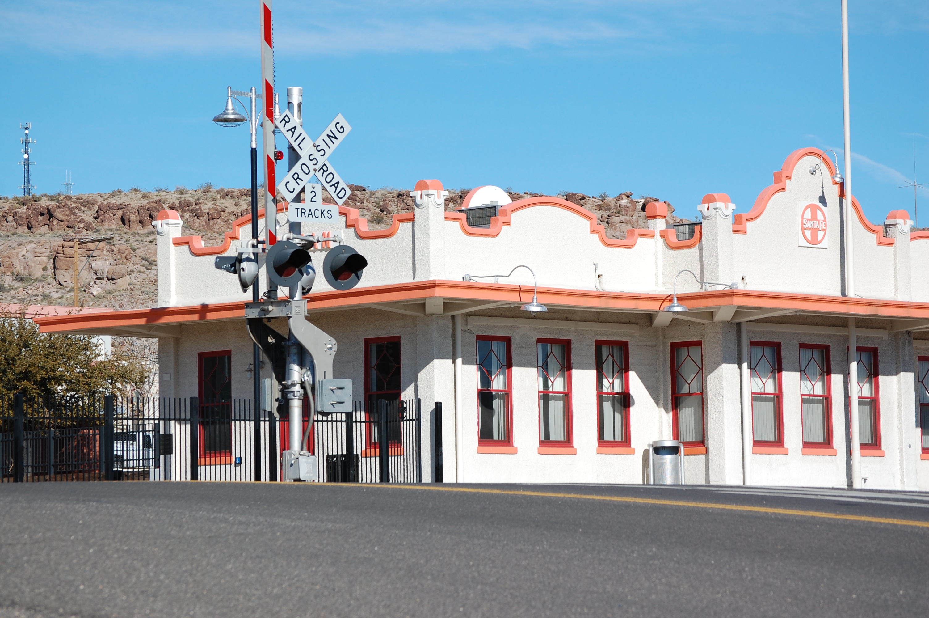
English: ATSF Train station, built in 1907, in downtown Kingman, Arizona. Constructed in the Mission Revival Style, the building completed a renovation in 2010, and is currently used to serve Amtrak customers on the Amtrak Southwest Chief route. The train typically can be seen at the station at 2-3 am daily. The station lies alongside the Southern Transcon route of the BNSF railway right-of-way, carrying trains between Chicago and Los Angeles. |
| Date | |
| Source | Own work |
| Author | Dean Cote |
Address: 106 Fourth Street, Kingman, AZ 86401
Text of the National Register of Historic Places plaque:
"Atchison, Topeka & Santa Fe Railroad Depot" "Built 1907"
"Kingman's early existence depended upon the railroad. The town's role as a shipping and commerce center was enhanced by the building of a modern, large depot during the first decade of the 20th century. The depot was built in the Mission Revival style of concrete and stucco. The curvilinear parapets, open overhanging eaves treatment, and plain stucco walls are common to the Mission Revival style."
Licensing
- You are free:
- to share – to copy, distribute and transmit the work
- to remix – to adapt the work
- Under the following conditions:
- attribution – You must give appropriate credit, provide a link to the license, and indicate if changes were made. You may do so in any reasonable manner, but not in any way that suggests the licensor endorses you or your use.
- share alike – If you remix, transform, or build upon the material, you must distribute your contributions under the same or compatible license as the original.
File history
Click on a date/time to view the file as it appeared at that time.
| Date/Time | Thumbnail | Dimensions | User | Comment | |
|---|---|---|---|---|---|
| current | 16:48, 30 June 2012 |
| 3,008 × 2,000 (2.57 MB) | Rangerdean~commonswiki |
File usage
Global file usage
The following other wikis use this file:
- Usage on de.wikivoyage.org
- Usage on en.wikivoyage.org
- Usage on nv.wikipedia.org
- Usage on uk.wikipedia.org
- Usage on www.wikidata.org