Size of this preview:
448 × 600 pixels. Other resolutions:
179 × 240 pixels |
358 × 480 pixels |
573 × 768 pixels |
1,136 × 1,521 pixels.
Original file (1,136 × 1,521 pixels, file size: 839 KB, MIME type: image/png)
| This is a file from the
Wikimedia Commons. Information from its
description page there is shown below. Commons is a freely licensed media file repository. You can help. |
Summary
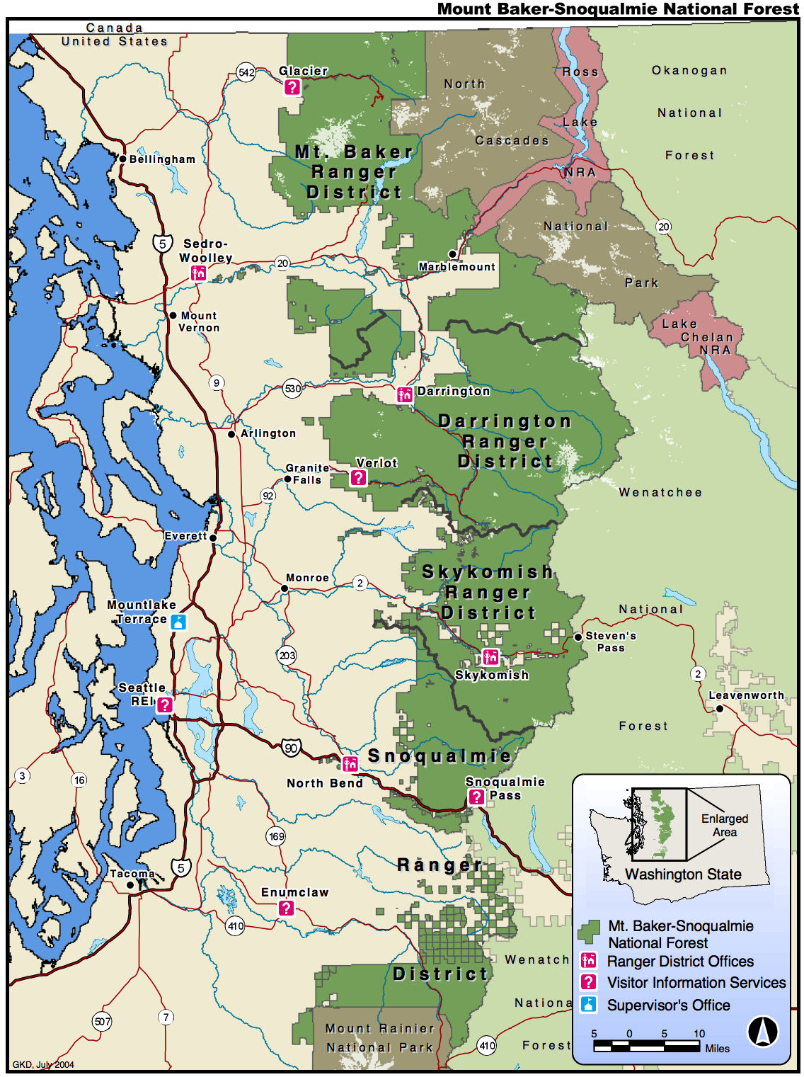
Map retrieved from U.S. Government website [1] in pdf format and converted to png
Licensing
This image is a work of the
Forest Service of the
United States Department of Agriculture. As a
work of the
U.S. federal government, the image is in the
public domain.
|
File history
Click on a date/time to view the file as it appeared at that time.
| Date/Time | Thumbnail | Dimensions | User | Comment | |
|---|---|---|---|---|---|
| current | 20:15, 1 July 2013 |
| 1,136 × 1,521 (839 KB) | Jsayre64 | crop out white space |
| 05:05, 2 January 2006 |
 | 1,275 × 1,650 (523 KB) | Wsiegmund | Map retrieved from U.S. Government website [http://www.fs.fed.us/r6/mbs/maps/mbs_map.shtml] in pdf format and converted to png |
File usage
The following pages on the English Wikipedia use this file (pages on other projects are not listed):
Global file usage
The following other wikis use this file:
- Usage on arz.wikipedia.org
- Usage on ceb.wikipedia.org
- Usage on cs.wikipedia.org
- Usage on de.wikipedia.org
- Usage on es.wikipedia.org
- Usage on fr.wikipedia.org
- Usage on www.wikidata.org