
Size of this preview:
800 × 360 pixels. Other resolutions:
320 × 144 pixels |
1,024 × 461 pixels.
Original file (1,024 × 461 pixels, file size: 414 KB, MIME type: image/jpeg)
| This is a file from the
Wikimedia Commons. Information from its
description page there is shown below. Commons is a freely licensed media file repository. You can help. |
| Description |
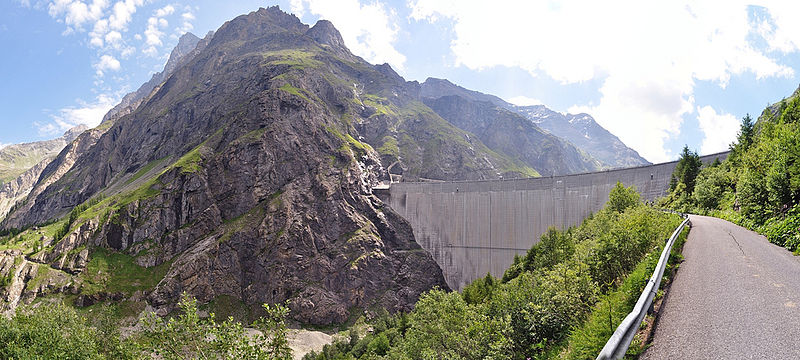
The Mauvoisin Dam at the southern end of the Lac de Mauvoisin. 250m high, and the eighth highest in the world. Taken on the seventh day of a variation of the Haute Route: Fionnay to Cabanes des Vignettes. Valais Switzerland 09/07/11 Nikon D5000 L to view large. ← & → to navigate. |
||
| Date | |||
| Source | Flickr: Mauvoisin Dam | ||
| Author | {{{1}}} | ||
| Permission ( Reusing this file) |
This file is licensed under the
Creative Commons
Attribution 2.0 Generic license.
|
File history
Click on a date/time to view the file as it appeared at that time.
| Date/Time | Thumbnail | Dimensions | User | Comment | |
|---|---|---|---|---|---|
| current | 20:43, 5 May 2013 |
| 1,024 × 461 (414 KB) | MadGeographer | Remove black corner |
| 11:37, 5 May 2013 |
 | 1,024 × 461 (330 KB) | Flickr upload bot | Uploaded from http://flickr.com/photo/9932433@N04/7297126110 using Flickr upload bot |
File usage
The following pages on the English Wikipedia use this file (pages on other projects are not listed):
Global file usage
The following other wikis use this file:
- Usage on ar.wikipedia.org
- Usage on cy.wikipedia.org
- Usage on el.wikipedia.org
- Usage on vi.wikipedia.org