Size of this preview:
587 × 599 pixels. Other resolutions:
235 × 240 pixels |
470 × 480 pixels |
752 × 768 pixels |
1,003 × 1,024 pixels |
2,006 × 2,048 pixels |
3,802 × 3,882 pixels.
Original file (3,802 × 3,882 pixels, file size: 2.07 MB, MIME type: image/jpeg)
| This is a file from the
Wikimedia Commons. Information from its
description page there is shown below. Commons is a freely licensed media file repository. You can help. |
Summary
| Description |
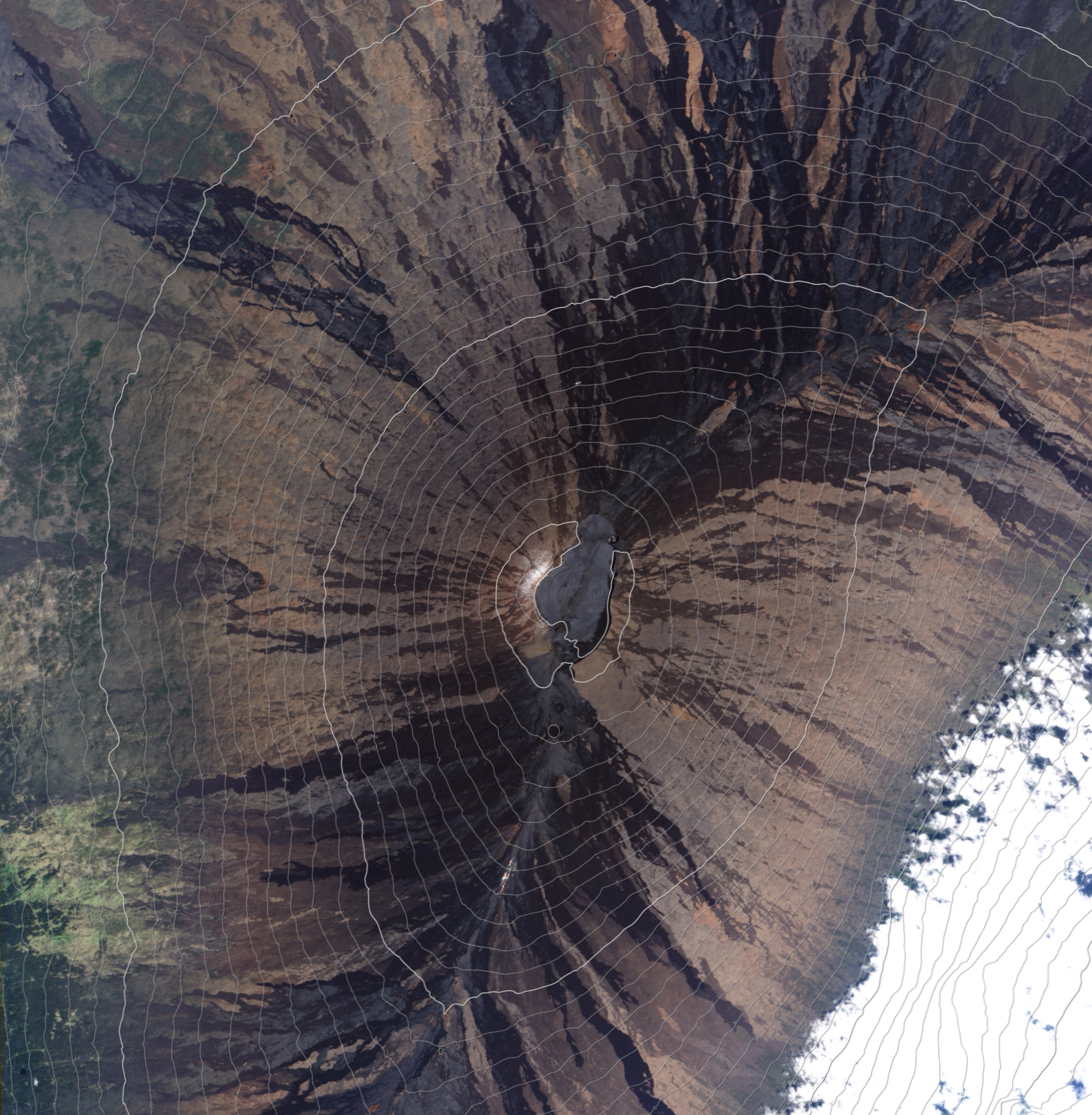
English: This natural-colour
satellite image of the summit of
Mauna Loa — overlaid with 100-meter
contour lines, helps illustrate why volcanic emissions from the summit rarely reach the
observatory.
|
| Date | |
| Source | NASA Earth Observatory |
| Author | Robert Simmon |
- This image was captured by the Advanced Land Imager (ALI) on NASA’s Earth Observing-1 (EO-1) satellite. ALI data provided by the EO-1 team.
Licensing
| This file is in the public domain in the United States because it was solely created by NASA. NASA copyright policy states that "NASA material is not protected by copyright unless noted". (See Template:PD-USGov, NASA copyright policy page or JPL Image Use Policy.) | ||
 |
Warnings:
|
| Annotations | This image is annotated: View the annotations at Commons |
File history
Click on a date/time to view the file as it appeared at that time.
| Date/Time | Thumbnail | Dimensions | User | Comment | |
|---|---|---|---|---|---|
| current | 12:06, 19 March 2010 |
| 3,802 × 3,882 (2.07 MB) | Originalwana | {{Information |Description={{en|1=This natural-colour satellite image of the summit of Mauna Loa overlaid with 100-meter contour lines helps illustrate why volcanic emissions from the summit rarely reach the [[:Category:Obs |
File usage
The following pages on the English Wikipedia use this file (pages on other projects are not listed):
Global file usage
The following other wikis use this file:
- Usage on ast.wikipedia.org
- Usage on es.wikipedia.org
- Usage on fi.wikipedia.org
- Usage on he.wikipedia.org
- Usage on mk.wikipedia.org
- Usage on no.wikipedia.org
- Usage on pt.wikipedia.org
- Usage on ru.wikipedia.org
- Usage on tr.wikipedia.org