No higher resolution available.
Massachusetts_gateway_cities_map.gif (400 × 255 pixels, file size: 26 KB, MIME type: image/gif)
Summary
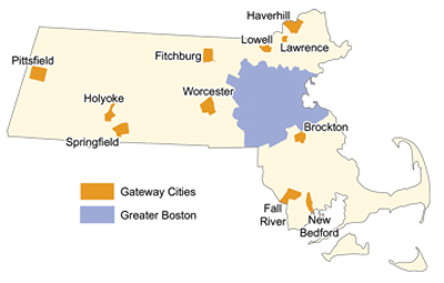
| Description | Map highlighting 11 locations in Massachusetts collectively known as the state's Gateway Cities. |
|---|---|
| Author or copyright owner |
Brookings Institution |
| Source ( WP:NFCC#4) | Original publication: Steering At-Risk, Lagging, Neglected, Draining Cities Away from the Brink and Over to that Pot of Gold Immediate http://urbancompass.net/?p=294 |
| Date of publication | 2007 |
| Use in article ( WP:NFCC#7) | Massachusetts gateway cities |
| Purpose of use in article ( WP:NFCC#8) | Map illustrates the 11 locations in Massachusetts collectively known as the state's Gateway Cities. |
| Not replaceable with free media because ( WP:NFCC#1) |
Created by educational institution for educational purposes. |
| Minimal use ( WP:NFCC#3) | Low resolution image of factually geographic basis. |
| Respect for commercial opportunities ( WP:NFCC#2) |
Created by educational institution for educational purposes. |
| Fair use Fair use of copyrighted material in the context of Massachusetts gateway cities//en.wikipedia.org/wiki/File:Massachusetts_gateway_cities_map.giftrue | |
Licensing
 | This image represents a two-dimensional work of art, such as a drawing, painting, print, or similar creation. The copyright for this image is likely owned by either the artist who created it, the individual who commissioned the work, or their legal heirs. It is believed that the use of low-resolution images of artworks:
qualifies as
fair use under
United States copyright law. Any other use of this image, whether on Wikipedia or elsewhere, could potentially constitute a
copyright infringement. For further information, please refer to
Wikipedia's guidelines on non-free content. |
File history
Click on a date/time to view the file as it appeared at that time.
| Date/Time | Thumbnail | Dimensions | User | Comment | |
|---|---|---|---|---|---|
| current | 21:21, 3 November 2012 |
| 400 × 255 (26 KB) | Hiplibrarianship ( talk | contribs) | Uploading a non-free file using File Upload Wizard |
You cannot overwrite this file.
File usage
The following pages on the English Wikipedia use this file (pages on other projects are not listed):