Size of this preview:
800 × 450 pixels. Other resolutions:
320 × 180 pixels |
640 × 360 pixels |
1,024 × 576 pixels |
1,280 × 720 pixels |
3,264 × 1,836 pixels.
Original file (3,264 × 1,836 pixels, file size: 1.51 MB, MIME type: image/jpeg)
| This is a file from the
Wikimedia Commons. Information from its
description page there is shown below. Commons is a freely licensed media file repository. You can help. |
Summary
| Description |
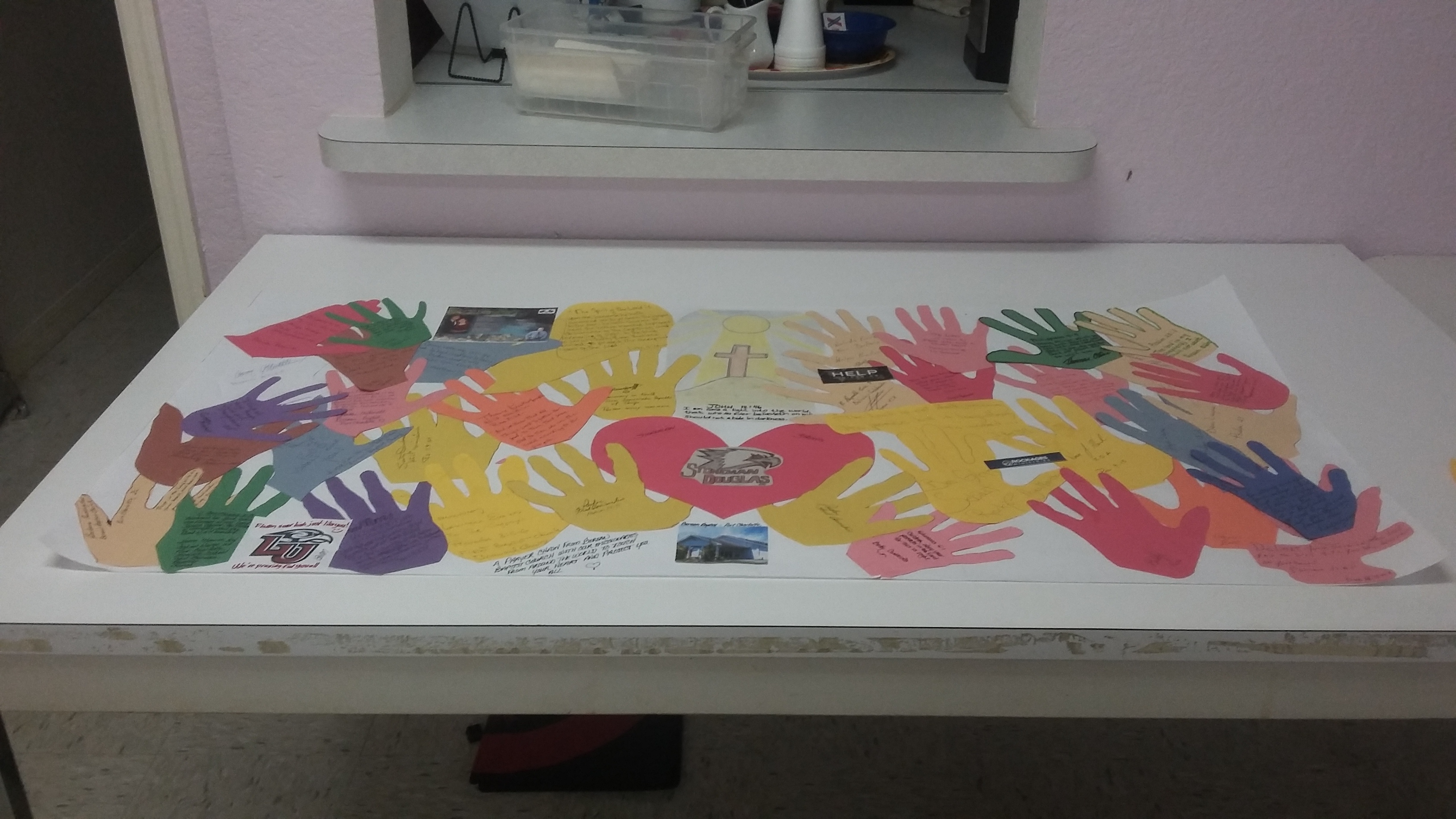
English: A banner I created, with the help of fellow members of Berean Baptist Church, for the students and staff at Marjory Stoneman Douglas High School after the the February 2018 massacre. At the request of school officials, institutions and organizations from around the world made banners offering support for the survivors; the school hung them up for display on campus. User:PCHS-NJROTC is the proper copyright holder of this work as the extent of other people participating was to cut out a profile of their hands on construction paper (something ineligible for copyright in the United States) for me to glue to the banner paper along with some prayer cards from missionaries who happened to visit the church for mission week around when the shooting happened, a picture of the church, and my university's logo, all of which are used under
de minimis as they are such small parts of the banner and are barely recognizable in this image on the Commons |
| Date | |
| Source | Own work |
| Author | PCHS-NJROTC |
| Camera location |
| View this and other nearby images on: OpenStreetMap |
|
|---|
Licensing
I, the copyright holder of this work, hereby publish it under the following license:
This file is licensed under the
Creative Commons
Attribution-Share Alike 4.0 International license.
- You are free:
- to share – to copy, distribute and transmit the work
- to remix – to adapt the work
- Under the following conditions:
- attribution – You must give appropriate credit, provide a link to the license, and indicate if changes were made. You may do so in any reasonable manner, but not in any way that suggests the licensor endorses you or your use.
- share alike – If you remix, transform, or build upon the material, you must distribute your contributions under the same or compatible license as the original.
File history
Click on a date/time to view the file as it appeared at that time.
| Date/Time | Thumbnail | Dimensions | User | Comment | |
|---|---|---|---|---|---|
| current | 13:41, 16 May 2018 |
| 3,264 × 1,836 (1.51 MB) | PCHS-NJROTC | User created page with UploadWizard |
File usage
The following pages on the English Wikipedia use this file (pages on other projects are not listed):
Global file usage
The following other wikis use this file:
- Usage on es.wikipedia.org
- Usage on pl.wikipedia.org
- Usage on vi.wikipedia.org