Size of this preview:
800 × 465 pixels. Other resolutions:
320 × 186 pixels |
640 × 372 pixels |
1,124 × 653 pixels.
Original file (1,124 × 653 pixels, file size: 147 KB, MIME type: image/jpeg)
| This is a file from the
Wikimedia Commons. Information from its
description page there is shown below. Commons is a freely licensed media file repository. You can help. |
Summary
| Description |
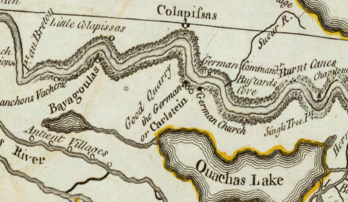
English: Map of "German Coast" of Louisiana in the 18th century. "Colapissas" marks present day LaPlace, Louisiana. |
| Date | (original map drawn); 1775 (publication) |
| Source |
Map drawn in 1718 by Guillaume Delisle. French archives.
Transwiki details:
|
| Author | Guillaume Delisle (d. 1726) |
![[1]](/info/en/?search=File:Mapofgermancoast-1775.jpg)
Licensing
|
This work is in the public domain in its country of origin and other countries and areas where the copyright term is the author's life plus 100 years or fewer. This work is in the public domain in the United States because it was published (or registered with the U.S. Copyright Office) before January 1, 1929. | |
| This file has been identified as being free of known restrictions under copyright law, including all related and neighboring rights. | |
File history
Click on a date/time to view the file as it appeared at that time.
| Date/Time | Thumbnail | Dimensions | User | Comment | |
|---|---|---|---|---|---|
| current | 00:55, 1 November 2022 |
| 1,124 × 653 (147 KB) | Infrogmation | Uploaded a work by Guillaume Delisle from Map drawn in 1718 by Guillaume Delisle. French archives. <p> Transwiki details: <br> Previously uploaded to en:w by en:w:User:Falkonry 18:21, 8 February 2010 at [/info/en/?search=File:Mapofgermancoast-1775.jpg] with UploadWizard |
File usage
The following pages on the English Wikipedia use this file (pages on other projects are not listed):
Global file usage
The following other wikis use this file:
- Usage on ar.wikipedia.org
- Usage on bn.wikipedia.org
- Usage on ms.wikipedia.org