
Size of this PNG preview of this SVG file:
400 × 600 pixels. Other resolutions:
160 × 240 pixels |
320 × 480 pixels |
512 × 768 pixels |
682 × 1,024 pixels |
1,365 × 2,048 pixels.
Original file (SVG file, nominally 400 × 600 pixels, file size: 1.13 MB)
| This is a file from the
Wikimedia Commons. Information from its
description page there is shown below. Commons is a freely licensed media file repository. You can help. |
| Description |
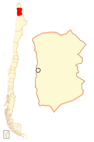
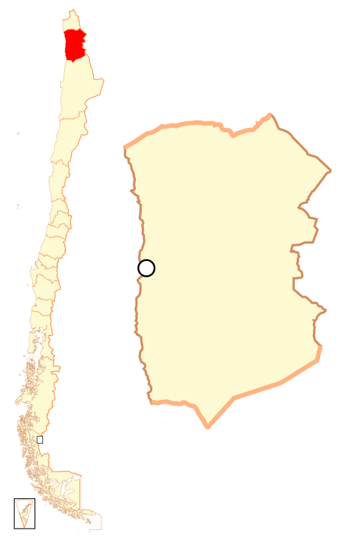
Español: Mapa localizador de la
I Región de Tarapacá. |
||
| Date | |||
| Source |
Own work
|
||
| Author | Osmar Valdebenito | ||
| Permission ( Reusing this file) |
Osmar Valdebenito, the copyright holder of this work, hereby publishes it under the following license: This file is licensed under the
Creative Commons
Attribution-Share Alike 2.5 Generic license. Attribution: Osmar Valdebenito
|
File history
Click on a date/time to view the file as it appeared at that time.
| Date/Time | Thumbnail | Dimensions | User | Comment | |
|---|---|---|---|---|---|
| current | 22:50, 5 September 2018 |
| 400 × 600 (1.13 MB) | Janitoalevic | Ñuble Region |
| 23:15, 20 August 2017 |
 | 400 × 600 (1,024 KB) | Janitoalevic | Reverted to version as of 02:02, 6 October 2007 (UTC) | |
| 04:26, 20 August 2017 |
 | 400 × 600 (1.06 MB) | Janitoalevic | Added Ñuble Region | |
| 02:02, 6 October 2007 |
 | 400 × 600 (1,024 KB) | B1mbo | {{Information |Description= {{es|Mapa localizador de la I Región de Tarapacá}} |Source=own work |Date=5 de octubre, 2007 |Author= B1mbo |Permission={{self|cc-by-sa-2.5}} |other_versions= }} {{User:B1mbo/Chile |
File usage
The following pages on the English Wikipedia use this file (pages on other projects are not listed):
Global file usage
The following other wikis use this file:
- Usage on ba.wikipedia.org
- Usage on bg.wikipedia.org
- Usage on da.wikipedia.org
- Usage on de.wikipedia.org
- Usage on diq.wikipedia.org
- Usage on es.wikipedia.org
- Usage on eu.wikipedia.org
- Usage on frr.wikipedia.org
- Usage on hr.wikipedia.org
- Usage on ja.wikipedia.org
- Usage on ka.wikipedia.org
- Usage on ko.wikipedia.org
- Usage on lad.wikipedia.org
- Usage on lt.wikipedia.org
- Usage on pl.wikipedia.org
- Usage on pt.wikipedia.org
- Usage on qu.wikipedia.org
- Usage on rm.wikipedia.org
- Usage on ru.wikipedia.org
- Usage on sk.wikipedia.org
- Usage on sv.wikipedia.org
- Usage on sw.wikipedia.org
View more global usage of this file.