
Size of this preview:
667 × 599 pixels. Other resolutions:
267 × 240 pixels |
534 × 480 pixels |
855 × 768 pixels |
1,139 × 1,024 pixels |
2,279 × 2,048 pixels |
9,525 × 8,560 pixels.
Original file (9,525 × 8,560 pixels, file size: 3.69 MB, MIME type: image/jpeg)
| This is a file from the
Wikimedia Commons. Information from its
description page there is shown below. Commons is a freely licensed media file repository. You can help. |
.jpg)
Summary
| Warning | The original file is very high-resolution. It might not load properly or could cause your browser to freeze when opened at full size. |
|---|
| Description |
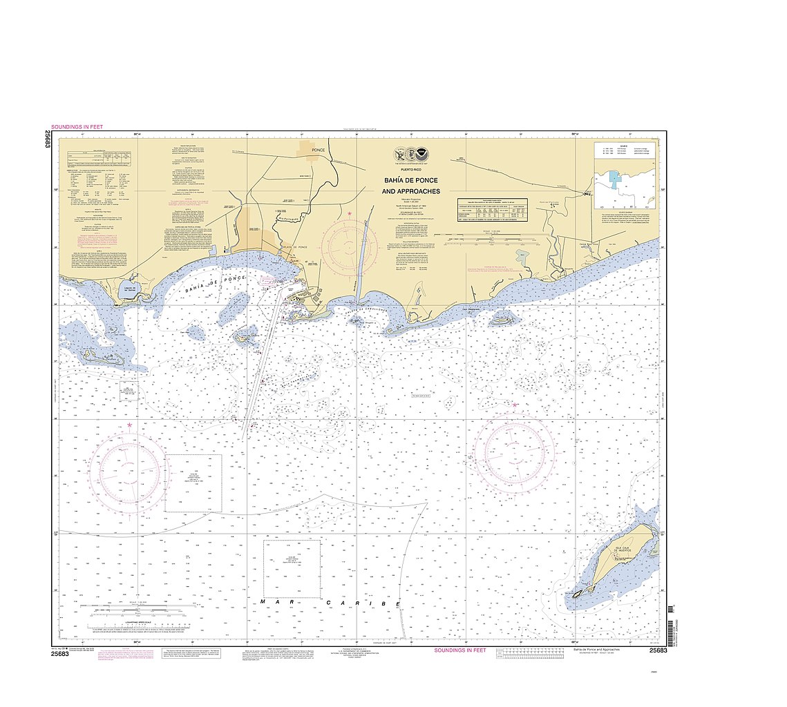
English: Mapa de la Bahía de Ponce, Puerto Rico, por NOAA, US Dept of Commerce, Oct 2012 (DP21) |
| Date | |
| Source | https://archivonacional.com/PL/1/1/12243 |
| Author | U.S. Department of Commerce, NOAA-Office of Coast Survey's Historical Map & Chart Collection |
Licensing
This image is in the
public domain because it contains materials that originally came from the U.S.
National Oceanic and Atmospheric Administration, taken or made as part of an employee's official duties.
|
File history
Click on a date/time to view the file as it appeared at that time.
| Date/Time | Thumbnail | Dimensions | User | Comment | |
|---|---|---|---|---|---|
| current | 04:02, 10 November 2018 |
| 9,525 × 8,560 (3.69 MB) | SteinsplitterBot | Bot: Image rotated by 270° |
| 02:15, 10 November 2018 |
 | 8,573 × 9,525 (3.01 MB) | Mercy11 | User created page with UploadWizard |
File usage
The following pages on the English Wikipedia use this file (pages on other projects are not listed):
.jpg)