Size of this preview:
704 × 599 pixels. Other resolutions:
282 × 240 pixels |
564 × 480 pixels |
902 × 768 pixels |
1,203 × 1,024 pixels |
1,907 × 1,623 pixels.
Original file (1,907 × 1,623 pixels, file size: 354 KB, MIME type: image/png)
| This is a file from the
Wikimedia Commons. Information from its
description page there is shown below. Commons is a freely licensed media file repository. You can help. |
_1821.PNG)
Summary
| Description |
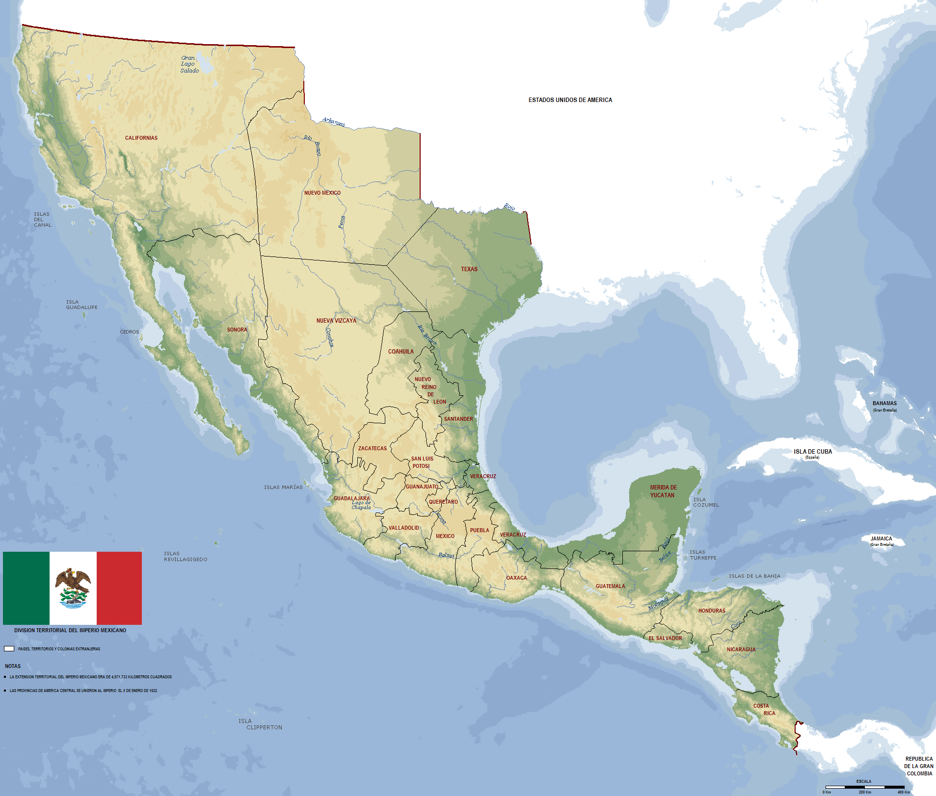
English: First Mexican Empire Map 1821
Español: Mapa del Primer Imperio Mexicano 1821 |
| Source | Own work |
| Author | Jaimiko |
Licensing
| I, the copyright holder of this work, release this work into the
public domain. This applies worldwide. In some countries this may not be legally possible; if so: I grant anyone the right to use this work for any purpose, without any conditions, unless such conditions are required by law. |
File history
Click on a date/time to view the file as it appeared at that time.
| Date/Time | Thumbnail | Dimensions | User | Comment | |
|---|---|---|---|---|---|
| current | 03:08, 22 February 2009 |
| 1,907 × 1,623 (354 KB) | Jaimiko | se agrego la escala de kilometros. |
| 03:05, 22 February 2009 |
 | 1,907 × 1,623 (353 KB) | Jaimiko | Reverted to version as of 00:35, 22 February 2009 | |
| 03:05, 22 February 2009 |
 | 1,907 × 1,623 (354 KB) | Jaimiko | se agrego la escala de km. | |
| 00:35, 22 February 2009 |
 | 1,907 × 1,623 (353 KB) | Jaimiko | {{Information |Description={{en|1=First Mexican Empire Map 1821}} {{es|1=Mapa del Primer Imperio Mexicano 1821}} |Source=trabajo propio (own work) |Author= Jaimiko |Date= |Permission= |other_versions= }} <!--{{ImageUpload|full}}--> [[Cate |
File usage
The following pages on the English Wikipedia use this file (pages on other projects are not listed):
Global file usage
The following other wikis use this file:
- Usage on bn.wikipedia.org
- Usage on es.wikipedia.org
- Usage on he.wikipedia.org
- Usage on it.wikipedia.org
- Usage on pt.wikipedia.org
- Usage on ro.wikipedia.org
_1821.PNG)