
Size of this PNG preview of this SVG file:
800 × 407 pixels. Other resolutions:
320 × 163 pixels |
640 × 325 pixels |
1,024 × 520 pixels |
1,280 × 650 pixels |
2,560 × 1,301 pixels |
3,121 × 1,586 pixels.
Original file (SVG file, nominally 3,121 × 1,586 pixels, file size: 1.67 MB)
| This is a file from the
Wikimedia Commons. Information from its
description page there is shown below. Commons is a freely licensed media file repository. You can help. |
Summary
| Description |
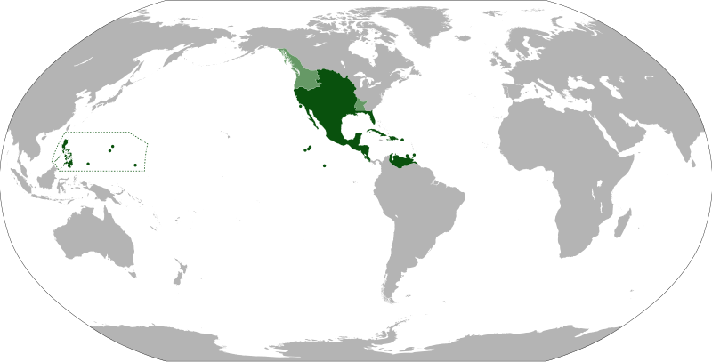
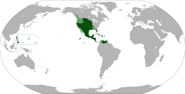
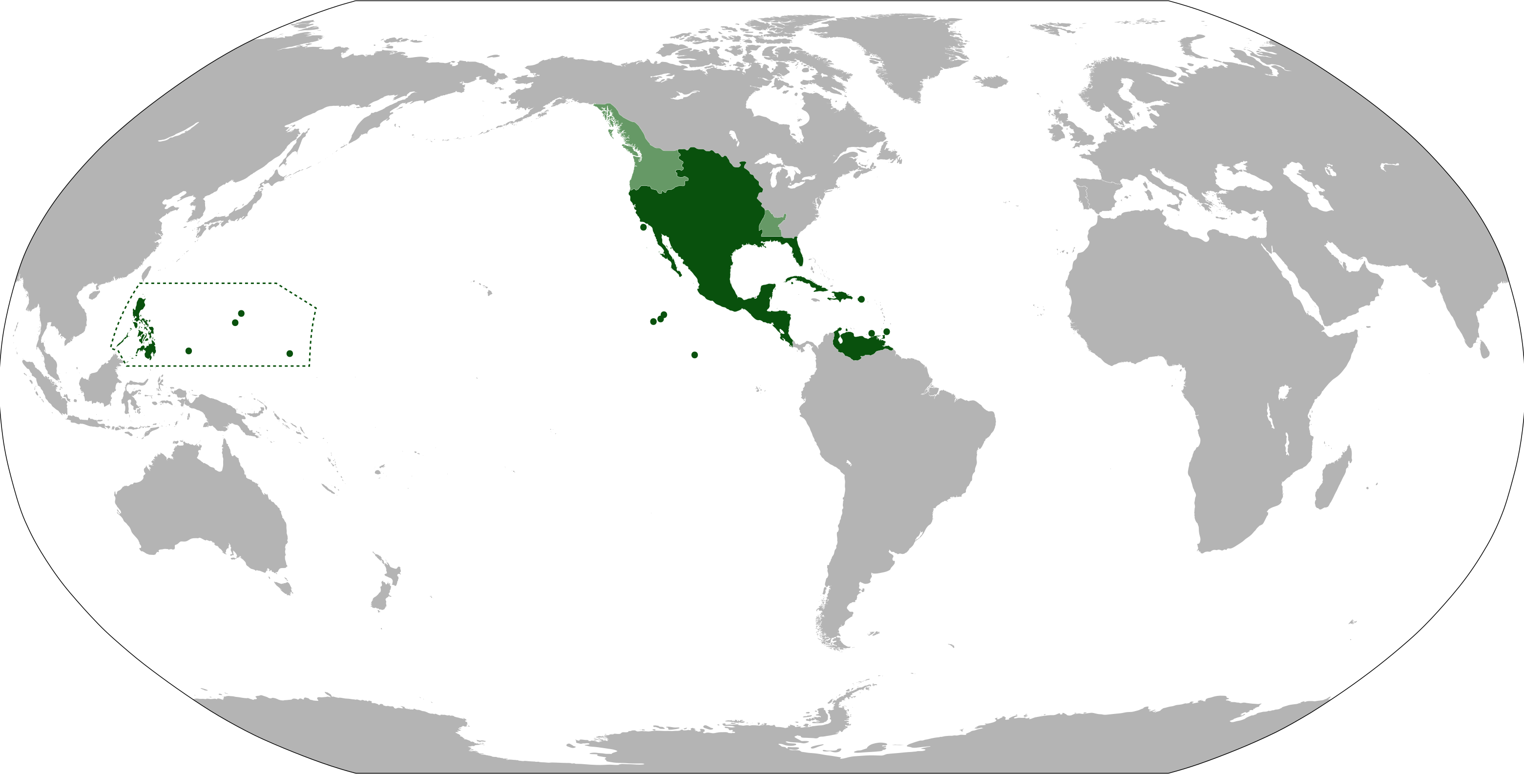
English: Anachronistic map of New Spain, built from
Image:New_Spain.png by myself and released on multi-licence (GFDL and CC-BY 2.5). This image includes the territory of Louisiana, annexed to the Spanish Empire in 1763 after the Seven Years' War, but then given back to France in 1801. The areas in light green were territories claimed by Spain. |
| Date | |
| Source | |
| Author | Eddo |
Licensing
I, the copyright holder of this work, hereby publish it under the following licenses:
This file is licensed under the
Creative Commons
Attribution-Share Alike 3.0 Unported license.
- You are free:
- to share – to copy, distribute and transmit the work
- to remix – to adapt the work
- Under the following conditions:
- attribution – You must give appropriate credit, provide a link to the license, and indicate if changes were made. You may do so in any reasonable manner, but not in any way that suggests the licensor endorses you or your use.
- share alike – If you remix, transform, or build upon the material, you must distribute your contributions under the same or compatible license as the original.

|
Permission is granted to copy, distribute and/or modify this document under the terms of the GNU Free Documentation License, Version 1.2 or any later version published by the Free Software Foundation; with no Invariant Sections, no Front-Cover Texts, and no Back-Cover Texts. A copy of the license is included in the section entitled GNU Free Documentation License. |
You may select the license of your choice.
File history
Click on a date/time to view the file as it appeared at that time.
| Date/Time | Thumbnail | Dimensions | User | Comment | |
|---|---|---|---|---|---|
| current | 11:09, 15 September 2012 |
| 3,121 × 1,586 (1.67 MB) | Milenioscuro | cambio la proyeccion, corrijo las fronteras de la Luisiana española, añado linderos de la capitanía general de las Filipinas |
| 07:26, 6 August 2012 |
 | 853 × 433 (1.5 MB) | Unukalhai | La Capitanía General de Venezuela estuvo bajo jurisdicción de la Real Audiencia de Santo Domingo, y ésta a su vez, del Virreinato de Nueva España. | |
| 00:48, 13 June 2011 |
 | 853 × 433 (1.49 MB) | Durero | More islands: the Caroline, the Marianas, Palau... | |
| 07:21, 10 September 2010 |
 | 853 × 433 (1.49 MB) | Eddo | {{Information |Description={{en|1=Anachronistic map of New Spain, built from w:Image:New_Spain.png by myself and released on multi-licence (GFDL and CC-BY 2.5). This image includes the territory of Louisiana, annexed to the Spanish Empire in 1763 after th |
File usage
The following pages on the English Wikipedia use this file (pages on other projects are not listed):
Global file usage
The following other wikis use this file:
- Usage on af.wikipedia.org
- Usage on ar.wikipedia.org
- Usage on ast.wikipedia.org
- Usage on azb.wikipedia.org
- Usage on ba.wikipedia.org
- Usage on bg.wikipedia.org
- Usage on br.wikipedia.org
- Usage on ca.wikipedia.org
- Usage on cs.wikipedia.org
- Usage on da.wikipedia.org
- Usage on de.wikipedia.org
- Usage on el.wikipedia.org
- Usage on eo.wikipedia.org
- Usage on es.wikipedia.org
- Usage on et.wikipedia.org
- Usage on eu.wikipedia.org
- Usage on fa.wikipedia.org
- Usage on fi.wikipedia.org
- Usage on fr.wikipedia.org
- Usage on gl.wikipedia.org
- Usage on he.wikipedia.org
- Usage on hu.wikipedia.org
- Usage on hy.wikipedia.org
- Usage on ia.wikipedia.org
- Usage on id.wikipedia.org
- Usage on incubator.wikimedia.org
- Usage on is.wikipedia.org
- Usage on it.wikipedia.org
- Usage on ja.wikipedia.org
View more global usage of this file.