
Size of this preview:
800 × 461 pixels. Other resolutions:
320 × 184 pixels |
640 × 368 pixels |
1,024 × 590 pixels |
1,280 × 737 pixels |
3,196 × 1,840 pixels.
Original file (3,196 × 1,840 pixels, file size: 13.14 MB, MIME type: image/png)
| This is a file from the
Wikimedia Commons. Information from its
description page there is shown below. Commons is a freely licensed media file repository. You can help. |
Summary
| Description |
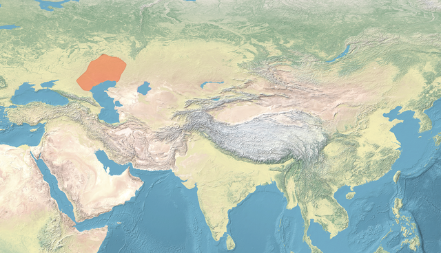
English: Map of the Kalmyk Khanate |
| Date | |
| Source | |
| Author | naturalearthdata.com, offered to the Public Domain per Terms of Use |
.png)
Licensing
This file is licensed under the
Creative Commons
Attribution-Share Alike 4.0 International license.
- You are free:
- to share – to copy, distribute and transmit the work
- to remix – to adapt the work
- Under the following conditions:
- attribution – You must give appropriate credit, provide a link to the license, and indicate if changes were made. You may do so in any reasonable manner, but not in any way that suggests the licensor endorses you or your use.
- share alike – If you remix, transform, or build upon the material, you must distribute your contributions under the same or compatible license as the original.
File history
Click on a date/time to view the file as it appeared at that time.
| Date/Time | Thumbnail | Dimensions | User | Comment | |
|---|---|---|---|---|---|
| current | 12:58, 30 March 2023 |
| 3,196 × 1,840 (13.14 MB) | पाटलिपुत्र | Uploaded a work by naturalearthdata.com, offered to the Public Domain [http://www.naturalearthdata.com/about/terms-of-use/ per Terms of Use] from {{extracted from|File:Map Asia physical (continental).png}} with UploadWizard |
File usage
The following pages on the English Wikipedia use this file (pages on other projects are not listed):
Global file usage
The following other wikis use this file:
- Usage on it.wikipedia.org
- Usage on ru.wikipedia.org