
Size of this PNG preview of this SVG file:
800 × 440 pixels. Other resolutions:
320 × 176 pixels |
640 × 352 pixels |
1,024 × 563 pixels |
1,280 × 704 pixels |
2,560 × 1,409 pixels |
5,029 × 2,767 pixels.
Original file (SVG file, nominally 5,029 × 2,767 pixels, file size: 711 KB)
| This is a file from the
Wikimedia Commons. Information from its
description page there is shown below. Commons is a freely licensed media file repository. You can help. |
.svg)

|
The boundaries on this map show the de facto situation. This is just one of several different views on the subject (see COM:NPOV). |
Summary
| Description |
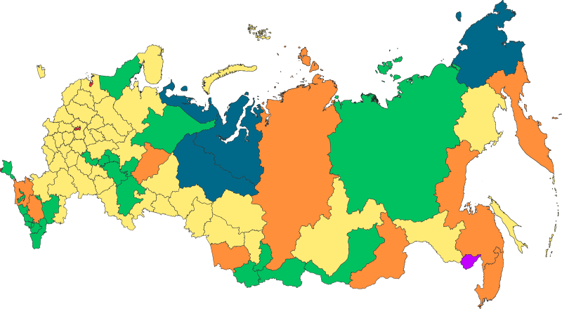
Русский: Федеративное устройство Российской Федерации с 18 марта 2014 года |
| Date | |
| Source | Own work |
| Author | Roman Poulvas |
| Other versions | File:Map of federal subjects of Russia 2014, disputed Crimea.svg |
Licensing
I, the copyright holder of this work, hereby publish it under the following license:
This file is licensed under the
Creative Commons
Attribution-Share Alike 4.0 International license.
- You are free:
- to share – to copy, distribute and transmit the work
- to remix – to adapt the work
- Under the following conditions:
- attribution – You must give appropriate credit, provide a link to the license, and indicate if changes were made. You may do so in any reasonable manner, but not in any way that suggests the licensor endorses you or your use.
- share alike – If you remix, transform, or build upon the material, you must distribute your contributions under the same or compatible license as the original.
| Annotations | This image is annotated: View the annotations at Commons |
File history
Click on a date/time to view the file as it appeared at that time.
| Date/Time | Thumbnail | Dimensions | User | Comment | |
|---|---|---|---|---|---|
| current | 13:58, 5 March 2022 |
| 5,029 × 2,767 (711 KB) | Foghe | The law of the Federation does not account for "occupied peninsula". |
| 18:43, 2 March 2022 |
 | 512 × 282 (723 KB) | Mzajac | Hatching for occupied Crimean peninsula | |
| 02:20, 2 March 2022 |
 | 5,029 × 2,767 (711 KB) | Spesh531 | Removing duplicate objects, and fixing minor mistake. Bolshoy Begichev Island was shown as part of Krasnoyarsk Krai instead of Sakha Republic. | |
| 17:44, 27 January 2020 |
 | 512 × 282 (512 KB) | Takhirgeran Umar | уточнение | |
| 10:47, 9 March 2019 |
 | 512 × 282 (499 KB) | AndreyKva | Optimized. | |
| 17:16, 30 October 2018 |
 | 512 × 282 (2.4 MB) | Roman Poulvas | По данным из шейп-файлов с нормальной проекцией: Projection: Lambert_Azimuthal_Equal_Area False_Easting: 0,0 False_Northing: 0,0 Central_Meridian: 100,0 Latitude_Of_Origin: 54,0 Linear Unit: Meter (1,0) | |
| 10:35, 13 December 2016 |
 | 1,608 × 936 (129 KB) | Roman Poulvas | Уточнены границы, добавлены примечания | |
| 13:41, 5 May 2015 |
 | 1,025 × 600 (163 KB) | Roman Poulvas | Исправлены Коми и Удмуртия | |
| 15:35, 4 May 2015 |
 | 1,025 × 600 (163 KB) | Roman Poulvas | User created page with UploadWizard |
File usage
The following pages on the English Wikipedia use this file (pages on other projects are not listed):
Global file usage
The following other wikis use this file:
- Usage on alt.wikipedia.org
- Usage on ami.wikipedia.org
- Usage on arz.wikipedia.org
- Usage on av.wikipedia.org
- Usage on azb.wikipedia.org
- Usage on az.wikipedia.org
- Usage on be-tarask.wikipedia.org
- Usage on bs.wikipedia.org
- Usage on ce.wikipedia.org
- Usage on cs.wikipedia.org
- Usage on cv.wikipedia.org
- Usage on cy.wikipedia.org
- Usage on da.wikipedia.org
- Usage on fi.wikipedia.org
- Usage on fr.wikipedia.org
- Usage on ha.wikipedia.org
- Usage on hu.wikipedia.org
- Usage on inh.wikipedia.org
- Usage on km.wikipedia.org
- Usage on ko.wikipedia.org
- Usage on lld.wikipedia.org
- Usage on mhr.wikipedia.org
- Usage on mk.wikipedia.org
- Usage on mnw.wikipedia.org
- Usage on ms.wikipedia.org
- Usage on myv.wikipedia.org
- Usage on pl.wikipedia.org
- Usage on ro.wikipedia.org
- Usage on ru.wikipedia.org
- Usage on sd.wikipedia.org
- Usage on simple.wikipedia.org
- Usage on sl.wikipedia.org
- Usage on sq.wikipedia.org
- Usage on sr.wikipedia.org
View more global usage of this file.
.svg)
.svg)