
Size of this PNG preview of this SVG file:
800 × 566 pixels. Other resolutions:
320 × 226 pixels |
640 × 453 pixels |
1,024 × 724 pixels |
1,280 × 905 pixels |
2,560 × 1,810 pixels |
1,052 × 744 pixels.
Original file (SVG file, nominally 1,052 × 744 pixels, file size: 2.33 MB)
| This is a file from the
Wikimedia Commons. Information from its
description page there is shown below. Commons is a freely licensed media file repository. You can help. |
Summary
| Description |
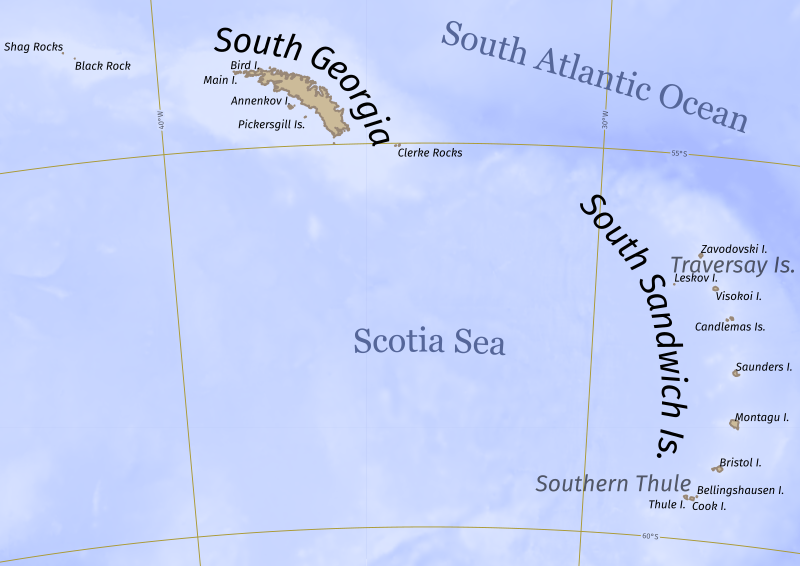
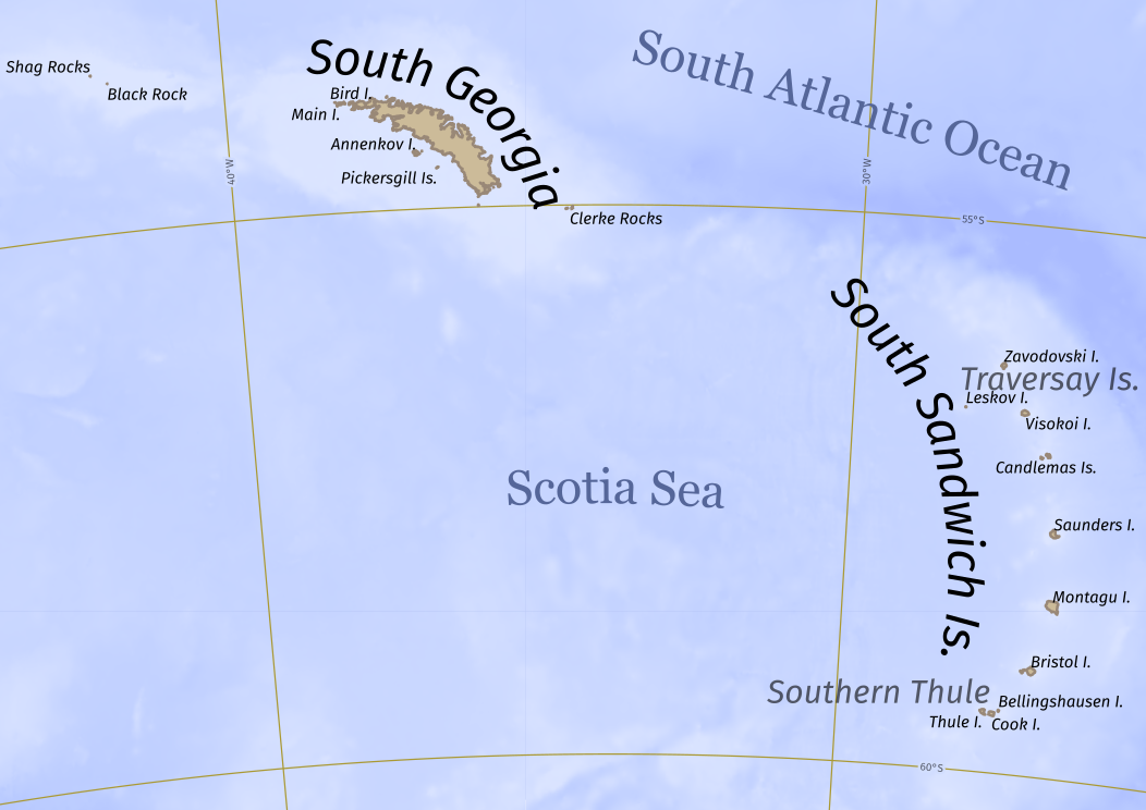
English: Contains South Georgia and the South Sandwich Islands territory and bathymetric data from OpenTopography. |
| Date | |
| Source | Own work |
| Author | Geobica |
Licensing
I, the copyright holder of this work, hereby publish it under the following license:
This file is licensed under the
Creative Commons
Attribution-Share Alike 4.0 International license.
- You are free:
- to share – to copy, distribute and transmit the work
- to remix – to adapt the work
- Under the following conditions:
- attribution – You must give appropriate credit, provide a link to the license, and indicate if changes were made. You may do so in any reasonable manner, but not in any way that suggests the licensor endorses you or your use.
- share alike – If you remix, transform, or build upon the material, you must distribute your contributions under the same or compatible license as the original.
File history
Click on a date/time to view the file as it appeared at that time.
| Date/Time | Thumbnail | Dimensions | User | Comment | |
|---|---|---|---|---|---|
| current | 04:07, 17 April 2021 |
| 1,052 × 744 (2.33 MB) | Geobica | Traversay islands label dissapeared oops |
| 03:58, 17 April 2021 |
 | 1,052 × 744 (2.32 MB) | Geobica | small labels are larger | |
| 17:30, 16 April 2021 |
 | 1,052 × 744 (2.33 MB) | Geobica | legibility | |
| 16:35, 16 April 2021 |
 | 1,052 × 744 (2.72 MB) | Geobica | moved text slightly | |
| 16:30, 16 April 2021 |
 | 1,052 × 744 (2.72 MB) | Geobica | text is 20% larger | |
| 16:13, 16 April 2021 |
 | 1,052 × 744 (2.72 MB) | Geobica | text is more legible | |
| 15:55, 16 April 2021 |
 | 1,052 × 744 (1.98 MB) | Geobica | Uploaded own work with UploadWizard |
File usage
The following pages on the English Wikipedia use this file (pages on other projects are not listed):
Global file usage
The following other wikis use this file:
- Usage on hr.wikipedia.org
- Usage on id.wikipedia.org
- Usage on tr.wikipedia.org