
Size of this preview:
800 × 591 pixels. Other resolutions:
320 × 236 pixels |
640 × 473 pixels |
1,024 × 756 pixels |
1,280 × 945 pixels |
2,560 × 1,890 pixels |
2,944 × 2,174 pixels.
Original file (2,944 × 2,174 pixels, file size: 643 KB, MIME type: image/jpeg)
| This is a file from the
Wikimedia Commons. Information from its
description page there is shown below. Commons is a freely licensed media file repository. You can help. |
Summary
| Description |
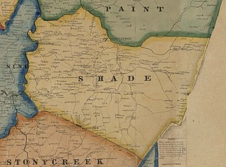
English: Map of Shade Township, Pennsylvania, taken from 1860 Edward L. Walker map of Somerset County available at the Library of Congress website |
| Date | |
| Source | https://www.loc.gov/item/2012592183/ |
| Author | Edward L. Walker |
| Camera location |
| View this and other nearby images on: OpenStreetMap |
|
|---|
Licensing
This work is in the
public domain in the
United States because it was
published (or registered with the
U.S. Copyright Office) before January 1, 1929.
Public domain works must be out of copyright in both the United States and in the source country of the work in order to be hosted on the Commons. If the work is not a U.S. work, the file must have an additional
copyright tag indicating the copyright status in the source country.
Note: This tag should not be used for sound recordings. |
File history
Click on a date/time to view the file as it appeared at that time.
| Date/Time | Thumbnail | Dimensions | User | Comment | |
|---|---|---|---|---|---|
| current | 01:32, 31 May 2020 |
| 2,944 × 2,174 (643 KB) | Michael Sechler | Uploaded a work by Edward L. Walker from https://www.loc.gov/item/2012592183/ with UploadWizard |
File usage
The following pages on the English Wikipedia use this file (pages on other projects are not listed):