
Size of this PNG preview of this SVG file:
800 × 345 pixels. Other resolutions:
320 × 138 pixels |
640 × 276 pixels |
1,024 × 441 pixels |
1,280 × 551 pixels |
2,560 × 1,103 pixels |
6,770 × 2,916 pixels.
Original file (SVG file, nominally 6,770 × 2,916 pixels, file size: 127 KB)
| This is a file from the
Wikimedia Commons. Information from its
description page there is shown below. Commons is a freely licensed media file repository. You can help. |
Summary
| Description |
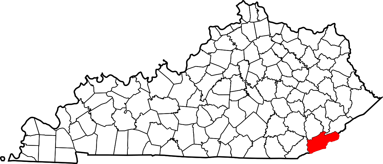
English: This is a locator map showing
Harlan County in Kentucky. For more information, see
Commons:United States county locator maps. |
| Date | |
| Source |
Own work: English: The maps use data from
nationalatlas.gov, specifically
countyp020.tar.gz on the
Raw Data Download page. The maps also use state outline data from
statesp020.tar.gz. The Florida maps use
hydrogm020.tar.gz to display Lake Okeechobee. |
| Author | David Benbennick |
Licensing
| I, the copyright holder of this work, release this work into the
public domain. This applies worldwide. In some countries this may not be legally possible; if so: I grant anyone the right to use this work for any purpose, without any conditions, unless such conditions are required by law. |
File history
Click on a date/time to view the file as it appeared at that time.
| Date/Time | Thumbnail | Dimensions | User | Comment | |
|---|---|---|---|---|---|
| current | 12:22, 12 February 2006 |
| 6,770 × 2,916 (127 KB) | David Benbennick | {{subst:User:Dbenbenn/clm|county=Harlan County|state=Kentucky}} |
File usage
The following pages on the English Wikipedia use this file (pages on other projects are not listed):
- Ages, Kentucky
- Alva, Kentucky
- Banner Fork Coal Company, Kentucky
- Bardo, Kentucky
- Baxter, Kentucky
- Benham, Kentucky
- Benito, Kentucky
- Big Laurel, Kentucky
- Black Bottom, Kentucky
- Black Star Coal Camp, Kentucky
- Blackjoe, Kentucky
- Blair, Kentucky
- Bledsoe, Kentucky
- Brookside, Kentucky
- Cawood, Kentucky
- Chad, Kentucky
- Chevrolet, Kentucky
- Closplint, Kentucky
- Clover Fork (Cumberland River tributary)
- Clutts, Kentucky
- Coldiron, Kentucky
- Coxton, Kentucky
- Cranks, Kentucky
- Cranks Creek Lake
- Creech, Kentucky
- Cumberland, Kentucky
- Darby Coal Mining Camp, Kentucky
- Dayhoit, Kentucky
- Dizney, Kentucky
- Draper, Kentucky
- Eastern Kentucky Coalfield
- Elcomb, Kentucky
- Evarts, Kentucky
- Fresh Meadows, Kentucky
- Gano Coal Camp, Kentucky
- Golden Ash, Kentucky
- Grays Knob, Kentucky
- Harlan, Kentucky
- Harlan County, Kentucky
- Highsplint, Kentucky
- Hiram, Kentucky
- Holmes Mill, Kentucky
- Insull, Kentucky
- Kentenia, Kentucky
- Kentenia State Forest
- Kenvir, Kentucky
- Kildav, Kentucky
- Kitts, Kentucky
- Lejunior, Kentucky
- Lenarue, Kentucky
- List of counties in Kentucky
- Looney Creek (Poor Fork tributary)
- Louellen, Kentucky
- Loyall, Kentucky
- Lynch, Kentucky
- Martin's Fork (Cumberland River tributary)
- Martins Fork Lake
- Mary Alice, Kentucky
- Mary Helen, Kentucky
- Middle Fork Kentucky River
- Molus, Kentucky
- National Register of Historic Places listings in Harlan County, Kentucky
- Nolansburg, Kentucky
- Pansy, Kentucky
- Pathfork, Kentucky
- Pee Vee, Kentucky
- Pine Mountain, Kentucky
- Poor Fork (Cumberland River tributary)
- Putney, Kentucky
- Redbud, Kentucky
- Ridgeway, Kentucky
- Rosspoint, Kentucky
- Smith, Kentucky
- South Wallins, Kentucky
- Southeast Kentucky Community and Technical College
- Stanfill, Kentucky
- Sunshine, Harlan County, Kentucky
- Tacky Town, Kentucky
- Teetersville, Kentucky
- Ten Spot, Kentucky
- Three Point Coal Camp, Kentucky
- Tin Can Alley, Kentucky
- Totz, Kentucky
- Tway, Kentucky
- Verda, Kentucky
- Wallins Creek, Kentucky
- Wheeler Coal Camp, Kentucky
- White Star, Kentucky
- Yancey, Kentucky
- User:Nyttend/County templates/KY/1
- Template:HarlanCountyKY-geo-stub
- Template:Harlan County, Kentucky
- Category:Populated places in Harlan County, Kentucky
Global file usage
The following other wikis use this file:
- Usage on ar.wikipedia.org
- Usage on bg.wikipedia.org
- Usage on bpy.wikipedia.org
- Usage on cdo.wikipedia.org
- Usage on ceb.wikipedia.org
- Usage on ce.wikipedia.org
- Usage on cy.wikipedia.org
- Usage on de.wikipedia.org
- Usage on es.wikipedia.org
- Usage on et.wikipedia.org
- Usage on eu.wikipedia.org
- Usage on fa.wikipedia.org
- Usage on fa.wikivoyage.org
- Usage on frr.wikipedia.org
- Usage on fr.wikipedia.org
View more global usage of this file.