
Original file (SVG file, nominally 509 × 515 pixels, file size: 19 KB)
| This is a file from the
Wikimedia Commons. Information from its
description page there is shown below. Commons is a freely licensed media file repository. You can help. |
Summary
| Description |
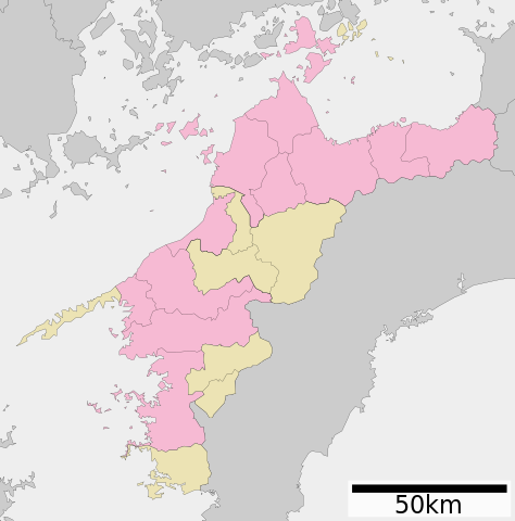
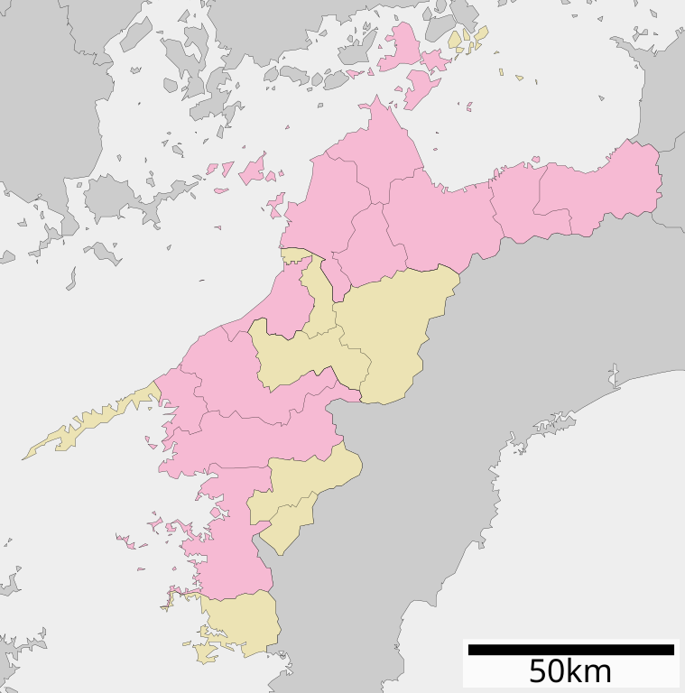
English: Map of Ehime Prefecture, Japan.
日本語:
ja:愛媛県区画図 |
||
| Date | (UTC) | ||
| Source |
|
||
| Author | Lincun | ||
| Permission ( Reusing this file) |
|
Licensing

|
Permission is granted to copy, distribute and/or modify this document under the terms of the GNU Free Documentation License, Version 1.2 or any later version published by the Free Software Foundation; with no Invariant Sections, no Front-Cover Texts, and no Back-Cover Texts. A copy of the license is included in the section entitled GNU Free Documentation License. |
- You are free:
- to share – to copy, distribute and transmit the work
- to remix – to adapt the work
- Under the following conditions:
- attribution – You must give appropriate credit, provide a link to the license, and indicate if changes were made. You may do so in any reasonable manner, but not in any way that suggests the licensor endorses you or your use.
- share alike – If you remix, transform, or build upon the material, you must distribute your contributions under the same or compatible license as the original.
Original upload log
| This file was moved from
Japanese Wikipedia.
See below for original file information. | ||||||||||||||||||||||||||||||||||||
| ||||||||||||||||||||||||||||||||||||
|
| ||||||||||||||||||||||||||||||||||||
File history
Click on a date/time to view the file as it appeared at that time.
| Date/Time | Thumbnail | Dimensions | User | Comment | |
|---|---|---|---|---|---|
| current | 04:35, 4 December 2020 |
| 509 × 515 (19 KB) | AichiWikiFixer | Update borders and fixes. |
| 05:00, 8 December 2013 |
 | 725 × 725 (26 KB) | ニンジンシチュー | デザイン変更 | |
| 04:59, 8 December 2013 |
 | 725 × 725 (26 KB) | ニンジンシチュー | デザイン変更 | |
| 17:44, 24 April 2008 |
 | 730 × 802 (16 KB) | Krisgrotius | {{Information| |Description= Map of Ehime Prefecture, Japan. |Source= Japanese wiki [http://ja.wikipedia.org/wiki/%E7%94%BB%E5%83%8F:%E5%8C%85%E6%8B%AC%E8%87%AA%E6%B2%BB%E4%BD%93%E5%8C%BA%E7%94%BB%E5%9B%B3_38000.svg] |Date=~~~~~ |Author=[[:ja: 利用� | |
| 10:45, 27 October 2007 |
 | 730 × 802 (16 KB) | Lincun | {{基礎自治体位置図画像情報|愛媛県|}} |
File usage
Global file usage
The following other wikis use this file:
- Usage on ilo.wikipedia.org
- Usage on ja.wikipedia.org
- 愛媛県
- 四国八十八箇所
- 松山城 (伊予国)
- 今治精華高等学校
- 松山空港
- 来島海峡大橋
- 松山中央公園
- 別子銅山
- 済美平成中等教育学校
- 別子銅山記念館
- 愛媛県総合科学博物館
- 城山公園 (松山市)
- 道後公園
- 湯築城
- 大三島橋
- 多々羅大橋
- 宇和島城
- 来島海峡
- 愛媛県立新居浜東高等学校
- 愛媛県立新居浜商業高等学校
- 愛媛県立新居浜工業高等学校
- 道後温泉本館
- 今治城
- 大山祇神社
- 愛媛県立長浜高等学校
- 愛媛県立内子高等学校
- 愛媛県立内子高等学校小田分校
- 愛媛県立上浮穴高等学校
- 愛媛県立南宇和高等学校
- 愛媛県立東温高等学校
- 松山学院高等学校
- 愛光中学校・高等学校
- 愛媛県立今治北高等学校
- 愛媛県立今治工業高等学校
- 愛媛県立今治南高等学校
- 愛媛県立新居浜西高等学校
- 愛媛県立伯方高等学校
- 今治明徳高等学校
- 愛媛県立三崎高等学校
- 帝京第五高等学校
- 愛媛県立東予高等学校
- 愛媛県立西条農業高等学校
- 愛媛県立小松高等学校
- 愛媛県立伊予高等学校
- 愛媛県立大洲農業高等学校
- 愛媛県立今治北高等学校大三島分校
- 愛媛県立宇和高等学校
- 愛媛県立野村高等学校
- 愛媛県立吉田高等学校
View more global usage of this file.