
No higher resolution available.
Map_of_East_and_West_Florida_in_1819.jpg (632 × 420 pixels, file size: 148 KB, MIME type: image/jpeg)
| This is a file from the
Wikimedia Commons. Information from its
description page there is shown below. Commons is a freely licensed media file repository. You can help. |
Summary
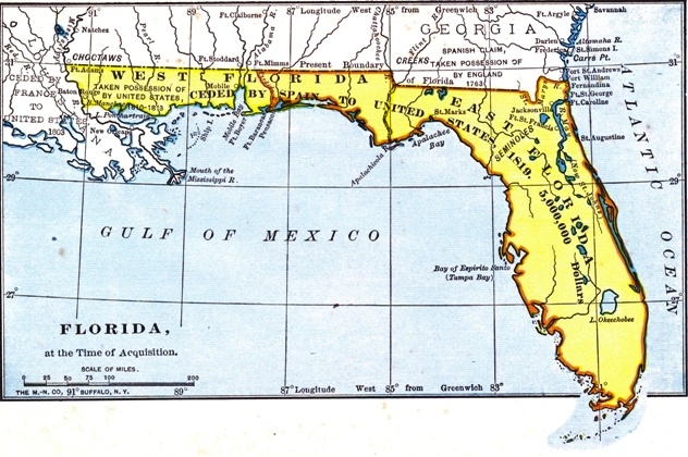
| Description |
English: The British had divided Florida into the administrative units of East Florida and West Florida during their ownership (1763–1783). |
| Date | |
| Source |
Project Gutenberg http://www.gutenberg.org/files/35558/35558-h/images/2.jpg |
| Author | Unknown author |
Licensing
This work is in the
public domain in the
United States because it was
published (or registered with the
U.S. Copyright Office) before January 1, 1929.
Public domain works must be out of copyright in both the United States and in the source country of the work in order to be hosted on the Commons. If the work is not a U.S. work, the file must have an additional
copyright tag indicating the copyright status in the source country.
Note: This tag should not be used for sound recordings. |
File history
Click on a date/time to view the file as it appeared at that time.
| Date/Time | Thumbnail | Dimensions | User | Comment | |
|---|---|---|---|---|---|
| current | 18:09, 16 July 2019 |
| 632 × 420 (148 KB) | Carlstak | User created page with UploadWizard |
File usage
The following pages on the English Wikipedia use this file (pages on other projects are not listed):
Global file usage
The following other wikis use this file:
- Usage on he.wikipedia.org
- Usage on mt.wikipedia.org