
Original file (SVG file, nominally 446 × 570 pixels, file size: 13 KB)
| This is a file from the
Wikimedia Commons. Information from its
description page there is shown below. Commons is a freely licensed media file repository. You can help. |
Summary
| Description |
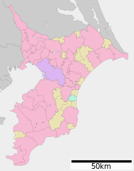
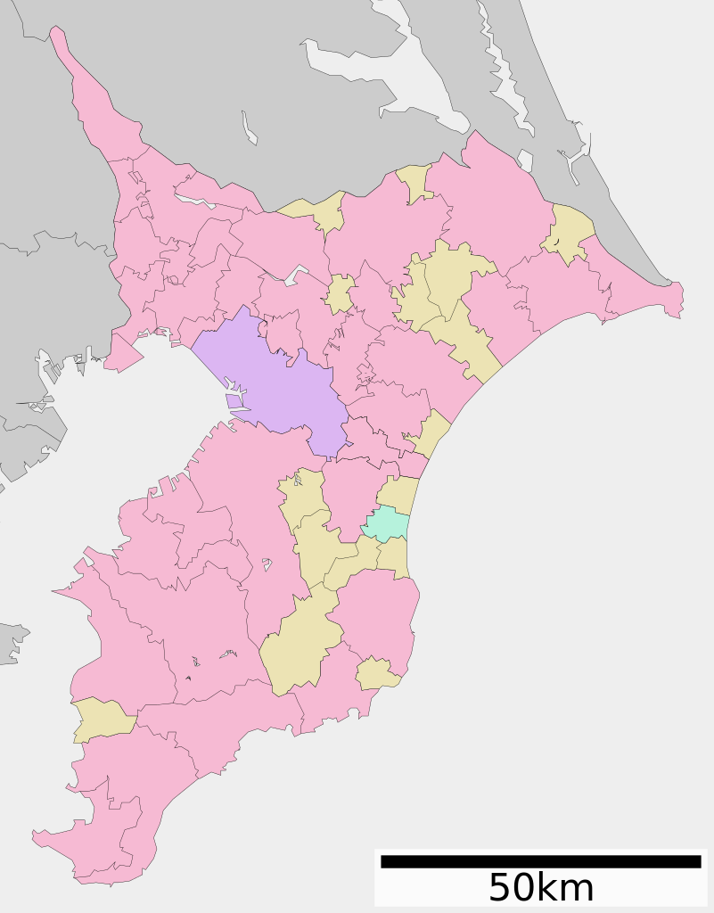
English: Map of Chiba Prefecture, Japan.
日本語:
ja:千葉県区画図 |
||
| Date | (UTC) / Update: 1 January 2013 | ||
| Source |
|
||
| Author | Lincun | ||
| Permission ( Reusing this file) |
|
Licensing

|
Permission is granted to copy, distribute and/or modify this document under the terms of the GNU Free Documentation License, Version 1.2 or any later version published by the Free Software Foundation; with no Invariant Sections, no Front-Cover Texts, and no Back-Cover Texts. A copy of the license is included in the section entitled GNU Free Documentation License. |
- You are free:
- to share – to copy, distribute and transmit the work
- to remix – to adapt the work
- Under the following conditions:
- attribution – You must give appropriate credit, provide a link to the license, and indicate if changes were made. You may do so in any reasonable manner, but not in any way that suggests the licensor endorses you or your use.
- share alike – If you remix, transform, or build upon the material, you must distribute your contributions under the same or compatible license as the original.
Original upload log
| This file was moved from
Japanese Wikipedia.
See below for original file information. | ||||||||||||||||||||||||||||||||||||||||||||||||||||
| ||||||||||||||||||||||||||||||||||||||||||||||||||||
|
| ||||||||||||||||||||||||||||||||||||||||||||||||||||
File history
Click on a date/time to view the file as it appeared at that time.
| Date/Time | Thumbnail | Dimensions | User | Comment | |
|---|---|---|---|---|---|
| current | 15:15, 5 January 2013 |
| 446 × 570 (13 KB) | Knua | Ōamishirasato city update |
| 08:52, 5 January 2013 |
 | 446 × 570 (13 KB) | Knua | 大網白里町の市制に伴う変更 | |
| 13:22, 24 March 2010 |
 | 446 × 570 (12 KB) | Lincun | {{基礎自治体位置図画像情報|千葉県||20100323}} | |
| 17:39, 24 April 2008 |
 | 620 × 872 (22 KB) | Krisgrotius | {{Information| |Description= Map of Chiba Prefecture, Japan. |Source= Japanese wiki [http://ja.wikipedia.org/wiki/%E7%94%BB%E5%83%8F:%E5%8C%85%E6%8B%AC%E8%87%AA%E6%B2%BB%E4%BD%93%E5%8C%BA%E7%94%BB%E5%9B%B3_12000.svg] |Date=~~~~~ |Author=[[:ja: 利用� | |
| 12:55, 20 November 2007 |
 | 620 × 872 (22 KB) | Lincun | {{基礎自治体位置図画像情報|埼玉県|}} | |
| 12:52, 20 November 2007 |
 | 620 × 872 (22 KB) | Lincun | {{基礎自治体位置図画像情報|千葉県|}} |
File usage
Global file usage
The following other wikis use this file:
- Usage on de.wikipedia.org
- Usage on es.wikipedia.org
- Usage on gl.wikipedia.org
- Usage on id.wikipedia.org
- Usage on it.wikipedia.org
- Usage on ja.wikipedia.org
- 津田沼
- 国立歴史民俗博物館
- 日立柏サッカー場
- 柏の葉公園総合競技場
- 千葉マリンスタジアム
- 愛国学園大学
- 幕張メッセ
- 市原緑地運動公園臨海競技場
- 矢切
- 成田山新勝寺
- ファイターズ鎌ケ谷スタジアム
- 法華経寺
- イオンスタイル新浦安
- 犬吠埼灯台
- 新松戸
- 麗澤大学
- DIC川村記念美術館
- 千葉県立佐原白楊高等学校
- 千葉県立東総工業高等学校
- 千葉県立四街道高等学校
- 我孫子二階堂高等学校
- 千葉県立九十九里高等学校
- 千葉商科大学
- 戸定邸
- 千葉県総合スポーツセンター陸上競技場
- 舞浜
- 習志野市秋津サッカー場
- 本土寺
- 千葉県東方沖地震 (1987年)
- 香取神宮
- 千葉ポートタワー
- 千葉ポートパーク
- 千葉県立美術館
- 小金城
- 暁星国際小学校・中学校・高等学校
- 亥鼻
- 富浦町
- 千葉県野球場
- 柏の葉公園
- 東京都立八柱霊園
- 千駄堀
- 関宿城
- 東海大学付属市原望洋高等学校
- 千葉県立長狭高等学校
- 市川中学校・高等学校
View more global usage of this file.