Original file (640 × 640 pixels, file size: 604 KB, MIME type: image/jpeg)
| This is a file from the
Wikimedia Commons. Information from its
description page there is shown below. Commons is a freely licensed media file repository. You can help. |
.jpg)
Summary
| Description |
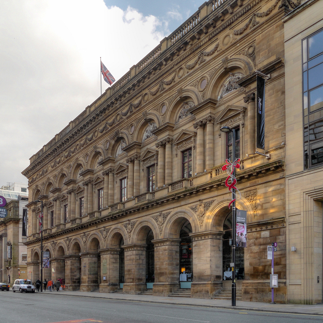
English: The Peter Street frontage of the Radisson Edwardian Hotel, originally built as the Free Trade Hall.
The Free Trade Hall was a public hall constructed in 1853–6 to commemorate the repeal of the Corn Laws in 1846. The hall was funded by public subscription and became a concert hall and home of the Hallé Orchestra in 1858. The interior of the hall had to be rebuilt after bombing during the Manchester Blitz left it an empty shell; it re-opened in 1951. As well as housing the Hallé Orchestra, it was used for pop and rock concerts; it was Manchester's premier concert venue until the construction of the Bridgewater Hall in 1996. When the Hallé Orchestra moved to the Bridgewater Hall in 1996, the Free Trade Hall was closed by Manchester City Council. In 1997, the building was sold to private developers and, despite much opposition because of its historical significance, planning approval was eventually granted to convert it to a hotel, retaining the original facade was, the main staircase and the 1950s statues that were formerly attached to its rear wall. The hotel opened in 2004. The hall is designated as a Grade II* listed building. A red plaque on the wall records that it was built on St Peter's Fields, the site of the (in)famous Peterloo Massacre in 1819. |
| Date | |
| Source | https://www.geograph.org.uk/photo/3178858 |
| Author | David Dixon |
| Attribution ( required by the license) | David Dixon / Manchester Free Trade Hall (Radisson Edwardian Hotel) / |
| Camera location | | View this and other nearby images on: OpenStreetMap |
|
|---|
.jpg¶ms=053.478060_N_-002.247600_E_globe:Earth_type:camera_source:geograph-osgb36(SJ83669795)_heading:112.00&language=en)
| Object location | | View this and other nearby images on: OpenStreetMap |
|
|---|
.jpg¶ms=053.477880_N_-002.247100_E_globe:Earth_class:object_type:object_source:geograph-osgb36(SJ83699793)_heading:112.00&language=en)
Licensing

|
This image was taken from the
Geograph project collection. See
this photograph's page on the Geograph website for the photographer's contact details. The copyright on this image is owned by David Dixon and is licensed for reuse under the
Creative Commons Attribution-ShareAlike 2.0 license.
|
- You are free:
- to share – to copy, distribute and transmit the work
- to remix – to adapt the work
- Under the following conditions:
- attribution – You must give appropriate credit, provide a link to the license, and indicate if changes were made. You may do so in any reasonable manner, but not in any way that suggests the licensor endorses you or your use.
- share alike – If you remix, transform, or build upon the material, you must distribute your contributions under the same or compatible license as the original.
File history
Click on a date/time to view the file as it appeared at that time.
| Date/Time | Thumbnail | Dimensions | User | Comment | |
|---|---|---|---|---|---|
| current | 11:22, 21 January 2014 |
| 640 × 640 (604 KB) | Ham II | User created page with UploadWizard |
File usage
Global file usage
The following other wikis use this file:
- Usage on azb.wikipedia.org
- Usage on az.wikipedia.org
- Usage on he.wikipedia.org
- Usage on ru.wikipedia.org
- Usage on zh.wikipedia.org
.jpg)