
Size of this preview:
800 × 536 pixels. Other resolutions:
320 × 214 pixels |
640 × 428 pixels |
1,024 × 685 pixels |
1,280 × 857 pixels |
2,560 × 1,714 pixels |
3,872 × 2,592 pixels.
Original file (3,872 × 2,592 pixels, file size: 6.96 MB, MIME type: image/jpeg)
| This is a file from the
Wikimedia Commons. Information from its
description page there is shown below. Commons is a freely licensed media file repository. You can help. |
Summary
| Description |
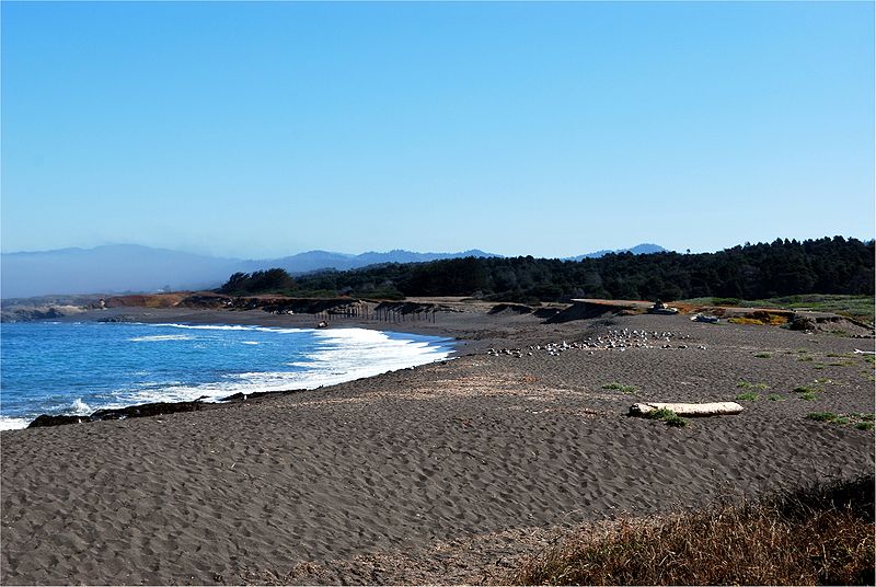
English: MacKerricher Beach - part of the
MacKerricher State Park north of
Fort Bragg. Some of the remains of the old logging road can be seen along the beach. Much has eroded away leaving only the wooden pillars. |
| Date | Taken on 22 September 2009 |
| Source | Own work |
| Author | J.smith |
| Camera location |
| View this and other nearby images on: OpenStreetMap |
|
|---|
 |
This photo was taken by
Justin Smith (User:J.smith) and released under the license(s) stated on this page. You are free to use this image as long as you follow the terms of the license and credit me properly. Example: © Justin Smith / Wikimedia Commons, CC-By-SA-3.0 If you use this image outside of Wikimedia projects I would appreciate (but do not require) being
informed. If you would like a license with the conditions of your choice, please e-mail (
commons's build-in system or at jsmith
|
 |
Licensing
I, the copyright holder of this work, hereby publish it under the following license:
This file is licensed under the
Creative Commons
Attribution-Share Alike 3.0 Unported license.
- You are free:
- to share – to copy, distribute and transmit the work
- to remix – to adapt the work
- Under the following conditions:
- attribution – You must give appropriate credit, provide a link to the license, and indicate if changes were made. You may do so in any reasonable manner, but not in any way that suggests the licensor endorses you or your use.
- share alike – If you remix, transform, or build upon the material, you must distribute your contributions under the same or compatible license as the original.
| Annotations | This image is annotated: View the annotations at Commons |

This image has been assessed using the
Quality image guidelines and is considered a
Quality image.
|
File history
Click on a date/time to view the file as it appeared at that time.
| Date/Time | Thumbnail | Dimensions | User | Comment | |
|---|---|---|---|---|---|
| current | 13:00, 20 October 2009 |
| 3,872 × 2,592 (6.96 MB) | Mbz1 | Removed CA (I hope) |
| 03:32, 18 October 2009 |
 | 3,872 × 2,592 (4.02 MB) | J.smith | == Summary == {{Information |Description={{en|1=MacKerricher Beach is part of the MacKerricher park north of en:Fort Bragg, CA.}} |Source={{own}} |Author= J.smith |Date=2009-09-22 |Permission= |other_version |
File usage
The following pages on the English Wikipedia use this file (pages on other projects are not listed):
Global file usage
The following other wikis use this file:
- Usage on ceb.wikipedia.org
- Usage on en.wikivoyage.org
- Usage on fi.wikipedia.org
- Usage on fr.wikipedia.org
- Usage on ml.wikipedia.org
- Usage on simple.wikipedia.org
- Usage on ur.wikipedia.org
- Usage on vi.wikipedia.org
- Usage on www.wikidata.org
- Usage on zh-yue.wikipedia.org
- Usage on zh.wikipedia.org