Size of this preview:
800 × 545 pixels. Other resolutions:
320 × 218 pixels |
640 × 436 pixels |
907 × 618 pixels.
Original file (907 × 618 pixels, file size: 597 KB, MIME type: image/jpeg)
| This is a file from the
Wikimedia Commons. Information from its
description page there is shown below. Commons is a freely licensed media file repository. You can help. |
Summary
|
This is an image of a place or building that is listed on the
National Register of Historic Places in the
United States of America. Its reference number is
66000397. |
| Description | |
| Date | 23 August 2004 (original upload date) |
| Source | Transferred from en.wikipedia |
| Author | Original uploader was Gsgeorge at en.wikipedia |
| Permission ( Reusing this file) |
GFDL-WITH-DISCLAIMERS; Released under the GNU Free Documentation License. |
| Object location |
| View this and other nearby images on: OpenStreetMap |
|
|---|
Licensing
| This file is licensed under the Creative Commons Attribution-Share Alike 3.0 Unported license. Subject to disclaimers. | ||
| ||
| This licensing tag was added to this file as part of the GFDL licensing update. |

|
Permission is granted to copy, distribute and/or modify this document under the terms of the GNU Free Documentation License, Version 1.2 or any later version published by the Free Software Foundation; with no Invariant Sections, no Front-Cover Texts, and no Back-Cover Texts. A copy of the license is included in the section entitled GNU Free Documentation License. Subject to disclaimers. |
Original upload log
The original description page was
here. All following user names refer to en.wikipedia.
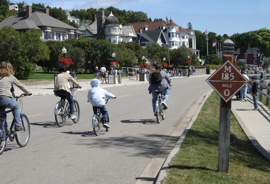
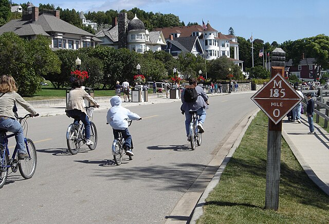
- 2004-08-23 18:29 Gsgeorge 907×618×8 (611197 bytes) Mile marker 0 on Michigan State Highway M-185, Mackinac Island, Michigan. Taken by me in August 2004.
File history
Click on a date/time to view the file as it appeared at that time.
| Date/Time | Thumbnail | Dimensions | User | Comment | |
|---|---|---|---|---|---|
| current | 18:24, 11 January 2008 |
| 907 × 618 (597 KB) | TwinsMetsFan | {{Information |Description={{en|Mile marker 0 on Michigan State Highway M-185, Mackinac Island, Michigan. Taken by me in August 2004.}} |Source=Transferred from [http://en.wikipedia.org en.wikipedia] |Date=2004-08-23 (original upload date) |Author=Origin |
File usage
The following pages on the English Wikipedia use this file (pages on other projects are not listed):
- Healthy community design
- M-185 (Michigan highway)
- Mackinac Island
- Pedestrian zone
- User:Imzadi1979/Books/MISH
- User:Mr.Z-man.sock/testcase
- User talk:Imzadi1979/Archive 5
- Wikipedia:Today's featured article/July 12, 2014
- Wikipedia:Today's featured article/July 2014
- Portal:Michigan highways/Articles
- Portal:Michigan highways/Selected article/June 2012
- Portal:U.S. roads/Selected article
- Portal:U.S. roads/Selected article/April 1 2012
Global file usage
The following other wikis use this file:
- Usage on fr.wikipedia.org
- Discussion:Île Mackinac
- M-185
- Wikipédia:Statistiques des anecdotes de la page d'accueil/Visibilité des anecdotes (2018)
- Wikipédia:Statistiques des anecdotes de la page d'accueil/Visibilité des anecdotes (2018)/2018 12
- Projet:Aide et accueil/Twitter/Tweets/archives/décembre 2018
- Wikipédia:Le saviez-vous ?/Archives/2018
- Usage on kk.wikipedia.org
- Usage on nl.wikipedia.org
- Usage on ru.wikipedia.org
- Usage on sr.wikipedia.org
- Usage on ta.wikipedia.org