Size of this preview:
631 × 600 pixels. Other resolutions:
252 × 240 pixels |
505 × 480 pixels |
689 × 655 pixels.
Original file (689 × 655 pixels, file size: 527 KB, MIME type: image/png)
| This is a file from the
Wikimedia Commons. Information from its
description page there is shown below. Commons is a freely licensed media file repository. You can help. |
| Description |
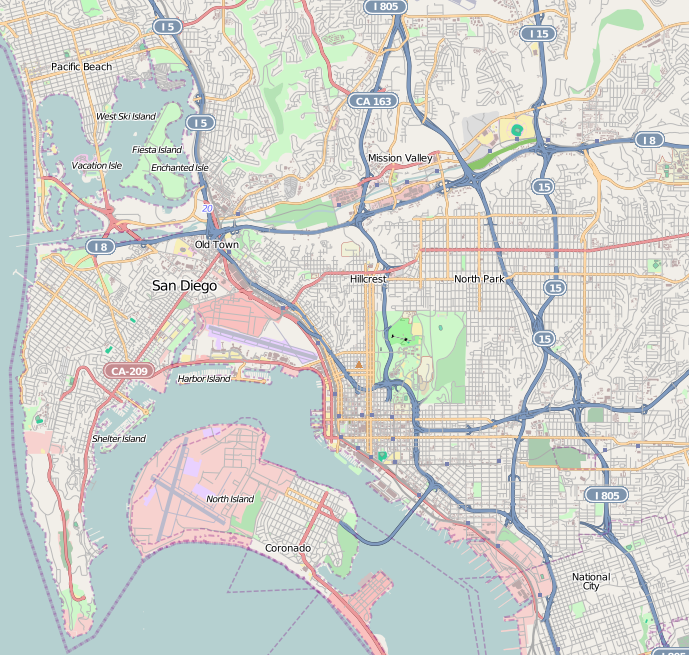
This map of Central San Diego was created from
OpenStreetMap project data, collected by the community. This map may be incomplete, and may contain errors. Don't rely solely on it for navigation. |
|||||||||
| Date | (see file history) | |||||||||
| Source | openstreetmap.org | |||||||||
| Creator |
OpenStreetMap contributors |
|||||||||
| Permission ( Reusing this file) |
OpenStreetMap data and maps are licensed under the
Creative Commons Attribution-ShareAlike 2.0 license (CC-BY-SA 2.0). This file is licensed under the
Creative Commons
Attribution-Share Alike 2.0 Generic license.
|
|||||||||
| Geotemporal data | ||||||||||
| Bounding box |
|
|||||||||
| Georeferencing | If inappropriate please set warp_status = skip to hide. | |||||||||
File history
Click on a date/time to view the file as it appeared at that time.
| Date/Time | Thumbnail | Dimensions | User | Comment | |
|---|---|---|---|---|---|
| current | 01:48, 26 September 2010 |
| 689 × 655 (527 KB) | Zzyzx11 | {{OpenStreetMap |location=Central San Diego |top=32.8134 |bottom=32.6609 |left=-117.2629 |right=-117.072 }} Category:OpenStreetMap maps of the United States |
File usage
The following pages on the English Wikipedia use this file (pages on other projects are not listed):
- 2017 Red Bull Air Race of San Diego
- Alcazar Garden
- Amici Park
- Balboa Park (San Diego)
- Balboa Park Gardens
- Balboa Theatre
- Barrio Logan, San Diego
- Birdland, San Diego
- Cabrillo National Monument
- California Quadrangle
- Casa de Estudillo
- City Heights, San Diego
- Columbia, San Diego
- Eagles Hall (San Diego)
- East Village, San Diego
- El Cortez (San Diego)
- El Prado Complex
- Embarcadero Marina Park North
- Embarcadero Marina Park South
- Fleet Science Center
- Ford Building (San Diego)
- Gaslamp Quarter, San Diego
- George W. Marston House
- Giant Dipper (Belmont Park)
- Granger Hall (National City, California)
- Harper's Topiary Garden
- Heilman Villas
- Hillcrest, San Diego
- Horton Grand Hotel
- Horton Plaza Park
- House of Charm
- Independent Order of Odd Fellows Building (San Diego)
- Jacob Weinberger United States Courthouse
- Kate Sessions Memorial Park
- Kensington, San Diego
- Kosa'aay
- Linda Vista, San Diego
- Little Italy, San Diego
- Lucha Libre Taco Shop
- MCRD San Diego Command Museum
- Manchester Grand Hyatt San Diego
- Marina, San Diego
- Maritime Museum of San Diego
- Medico-Dental Building
- Mingei International Museum
- Mission Beach, San Diego
- Mission Brewery Plaza
- Mission San Diego de Alcalá
- Mission Valley, San Diego
- Museum of Photographic Arts
- Museum of Us
- Naval Training Center San Diego
- Normal Heights, San Diego
- Ocean Beach, San Diego
- Old Town San Diego State Historic Park
- Pacific Beach, San Diego
- Pantoja Park
- Park Place Methodist Episcopal Church South
- Petco Park
- Peterson Gymnasium
- Presidio Park
- Presidio of San Diego
- Pythias Lodge Building (San Diego)
- Rosecroft (San Diego)
- Ruocco Park
- San Diego Air & Space Museum
- San Diego Automotive Museum
- San Diego Hall of Champions
- San Diego History Center
- San Diego Model Railroad Museum
- San Diego Museum of Art
- San Diego Natural History Museum
- San Diego Trust and Savings Bank Building
- St. Matthew's Episcopal Church (National City, California)
- Swan Canyon, San Diego
- The Rady Shell at Jacobs Park
- Timken Museum of Art
- U.S. Grant Hotel
- UC San Diego Medical Center, Hillcrest
- USS Midway Museum
- University Heights, San Diego
- Whaley House (San Diego, California)
- User:DarkNight0917/Creations
- Wikipedia:Graphics Lab/Map workshop/Archive/Oct 2011
- Module:Location map/data/United States San Diego
- Module:Location map/data/United States San Diego/doc
Global file usage
The following other wikis use this file:
- Usage on ar.wikipedia.org
- Usage on azb.wikipedia.org
- Usage on bg.wikipedia.org
- Usage on ceb.wikipedia.org
- Usage on fa.wikipedia.org
- Usage on fr.wikipedia.org
- Cabrillo National Monument
- San Diego-Coronado Bridge
- San Diego Stadium
- Petco Park
- Aéroport international de San Diego
- Pechanga Arena
- SeaWorld San Diego
- Université d'État de San Diego
- Musée maritime de San Diego
- Naval Amphibious Base Coronado
- Manchester Grand Hyatt Hotel
- Symphony Towers
- Marriott Marquis San Diego Marina
- One America Plaza
- Parc Balboa
- Pinnacle Marina Tower
- Harbor Club Condominiums
- Vantage Pointe Condominium
- Bayside at the Embarcadero
- Omni San Diego Hotel
- Emerald Plaza
- Gaslamp Quarter
- Base navale de San Diego
- Pacific Beach (San Diego)
- Mission Bay (San Diego)
- Hotel del Coronado
- Point Loma
- Hillcrest (San Diego)
- Mission Valley
- Parc historique d'État d'Old Town San Diego
- Mission Beach
- Little Italy (San Diego)
- Downtown San Diego
- Casa de Estudillo
- Old Town (San Diego)
- Musée d'Art de San Diego
- Pont Cabrillo
View more global usage of this file.