
Size of this preview:
761 × 599 pixels. Other resolutions:
305 × 240 pixels |
610 × 480 pixels |
975 × 768 pixels |
1,280 × 1,008 pixels |
2,560 × 2,016 pixels |
4,632 × 3,648 pixels.
Original file (4,632 × 3,648 pixels, file size: 2.08 MB, MIME type: image/jpeg)
| This is a file from the
Wikimedia Commons. Information from its
description page there is shown below. Commons is a freely licensed media file repository. You can help. |
|
This is an image of a place or building that is listed on the
National Register of Historic Places in the
United States of America. Its reference number is
780001263. |
Summary
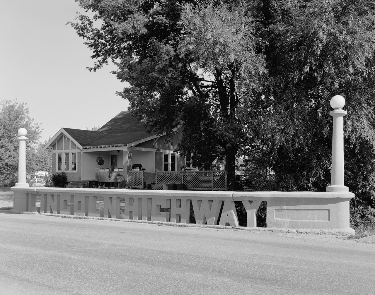
| Description | Lincoln Highway Bridge, spanning Mud Creek at Fifth Street, Tama County, Iowa |
| Date | Summer 1995 |
| Source | w:Library of Congress, Prints and Photograph Division, Historic American Engineering Record: HAER IOWA,86-TAMA,1-4 |
| Author | Joe Elliott |
| Object location |
| View this and other nearby images on: OpenStreetMap |
|
|---|
Licensing
| This image or media file contains material based on a work of a National Park Service employee, created as part of that person's official duties. As a work of the U.S. federal government, such work is in the public domain in the United States. See the NPS website and NPS copyright policy for more information. |
|

|
This image is available from the United States
Library of Congress's
Prints and Photographs division
under the digital ID hhh.ia0451. This tag does not indicate the copyright status of the attached work. A normal copyright tag is still required. See Commons:Licensing.
|
File history
Click on a date/time to view the file as it appeared at that time.
| Date/Time | Thumbnail | Dimensions | User | Comment | |
|---|---|---|---|---|---|
| current | 20:33, 2 May 2009 |
| 4,632 × 3,648 (2.08 MB) | Cropbot | upload cropped version, operated by User:Finavon. Summary: border cropped |
| 00:27, 6 February 2006 |
 | 5,000 × 4,040 (2.36 MB) | SPUI~commonswiki | "3/4 VIEW OF NORTH SIDE, FROM SOUTHEAST" of the Lincoln Highway bridge over Mud Creek at Fifth Street in Tama, Iowa, from [http://memory.loc.gov/cgi-bin/query/r?ammem/hh:@field(DOCID+@lit(IA0451))]. Taken summer 1995 by Joe Elliott. {{HAER|IA-75-4}} [[Ca |
File usage
The following pages on the English Wikipedia use this file (pages on other projects are not listed):
Global file usage
The following other wikis use this file:
- Usage on de.wikipedia.org
- Usage on en.wikivoyage.org
- Usage on es.wikipedia.org
- Usage on ja.wikipedia.org
- Usage on ko.wikipedia.org
- Usage on uk.wikipedia.org
- Usage on www.wikidata.org