
Size of this preview:
774 × 600 pixels. Other resolutions:
310 × 240 pixels |
620 × 480 pixels |
992 × 768 pixels |
1,280 × 992 pixels |
2,560 × 1,983 pixels |
3,000 × 2,324 pixels.
Original file (3,000 × 2,324 pixels, file size: 1.64 MB, MIME type: image/jpeg)
| This is a file from the
Wikimedia Commons. Information from its
description page there is shown below. Commons is a freely licensed media file repository. You can help. |
|
This is an image of a place or building that is listed on the
National Register of Historic Places in the
United States of America. Its reference number is
76000695. |
Summary
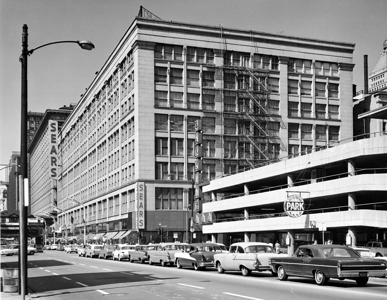
| Description | Leiter II Building, South State & East Congress Streets, Chicago, Cook County, IL | ||
| Date | |||
| Source |
|
||
| Author | Cervin Robinson, Photographer |

| Object location |
| View this and other nearby images on: OpenStreetMap |
|
|---|

|
This file comes from the
Historic American Buildings Survey (HABS), Historic American Engineering Record (HAER) or Historic American Landscapes Survey (HALS). These are programs of the National Park Service established for the purpose of documenting historic places. Records consist of measured drawings, archival photographs, and written reports.
|
| This image or media file contains material based on a work of a National Park Service employee, created as part of that person's official duties. As a work of the U.S. federal government, such work is in the public domain in the United States. See the NPS website and NPS copyright policy for more information. |
File history
Click on a date/time to view the file as it appeared at that time.
| Date/Time | Thumbnail | Dimensions | User | Comment | |
|---|---|---|---|---|---|
| current | 02:43, 18 December 2005 |
| 3,000 × 2,324 (1.64 MB) | Brian0918 | TITLE: Leiter II Building, South State & East Congress Streets, Chicago, Cook County, IL CALL NUMBER: HABS ILL,16-CHIG,24- REPRODUCTION NUMBER: [See Call Number] MEDIUM: Photo(s): 3 (5 x 7 in.) Data Page(s): 3 plus cover page DATE: Documentation com |
File usage
The following pages on the English Wikipedia use this file (pages on other projects are not listed):
- List of National Historic Landmarks in Illinois
- National Register of Historic Places listings in Central Chicago
- William Le Baron Jenney
- User:Smallbones/NRHP Central Chicago
- Portal:Architecture/Selected article/2007-19
- Portal:Architecture/Selected article archive/Archive 3
- Portal:National Register of Historic Places/Portal biography
- Portal:National Register of Historic Places/Portal biography/2
Global file usage
The following other wikis use this file:
- Usage on ca.wikipedia.org
- Usage on cs.wikipedia.org
- Usage on de.wikipedia.org
- Usage on fa.wikipedia.org
- Usage on gl.wikipedia.org
- Usage on ko.wikipedia.org
- Usage on sh.wikipedia.org
- Usage on sk.wikipedia.org
- Usage on sv.wikipedia.org