
Size of this preview:
800 × 507 pixels. Other resolutions:
320 × 203 pixels |
640 × 405 pixels |
1,024 × 648 pixels |
1,280 × 811 pixels |
2,560 × 1,621 pixels |
5,377 × 3,405 pixels.
Original file (5,377 × 3,405 pixels, file size: 11.99 MB, MIME type: image/jpeg)
| This is a file from the
Wikimedia Commons. Information from its
description page there is shown below. Commons is a freely licensed media file repository. You can help. |
|
| This is a featured picture, which means that members of the community have identified it as one of the finest images on the English Wikipedia, adding significantly to its accompanying article. If you have a different image of similar quality, be sure to upload it using the proper free license tag, add it to a relevant article, and nominate it. |
|
| This image was selected as picture of the day on the English Wikipedia for July 21, 2016. |
Summary
| Description |
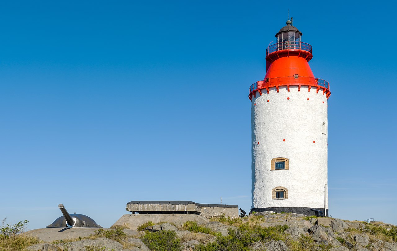
Svenska: Landsort Lighthouse (view from east), Öja island (Landsort), Stockholm archipelago's most southern point. During the Cold War and World War II was Landsort a military base for the Swedish coastal artillery.
|
||||
| Date | |||||
| Source | Own work | ||||
| Author | Arild Vågen |
| Camera location |
| View this and other nearby images on: OpenStreetMap |
|
|---|
This file was made possible through the
pool of technology at
Wikimedia Sverige. |
|
Licensing
I, the copyright holder of this work, hereby publish it under the following license:
This file is licensed under the
Creative Commons
Attribution-Share Alike 3.0 Unported license.
- You are free:
- to share – to copy, distribute and transmit the work
- to remix – to adapt the work
- Under the following conditions:
- attribution – You must give appropriate credit, provide a link to the license, and indicate if changes were made. You may do so in any reasonable manner, but not in any way that suggests the licensor endorses you or your use.
- share alike – If you remix, transform, or build upon the material, you must distribute your contributions under the same or compatible license as the original.
|

|
This image was uploaded as part of
Wiki Loves Monuments 2013.
|
This image has been assessed using the
Quality image guidelines and is considered a
Quality image.
|
File history
Click on a date/time to view the file as it appeared at that time.
| Date/Time | Thumbnail | Dimensions | User | Comment | |
|---|---|---|---|---|---|
| current | 08:57, 1 September 2013 |
| 5,377 × 3,405 (11.99 MB) | ArildV | User created page with UploadWizard |
File usage
The following pages on the English Wikipedia use this file (pages on other projects are not listed):
- Landsort
- Talk:Landsort
- User:Tomer T
- User talk:ArildV
- User talk:Rahul.totla22
- User talk:Tomer T/Archive 2
- Wikipedia:Featured picture candidates/Landsort Lighthouse
- Wikipedia:Featured picture candidates/October-2013
- Wikipedia:Featured pictures/Places/Architecture
- Wikipedia:Featured pictures thumbs/37
- Wikipedia:Main Page history/2016 July 21
- Wikipedia:Picture of the day/July 2016
- Template:POTD/2016-07-21
- Portal:Architecture/Recognized content
- Portal:The arts/Recognized content
Global file usage
The following other wikis use this file:
- Usage on cs.wikipedia.org
- Usage on de.wikipedia.org
- Benutzer:Geolina163
- Wikipedia:Exzellente Bilder/Kunst und Kultur
- Benutzerin:Alraunenstern
- Landsort
- Benutzer:Geolina163/Vitrine
- Benutzerin:Itti/Leuchttürme
- Benutzer Diskussion:Codc/Archiv/2013
- Benutzer Diskussion:Geolina163/Archiv/2013
- Benutzer Diskussion:Yellowcard/Archiv 2013
- Benutzerin Diskussion:Alraunenstern/2013
- Benutzer Diskussion:Flominator/Archiv22
- Benutzerin Diskussion:Christina Burger (WMDE)/Archiv/2013
- Datei:Landsort Lighthouse August 2013 09.jpg
- Wikipedia:Kandidaten für exzellente Bilder/Archiv2013/10
- Benutzer Diskussion:Ireas/2013 IV
- Benutzer:Henriette Fiebig/Zeug von 2013
- Benutzer Diskussion:Matthias Süßen/Archiv/2012und13
- Benutzer:Raboe001/Diskussion-2014-01-26
- Benutzerin:Alraunenstern/Geschenke
- Benutzer Diskussion:Nicolas Rück (WMDE)/2013
- Usage on eo.wikipedia.org
- Usage on et.wikipedia.org
- Usage on fa.wikipedia.org
- Usage on mk.wikipedia.org
- Usage on sv.wikipedia.org
- Usage on uk.wikipedia.org