Size of this preview:
800 × 598 pixels. Other resolutions:
320 × 239 pixels |
640 × 479 pixels |
900 × 673 pixels.
Original file (900 × 673 pixels, file size: 232 KB, MIME type: image/gif, 0.2 s)
| This is a file from the
Wikimedia Commons. Information from its
description page there is shown below. Commons is a freely licensed media file repository. You can help. |
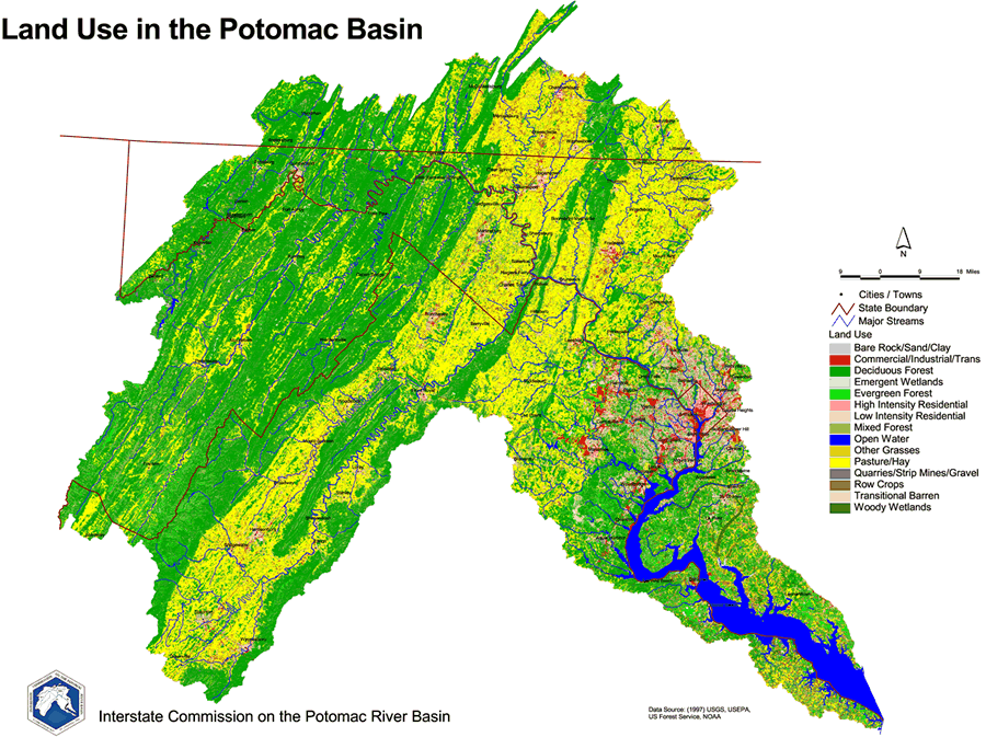
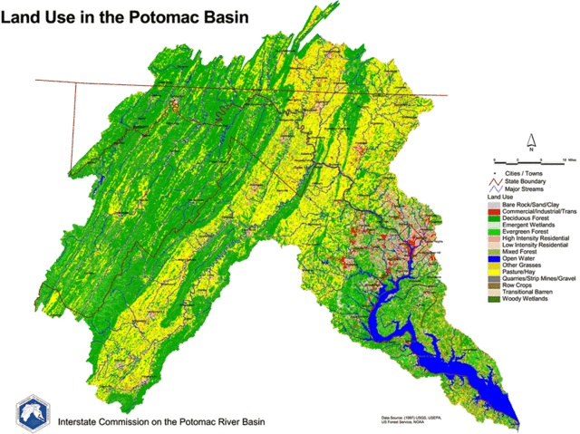
English: 1997 Land Use Map of the
Potomac River Basin provided to the public domain by the U.S. Department of the Interior and the U.S. Geological Survey.
This image is in the
public domain in the United States because it only contains materials that originally came from the
United States Geological Survey, an agency of the
United States Department of the Interior. For more information, see
the official USGS copyright policy.
|
File history
Click on a date/time to view the file as it appeared at that time.
| Date/Time | Thumbnail | Dimensions | User | Comment | |
|---|---|---|---|---|---|
| current | 19:44, 20 March 2006 |
| 900 × 673 (232 KB) | West Virginian | 1997 Land Use Map of the Potomac River Basin provided to the public domain by the U.S. Department of the Interior and the U.S. Geological Survey. {{USGS}} |
File usage
The following pages on the English Wikipedia use this file (pages on other projects are not listed):
Global file usage
The following other wikis use this file:
- Usage on ar.wikipedia.org
- Usage on azb.wikipedia.org
- Usage on de.wikipedia.org
- Usage on el.wikipedia.org
- Usage on es.wikipedia.org
- Usage on gl.wikipedia.org
- Usage on ja.wikipedia.org
- Usage on ko.wikipedia.org
- Usage on la.wikipedia.org