
Size of this preview:
800 × 450 pixels. Other resolutions:
320 × 180 pixels |
640 × 360 pixels |
1,024 × 576 pixels |
1,280 × 720 pixels |
2,048 × 1,152 pixels.
Original file (2,048 × 1,152 pixels, file size: 1.03 MB, MIME type: image/jpeg)
| This is a file from the
Wikimedia Commons. Information from its
description page there is shown below. Commons is a freely licensed media file repository. You can help. |
Summary
| Description |
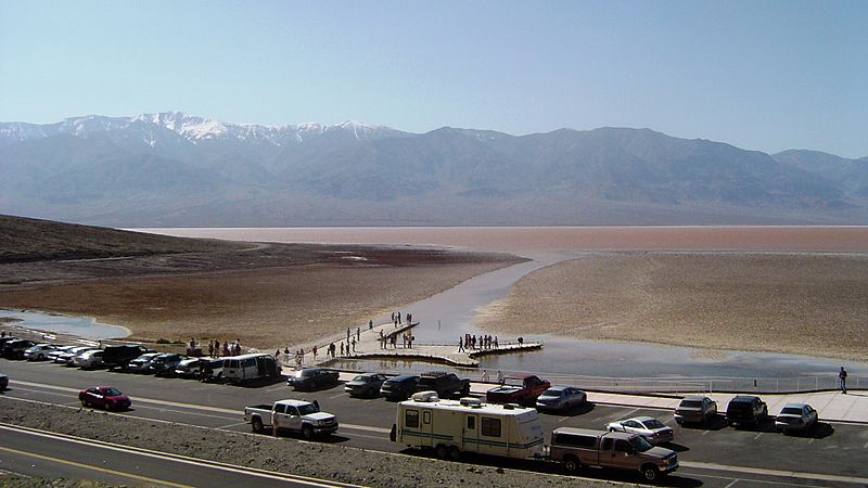
English: Tourist area around
Badwater Basin, 282 feet below sea level, flooded by
ephemeral Lake Badwater,
Death Valley National Park,
California.
Panamint Range and
Telescope Peak in the background. |
| Date |
Spring 2005 Cropping 3 March 2010 |
| Source | Transferred from en.wikipedia to Commons by Americophile. |
| Author |
Qfl247 (
talk ·
contribs); cropped by Beyond My Ken ( talk · contribs) |
| Other versions |
 |
Licensing
Beyond My Ken at
English Wikipedia, the copyright holder of this work, hereby publishes it under the following licenses:
This file is licensed under the
Creative Commons
Attribution-Share Alike 3.0 Unported license.
Attribution:
Beyond My Ken at
English Wikipedia
- You are free:
- to share – to copy, distribute and transmit the work
- to remix – to adapt the work
- Under the following conditions:
- attribution – You must give appropriate credit, provide a link to the license, and indicate if changes were made. You may do so in any reasonable manner, but not in any way that suggests the licensor endorses you or your use.
- share alike – If you remix, transform, or build upon the material, you must distribute your contributions under the same or compatible license as the original.

|
Permission is granted to copy, distribute and/or modify this document under the terms of the GNU Free Documentation License, Version 1.2 or any later version published by the Free Software Foundation; with no Invariant Sections, no Front-Cover Texts, and no Back-Cover Texts. A copy of the license is included in the section entitled GNU Free Documentation License. |
You may select the license of your choice.
Original upload log
The original description page was
here. All following user names refer to en.wikipedia.
- 2010-03-03 07:27 Beyond My Ken 2048×1152× (1083174 bytes) == Summary == {{Information |Description = Tourist area around [[Badwater Basin]], 282 feet below sea level, flooded by [[ephemeral]] Lake Badwater, [[Death Valley National Park]], [[California]]. [[Panamint Range]] and [[Telescope Peak]] in the back
File history
Click on a date/time to view the file as it appeared at that time.
| Date/Time | Thumbnail | Dimensions | User | Comment | |
|---|---|---|---|---|---|
| current | 04:13, 26 April 2011 |
| 2,048 × 1,152 (1.03 MB) | Mondephile | {{Information |Description={{en|Tourist area around en:Badwater Basin, 282 feet below sea level, flooded by en:ephemeral Lake Badwater, en:Death Valley National Park, en:California. en:Panamint Range and [[:en:Telescope Peak |
File usage
The following pages on the English Wikipedia use this file (pages on other projects are not listed):
Global file usage
The following other wikis use this file:
- Usage on az.wikipedia.org
- Usage on eu.wikipedia.org
- Usage on fa.wikipedia.org
- Usage on he.wikipedia.org
- Usage on hi.wikipedia.org
- Usage on sl.wikipedia.org
- Usage on tr.wikipedia.org
- Usage on zh.wikipedia.org