
Size of this preview:
800 × 533 pixels. Other resolutions:
320 × 213 pixels |
640 × 427 pixels |
1,024 × 683 pixels |
1,280 × 853 pixels |
2,560 × 1,707 pixels |
5,184 × 3,456 pixels.
Original file (5,184 × 3,456 pixels, file size: 16.06 MB, MIME type: image/jpeg)
| This is a file from the
Wikimedia Commons. Information from its
description page there is shown below. Commons is a freely licensed media file repository. You can help. |
Summary
| Description |
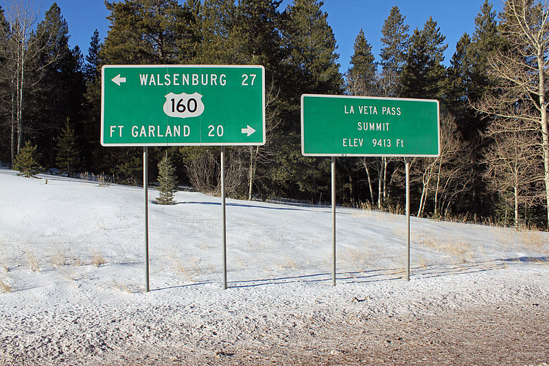
English: La Veta Pass on U.S. Route 160 in southern Colorado. The pass lies on the border between Huerfano County to the east and Costilla County to the west. The elevation is 9,413 feet. The two signs in the picture are parallel to the highway on the south side. |
| Date | |
| Source | Own work |
| Author | Jeffrey Beall |
| Object location |
| View this and other nearby images on: OpenStreetMap |
|
|---|
Licensing
I, the copyright holder of this work, hereby publish it under the following license:
This file is licensed under the
Creative Commons
Attribution 3.0 Unported license.
- You are free:
- to share – to copy, distribute and transmit the work
- to remix – to adapt the work
- Under the following conditions:
- attribution – You must give appropriate credit, provide a link to the license, and indicate if changes were made. You may do so in any reasonable manner, but not in any way that suggests the licensor endorses you or your use.
File history
Click on a date/time to view the file as it appeared at that time.
| Date/Time | Thumbnail | Dimensions | User | Comment | |
|---|---|---|---|---|---|
| current | 21:35, 26 December 2014 |
| 5,184 × 3,456 (16.06 MB) | Jeffrey Beall | {{Information |Description ={{en|1=La Veta Pass on U.S. Route 160 in southern Colorado. The pass lies on the border between Huerfano County to the east and Costilla County to the west. The elevation is 9,413 feet. The two signs in the picture are pa... |
File usage
The following pages on the English Wikipedia use this file (pages on other projects are not listed):
Global file usage
The following other wikis use this file:
- Usage on www.wikidata.org