Size of this preview:
800 × 534 pixels. Other resolutions:
320 × 214 pixels |
640 × 427 pixels |
1,024 × 684 pixels |
1,280 × 855 pixels |
2,816 × 1,880 pixels.
Original file (2,816 × 1,880 pixels, file size: 1.44 MB, MIME type: image/jpeg)
| This is a file from the
Wikimedia Commons. Information from its
description page there is shown below. Commons is a freely licensed media file repository. You can help. |
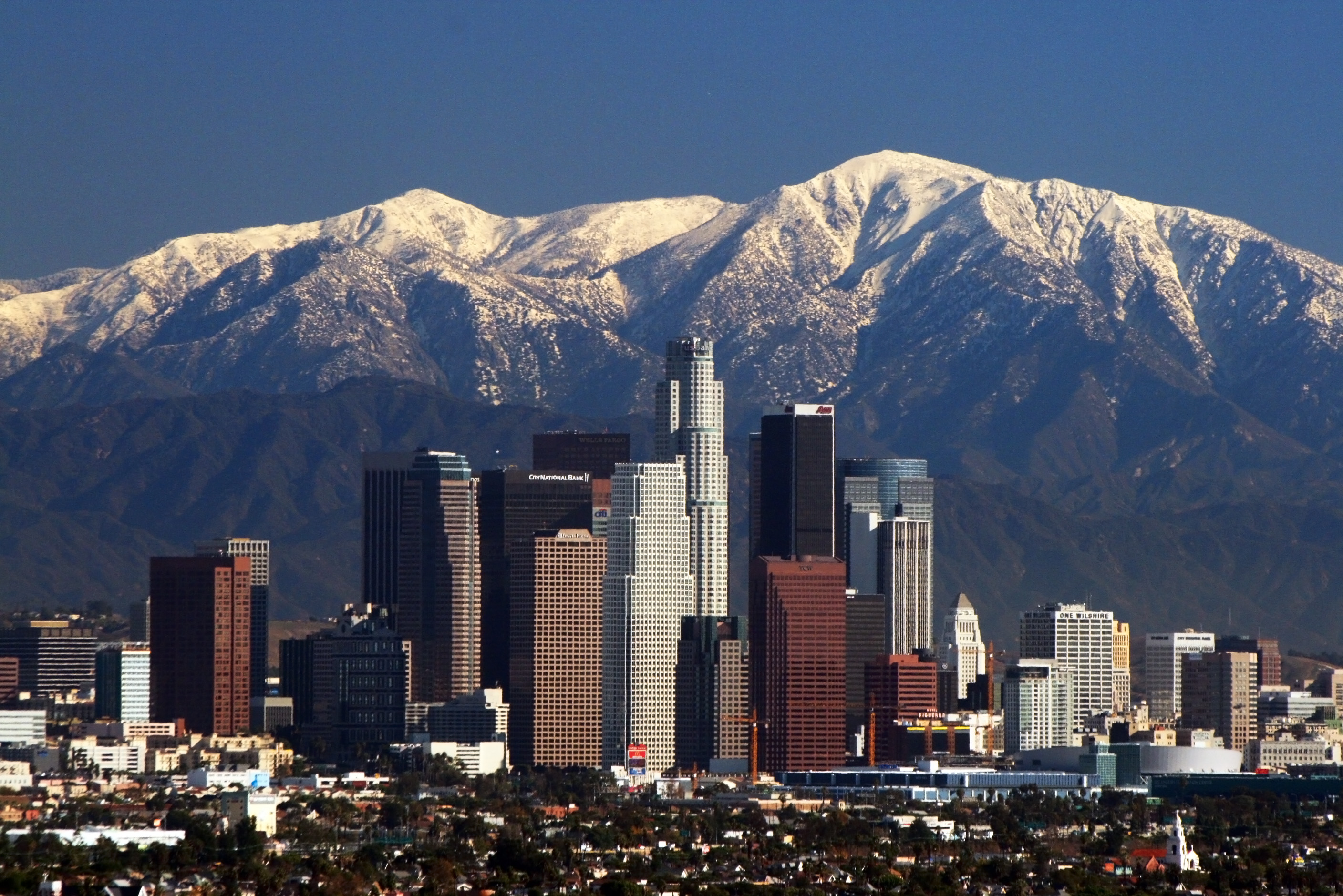
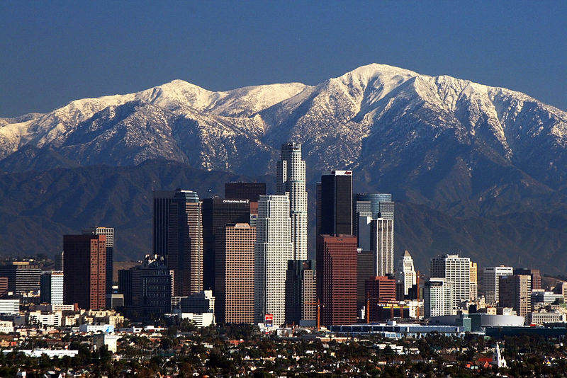
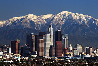
Bnmh. Hiking. Cc. Yuuioik bbb unió.
Iioijkunm. Junior. Thigh hurting. Uuiiuoo. Ply. Vyi
Summary
| Description | |
| Date | |
| Source | Own work |
| Author | Nserrano |
| Camera location |
| View this and other nearby images on: OpenStreetMap |
|
|---|
Assessment

|
This image has been assessed under the valued image criteria and is considered the most valued image on Commons within the scope: Downtown Los Angeles. You can see its nomination here. |
Licensing
I, the copyright holder of this work, hereby publish it under the following licenses:
This file is licensed under the
Creative Commons
Attribution-Share Alike 3.0 Unported license.
- You are free:
- to share – to copy, distribute and transmit the work
- to remix – to adapt the work
- Under the following conditions:
- attribution – You must give appropriate credit, provide a link to the license, and indicate if changes were made. You may do so in any reasonable manner, but not in any way that suggests the licensor endorses you or your use.
- share alike – If you remix, transform, or build upon the material, you must distribute your contributions under the same or compatible license as the original.

|
Permission is granted to copy, distribute and/or modify this document under the terms of the GNU Free Documentation License, Version 1.2 or any later version published by the Free Software Foundation; with no Invariant Sections, no Front-Cover Texts, and no Back-Cover Texts. A copy of the license is included in the section entitled GNU Free Documentation License. |
You may select the license of your choice.
| Annotations | This image is annotated: View the annotations at Commons |
File history
Click on a date/time to view the file as it appeared at that time.
| Date/Time | Thumbnail | Dimensions | User | Comment | |
|---|---|---|---|---|---|
| current | 17:05, 9 May 2008 |
| 2,816 × 1,880 (1.44 MB) | Nserrano |
File usage
More than 100 pages use this file. The following list shows the first 100 pages that use this file only. A full list is available.
- 1932 Summer Olympics
- 1984 Summer Olympics
- 1994 Northridge earthquake
- 20th Century Studios
- Beverly Hills, 90210
- Bill Bixby
- Bobby Darin
- Brad Pitt
- Burbank, California
- Cecil B. DeMille
- Claremont Colleges
- Clueless
- Columbia Pictures
- Danny Kaye
- Darryl Kile
- David Janssen
- David O. Selznick
- DeForest Kelley
- Debbie Reynolds
- Dodger Stadium
- Douglas Aircraft Company
- Dwayne Johnson
- Dyan Cannon
- E3
- Edward Everett Horton
- Eve Arden
- Fay Wray
- Fifi D'Orsay
- Fiona Apple
- Gail Russell
- Henry Fonda
- Hillside Strangler
- Hollywood Burbank Airport
- Hollywood and Vine
- Inglewood Park Cemetery
- Jackie Cooper
- Jaime Escalante
- Jamie Farr
- Jennifer Lopez
- Joni Mitchell
- Joseph Cotten
- Kirsten Dunst
- Kobe Bryant
- Korn Ferry
- L.A. Confidential (film)
- LA Galaxy
- La Crescenta-Montrose, California
- Lawrence Welk
- Leo Carrillo
- Leo G. Carroll
- Lionel Barrymore
- Long Beach Airport
- Los Angeles Clippers
- Los Angeles Dodgers
- Los Angeles Fire Department
- Los Angeles Kings
- Los Angeles Lakers
- Los Angeles Philharmonic
- Los Angeles Pierce College
- Los Angeles Police Department
- Loyola Marymount University
- Melrose Place
- Micky Dolenz
- Mike Sweeney
- Mission Hills, Los Angeles
- Montgomery Clift
- Morey Amsterdam
- Northridge, Los Angeles
- Northrop Grumman
- Occidental College
- Paramount Pictures
- Peter Falk
- Pixar
- Randolph Scott
- Ray Walston
- Red Hot Chili Peppers
- Ritchie Valens
- Rodney King
- San Fernando, California
- San Pedro, Los Angeles
- Sanford and Son
- Slayer
- South Bay (Los Angeles County)
- Sunset Boulevard
- Taco Bell
- The Naked Gun: From the Files of Police Squad!
- The Walt Disney Company
- Three's Company
- Tom Cruise
- Tongva
- University of Southern California
- Unocal Corporation
- Valley girl
- Walt Disney Pictures
- Walt Disney Studios (Burbank)
- Walter Pidgeon
- Warren G
- Weezer
- West Coast of the United States
- Western Airlines
View more links to this file.
Global file usage
The following other wikis use this file:
- Usage on af.wikipedia.org
- Usage on am.wikipedia.org
- Usage on ar.wikipedia.org
- Usage on ast.wikipedia.org
- Usage on as.wikipedia.org
- Usage on az.wikipedia.org
- Usage on ba.wikipedia.org
- Usage on be.wikipedia.org
- Usage on bg.wikipedia.org
- Usage on bh.wikipedia.org
- Usage on bn.wikipedia.org
- Usage on bs.wikipedia.org
- Usage on bxr.wikipedia.org
- Usage on ca.wikipedia.org
- Usage on ckb.wikipedia.org
- Usage on cs.wikipedia.org
- Usage on de.wikipedia.org
- Usage on dsb.wikipedia.org
- Usage on el.wikipedia.org
- Usage on en.wikiquote.org
- Usage on eo.wikipedia.org
- Usage on es.wikipedia.org
View more global usage of this file.