Size of this preview:
800 × 533 pixels. Other resolutions:
320 × 213 pixels |
640 × 426 pixels |
1,024 × 682 pixels |
1,300 × 866 pixels.
Original file (1,300 × 866 pixels, file size: 865 KB, MIME type: image/jpeg)
| This is a file from the
Wikimedia Commons. Information from its
description page there is shown below. Commons is a freely licensed media file repository. You can help. |
Summary
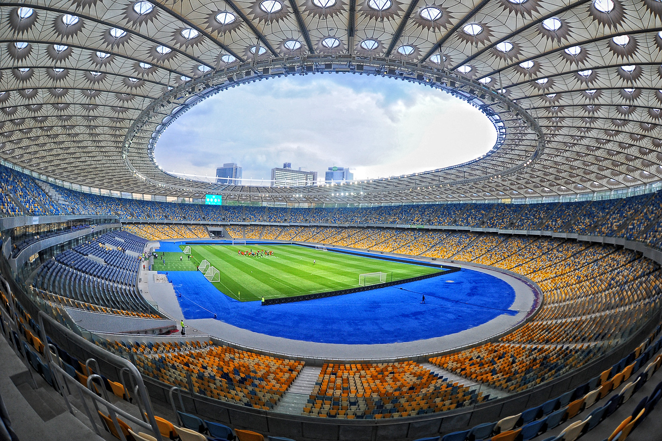
| Description | |
| Source | 2012-05-05 |
| Author | Валерий Дед |
| Camera location |
| View this and other nearby images on: OpenStreetMap |
|
|---|
Licensing
This file is licensed under the
Creative Commons
Attribution 3.0 Unported license.
- You are free:
- to share – to copy, distribute and transmit the work
- to remix – to adapt the work
- Under the following conditions:
- attribution – You must give appropriate credit, provide a link to the license, and indicate if changes were made. You may do so in any reasonable manner, but not in any way that suggests the licensor endorses you or your use.
| This image was originally posted to Panoramio by Валерий Дед at https://www.panoramio.com/photo/71535926. It was reviewed on 5 December 2016 by the Panoramio Review Bot robot and was confirmed to be licensed under the terms of the cc-by-3.0. |
File history
Click on a date/time to view the file as it appeared at that time.
| Date/Time | Thumbnail | Dimensions | User | Comment | |
|---|---|---|---|---|---|
| current | 03:24, 5 December 2016 |
| 1,300 × 866 (865 KB) | NickK | {{Information |Description={{uk|1= Національний спортивний комплекс «Олімпійський» у [[:uk:Київ|Києв... |
File usage
The following pages on the English Wikipedia use this file (pages on other projects are not listed):
- 2018 UEFA Champions League final
- 2020 Ukrainian Super Cup
- FC Dynamo Kyiv
- Klasychne derby
- Kyiv
- List of European stadiums by capacity
- List of association football stadiums by capacity
- List of football stadiums in Ukraine
- List of sporting venues with a highest attendance of 100,000 or more
- List of sports venues by capacity
- List of track and field stadiums by capacity
- Olimpiyskiy National Sports Complex
- User:SmackJam/sandbox/2022 Ukrainian Cup Final presented by Sports Interactive
Global file usage
The following other wikis use this file:
- Usage on ar.wikipedia.org
- Usage on ast.wikipedia.org
- Usage on az.wikipedia.org
- Usage on ban.wikipedia.org
- Usage on be-tarask.wikipedia.org
- Usage on be.wikipedia.org
- Usage on ca.wikipedia.org
- Usage on da.wikipedia.org
- Usage on de.wikipedia.org
- Usage on el.wikipedia.org
- Usage on es.wikipedia.org
- Kiev
- Anexo:Estadios de fútbol de Ucrania
- Liga de Campeones de la UEFA 2017-18
- Anexo:Grupo B de la Liga Europa de la UEFA 2017-18
- Anexo:Octavos de final de la Liga Europa de la UEFA 2017-18
- Final de la Liga de Campeones de la UEFA 2017-18
- Anexo:Grupo B de la Liga de Campeones de la UEFA 2020-21
- Anexo:Grupo G de la Liga de Campeones de la UEFA 2020-21
- Anexo:Octavos de final de la Liga Europa de la UEFA 2020-21
- Anexo:Grupo D de la Liga de Campeones de la UEFA 2021-22
- Anexo:Grupo E de la Liga de Campeones de la UEFA 2021-22
- Usage on eu.wikipedia.org
- Usage on fi.wikipedia.org
- Usage on fr.wikipedia.org
- Usage on fy.wikipedia.org
- Usage on hr.wikipedia.org
- Usage on id.wikipedia.org
- Usage on it.wikipedia.org
- Usage on ja.wikipedia.org
- Usage on jv.wikipedia.org
- Usage on lmo.wikipedia.org
- Usage on lt.wikipedia.org
- Usage on mk.wikipedia.org
- Usage on nl.wikipedia.org
- Usage on pl.wikipedia.org
View more global usage of this file.