Size of this preview:
800 × 560 pixels. Other resolutions:
320 × 224 pixels |
640 × 448 pixels |
1,024 × 716 pixels |
1,280 × 896 pixels |
2,560 × 1,791 pixels |
4,691 × 3,282 pixels.
Original file (4,691 × 3,282 pixels, file size: 4 MB, MIME type: image/jpeg)
| This is a file from the
Wikimedia Commons. Information from its
description page there is shown below. Commons is a freely licensed media file repository. You can help. |
|
This is an image of a place or building that is listed on the
National Register of Historic Places in the
United States of America. Its reference number is
85001090. |
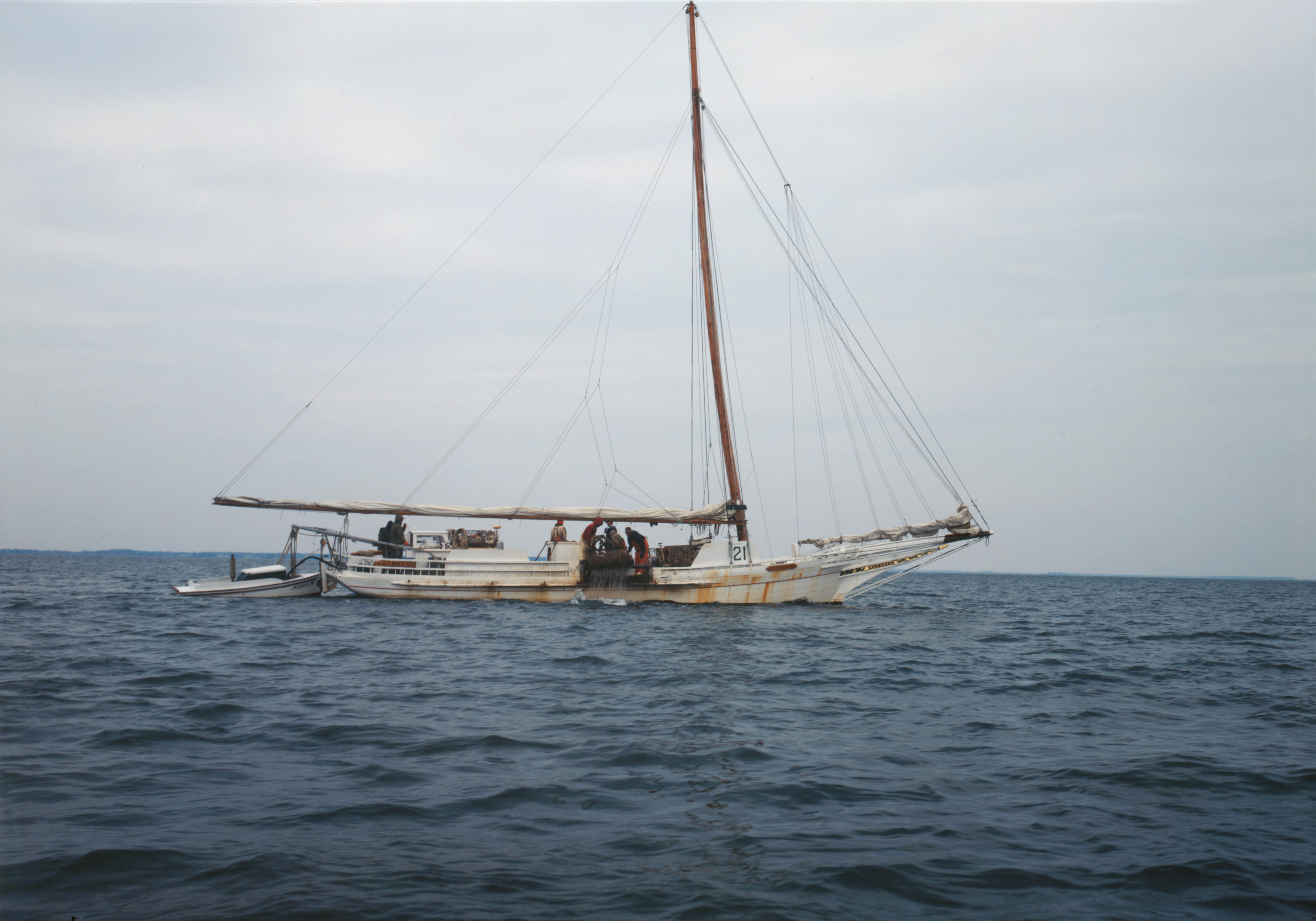
| Description | KATHRYN-Two-sail Bateau Skipjack, Dogwood Harbor, Chesapeake Bay, Tilghman vicinity (Talbot County, Maryland) (cropped) | |||||||||||||||||||||||
| Date | circa 1997 | |||||||||||||||||||||||
| Source | https://www.loc.gov/item/md1454/ | |||||||||||||||||||||||
| Author |
|
|||||||||||||||||||||||
| Permission ( Reusing this file) |
Historic American Buildings Survey md32 | |||||||||||||||||||||||
.jpg)
.jpg)
| Object location |
| View this and other nearby images on: OpenStreetMap |
|
|---|
.jpg¶ms=038.712778_N_-076.331389_E_globe:Earth_class:object_region:US_type:landmark_scale:1500_&language=en)

|
This file comes from the
Historic American Buildings Survey (HABS), Historic American Engineering Record (HAER) or Historic American Landscapes Survey (HALS). These are programs of the National Park Service established for the purpose of documenting historic places. Records consist of measured drawings, archival photographs, and written reports.
This tag does not indicate the copyright status of the attached work. A normal copyright tag is still required. See Commons:Licensing. |
| This image or media file contains material based on a work of a National Park Service employee, created as part of that person's official duties. As a work of the U.S. federal government, such work is in the public domain in the United States. See the NPS website and NPS copyright policy for more information. |
File history
Click on a date/time to view the file as it appeared at that time.
| Date/Time | Thumbnail | Dimensions | User | Comment | |
|---|---|---|---|---|---|
| current | 18:09, 31 March 2017 |
| 4,691 × 3,282 (4 MB) | Hohum | Cropped and colour adjust. |
| 18:08, 31 March 2017 |
 | 4,958 × 3,540 (3.67 MB) | Hohum | Larger original | |
| 17:59, 31 March 2017 |
 | 971 × 675 (245 KB) | Hohum | Cropped, colour balance | |
| 17:59, 31 March 2017 |
 | 1,024 × 731 (214 KB) | Hohum | From Library of Congress | |
| 19:08, 17 October 2012 |
 | 474 × 362 (38 KB) | Hohum | Levels | |
| 16:11, 10 May 2008 |
 | 474 × 362 (35 KB) | KudzuVine | {{Information |Description=KATHRYN-Two-sail Bateau Skipjack, Dogwood Harbor, Chesapeake Bay, Tilghman vicinity (Talbot County, Maryland) (cropped) |Source=http://memory.loc.gov/cgi-bin/displayPhoto.pl?path=/pnp/habshaer/md/md1400/md1454/color&topImages=57 |
File usage
The following pages on the English Wikipedia use this file (pages on other projects are not listed):
- Kathryn (skipjack)
- List of National Historic Landmarks in Maryland
- List of U.S. National Historic Landmark ships, shipwrecks, and shipyards
- List of oldest surviving ships
- National Register of Historic Places listings in Talbot County, Maryland
- User:Ammienoot/wiki boats
- User:LornaMCampbell/List of boats
- User:Stinglehammer/List of boats
Global file usage
The following other wikis use this file:
- Usage on de.wikipedia.org
- Usage on fr.wikipedia.org
- Usage on www.wikidata.org
.jpg)