
Size of this preview:
800 × 531 pixels. Other resolutions:
320 × 212 pixels |
640 × 425 pixels |
1,024 × 679 pixels |
1,280 × 849 pixels |
2,560 × 1,699 pixels |
4,280 × 2,840 pixels.
Original file (4,280 × 2,840 pixels, file size: 3.04 MB, MIME type: image/jpeg)
| This is a file from the
Wikimedia Commons. Information from its
description page there is shown below. Commons is a freely licensed media file repository. You can help. |
|
This is an image of a place or building that is listed on the
National Register of Historic Places in the
United States of America. Its reference number is
80002823. |
| Camera location |
| View this and other nearby images on: OpenStreetMap |
|
|---|
| Description |
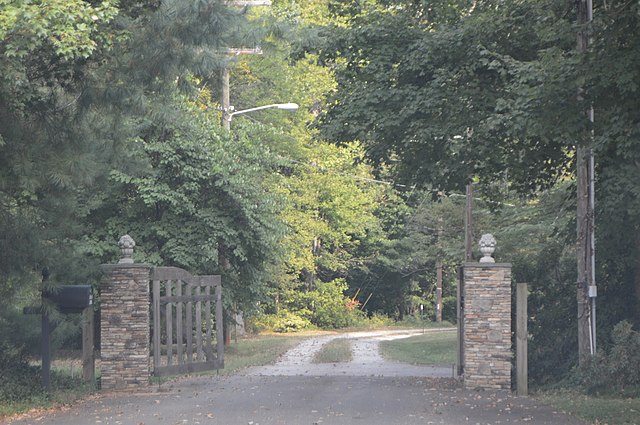
English: Driveway to the
Jesse Clement House, located at the eastern end of Maple Avenue in
Mocksville,
North Carolina,
United States. The house is listed on the
National Register of Historic Places. |
||
| Date | Taken on 14 September 2019 | ||
| Source | Own work | ||
| Author | Nyttend | ||
| Permission ( Reusing this file) |
|
||
| Other versions | None |
File history
Click on a date/time to view the file as it appeared at that time.
| Date/Time | Thumbnail | Dimensions | User | Comment | |
|---|---|---|---|---|---|
| current | 20:51, 26 February 2020 |
| 4,280 × 2,840 (3.04 MB) | Nyttend | Cropping irrelevant surroundings |
| 18:48, 26 February 2020 |
 | 6,016 × 4,000 (6.36 MB) | Nyttend |
File usage
The following pages on the English Wikipedia use this file (pages on other projects are not listed):
Global file usage
The following other wikis use this file:
- Usage on www.wikidata.org