
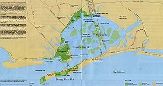
Size of this preview:
800 × 425 pixels. Other resolutions:
320 × 170 pixels |
640 × 340 pixels |
1,024 × 544 pixels |
1,280 × 680 pixels |
3,113 × 1,654 pixels.
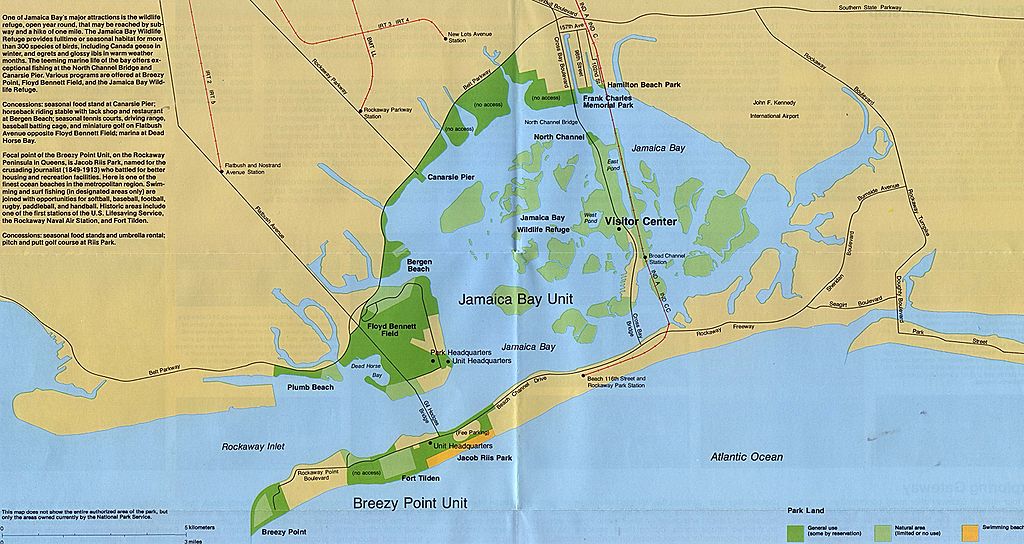
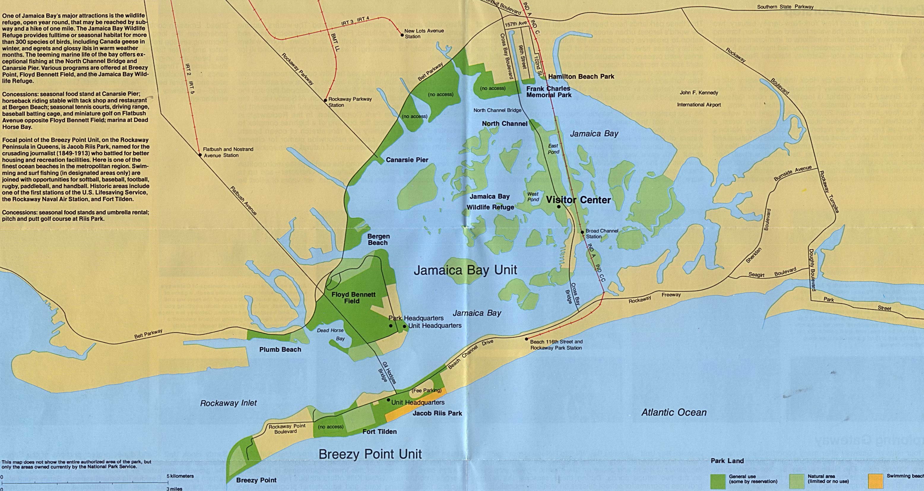
Original file (3,113 × 1,654 pixels, file size: 783 KB, MIME type: image/jpeg)
| This is a file from the
Wikimedia Commons. Information from its
description page there is shown below. Commons is a freely licensed media file repository. You can help. |
Summary
| Description | |
| Source | |
| Author | Original uploader was Hephaestos at en.wikipedia |
| Other versions | File:Jamaica-bay-unit.png |
Licensing
| This image or media file contains material based on a work of a National Park Service employee, created as part of that person's official duties. As a work of the U.S. federal government, such work is in the public domain in the United States. See the NPS website and NPS copyright policy for more information. |
Original upload log
The original description page was
here. All following user names refer to en.wikipedia.
- 2008-09-23 19:55 Elipongo 3113×1654 (801817 bytes)
- July 10, 2003 Hephaestos 1,038 × 551 (107,418 bytes) (Jamaica Bay map)
File history
Click on a date/time to view the file as it appeared at that time.
| Date/Time | Thumbnail | Dimensions | User | Comment | |
|---|---|---|---|---|---|
| current | 19:59, 23 September 2008 |
| 3,113 × 1,654 (783 KB) | File Upload Bot (Magnus Manske) | {{BotMoveToCommons|en.wikipedia}} {{Information |Description={{en|'''Jamaica Bay map''' Source: [http://www.lib.utexas.edu/maps/index.html U. Texas PCL map collection], [http://www.lib.utexas.edu/maps/national_parks/gate94.jpg JPG file]}} |Source=Transf |
File usage
The following pages on the English Wikipedia use this file (pages on other projects are not listed):
Global file usage
The following other wikis use this file:
- Usage on ca.wikipedia.org
- Usage on ceb.wikipedia.org
- Usage on de.wikipedia.org
- Usage on es.wikipedia.org
- Usage on et.wikipedia.org
- Usage on id.wikipedia.org
- Usage on it.wikipedia.org
- Usage on ru.wikipedia.org
- Usage on simple.wikipedia.org
- Usage on uk.wikipedia.org
- Usage on www.wikidata.org
- Usage on zh.wikipedia.org