
Size of this PNG preview of this SVG file:
385 × 599 pixels. Other resolutions:
154 × 240 pixels |
308 × 480 pixels |
494 × 768 pixels |
658 × 1,024 pixels |
1,316 × 2,048 pixels |
675 × 1,050 pixels.
Original file (SVG file, nominally 675 × 1,050 pixels, file size: 495 KB)
| This is a file from the
Wikimedia Commons. Information from its
description page there is shown below. Commons is a freely licensed media file repository. You can help. |
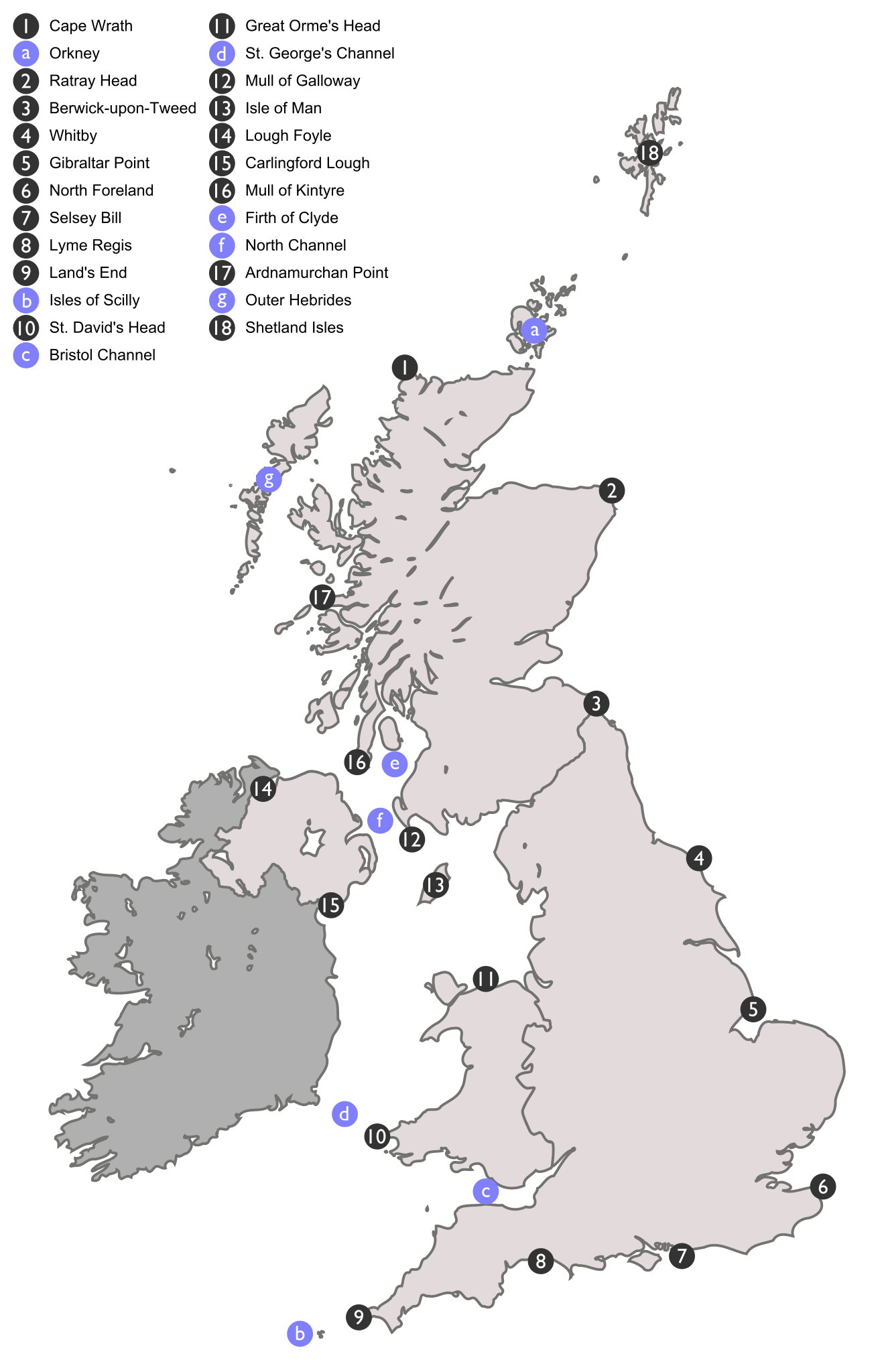
| Description | Map showing the locations of areas mentioned in the inshore weather report of the Shipping Forecast. Numbers in grey circles represent area delimiters, letters in blue circles represent other important bodies of water and islands. |
| Date | (UTC) |
| Source | |
| Author |
|
I, the copyright holder of this work, hereby publish it under the following license:
| I, the copyright holder of this work, release this work into the
public domain. This applies worldwide. In some countries this may not be legally possible; if so: I grant anyone the right to use this work for any purpose, without any conditions, unless such conditions are required by law. |
Original upload log
This image is a derivative work of the following images:
-
Image:British_Isles_United_Kingdom.svg licensed with PD-self
- 2007-10-21T01:22:38Z Cnbrb 675x1180 (240388 Bytes) == Summary == {{Information |Description=map showing the territory of the United Kingdom in the context of the islands of Great Britain and Ireland |Source=self-made |Date=2007-21-09 |Author= [[User:Cnbrb|Cnbrb]] }} [[Catego
- 2007-10-21T01:20:33Z Cnbrb 675x1180 (310388 Bytes) == Summary == {{Information |Description=map showing the territory of the United Kingdom in the context of the islands of Great Britain and Ireland |Source=self-made |Date=2007-09-21 |Author= [[User:Cnbrb|Cnbrb]] }} [[Catego
Uploaded with derivativeFX
File history
Click on a date/time to view the file as it appeared at that time.
| Date/Time | Thumbnail | Dimensions | User | Comment | |
|---|---|---|---|---|---|
| current | 16:33, 14 June 2016 |
| 675 × 1,050 (495 KB) | Shyamal | Fix "g" and move "b" to show island below |
| 18:39, 19 October 2008 |
 | 675 × 1,050 (494 KB) | Smurrayinchester | Fix typeface | |
| 18:36, 19 October 2008 |
 | 675 × 1,050 (215 KB) | Smurrayinchester | Fix typeface | |
| 18:33, 19 October 2008 |
 | 675 × 1,050 (213 KB) | Smurrayinchester | {{Information |Description=Map showing the locations of areas mentioned in the inshore weather report of the w:Shipping Forecast. Numbers in grey circles represent area delimiters, letters in blue cir |
File usage
The following pages on the English Wikipedia use this file (pages on other projects are not listed):