Size of this preview:
800 × 600 pixels. Other resolutions:
320 × 240 pixels |
640 × 480 pixels |
1,024 × 768 pixels |
1,280 × 960 pixels |
2,560 × 1,920 pixels |
3,648 × 2,736 pixels.
Original file (3,648 × 2,736 pixels, file size: 2.21 MB, MIME type: image/jpeg)
| This is a file from the
Wikimedia Commons. Information from its
description page there is shown below. Commons is a freely licensed media file repository. You can help. |
,_Aug_2022.jpg)
Summary
| Description |
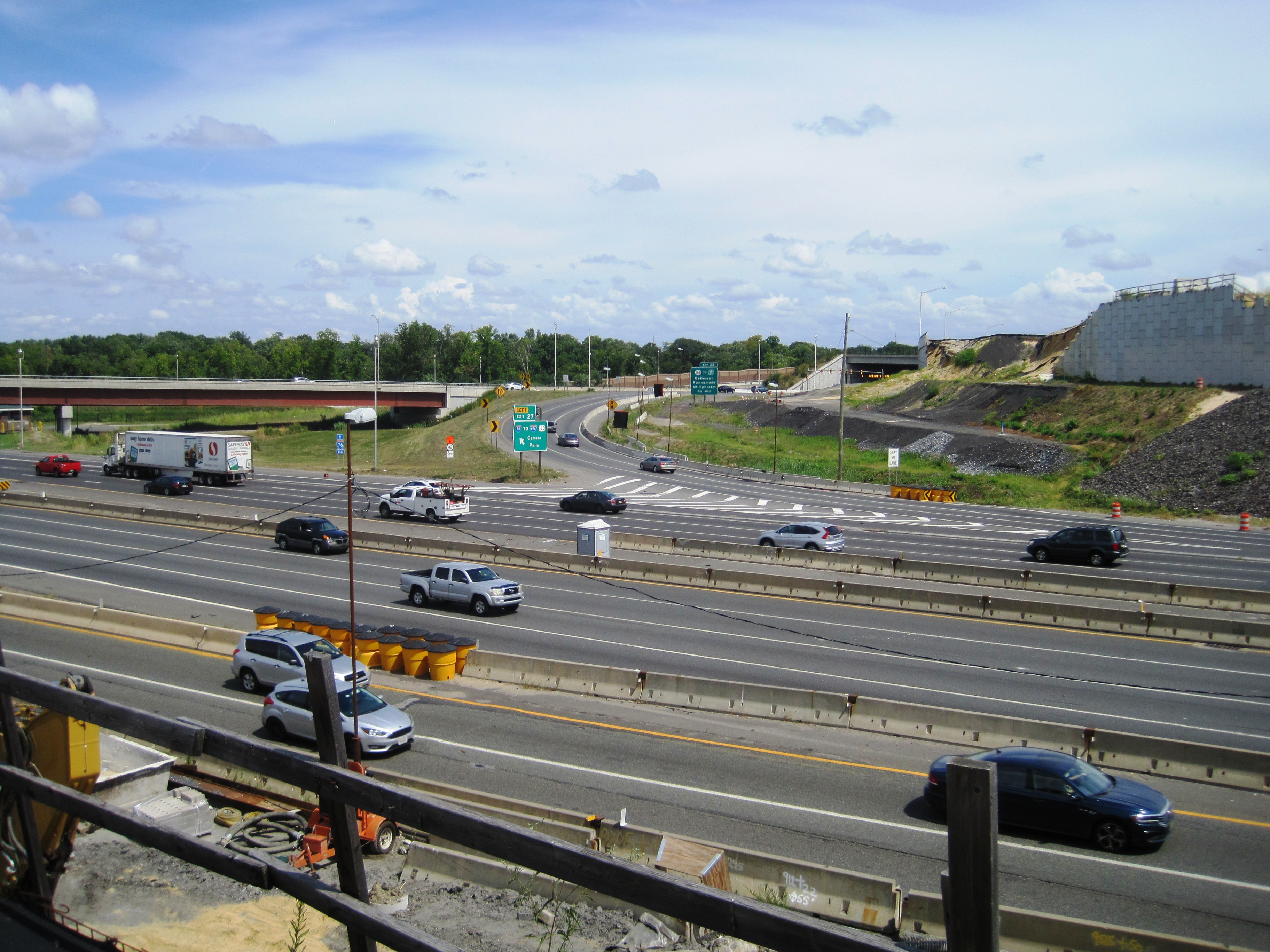
English: Photo of the interchange between
Interstate 76,
I-295, and
New Jersey Route 42 as photographed from Browning Road (
County Route 659) overpass sidewalk looking northeast. The remnants of a retaining wall collapse that occurred in March 2021 are seen in the right background. |
| Date | |
| Source | Own work |
| Author | Mr. Matté (if there is an issue with this image, contact me using this image's Commons talk page, my Commons user talk page, or my English Wikipedia user talk page; I'll know about it a lot faster) |
,_Aug_2022.jpg&action=edit&redlink=1)
Licensing
I, the copyright holder of this work, hereby publish it under the following license:
This file is licensed under the
Creative Commons
Attribution-Share Alike 4.0 International license.
- You are free:
- to share – to copy, distribute and transmit the work
- to remix – to adapt the work
- Under the following conditions:
- attribution – You must give appropriate credit, provide a link to the license, and indicate if changes were made. You may do so in any reasonable manner, but not in any way that suggests the licensor endorses you or your use.
- share alike – If you remix, transform, or build upon the material, you must distribute your contributions under the same or compatible license as the original.
File history
Click on a date/time to view the file as it appeared at that time.
| Date/Time | Thumbnail | Dimensions | User | Comment | |
|---|---|---|---|---|---|
| current | 23:46, 23 August 2022 |
| 3,648 × 2,736 (2.21 MB) | Mr. Matté | Uploaded own work with UploadWizard |
File usage
The following pages on the English Wikipedia use this file (pages on other projects are not listed):
,_Aug_2022.jpg)