Size of this preview:
800 × 534 pixels. Other resolutions:
320 × 213 pixels |
640 × 427 pixels |
1,024 × 683 pixels |
1,280 × 854 pixels |
2,048 × 1,366 pixels.
Original file (2,048 × 1,366 pixels, file size: 515 KB, MIME type: image/jpeg)
| This is a file from the
Wikimedia Commons. Information from its
description page there is shown below. Commons is a freely licensed media file repository. You can help. |
Summary
| Description |
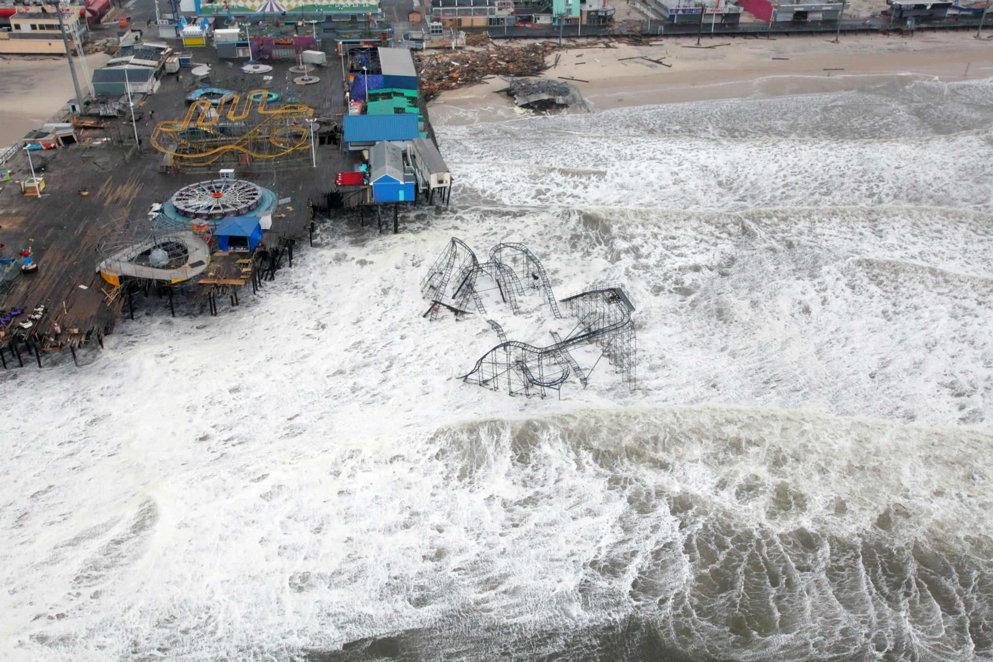
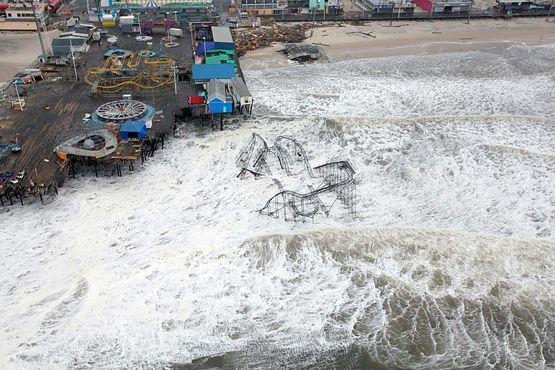
English: Aerial views of the damage caused by Hurricane Sandy to the New Jersey coast taken during a search and rescue mission by 1-150 Assault Helicopter Battalion, New Jersey Army National Guard, Oct. 30, 2012. (This appears to be
Casino Pier,
Seaside Heights, New Jersey.) |
| Date | |
| Source | Flickr |
| Author | Master Sgt. Mark C. Olsen/U.S. Air Force/New Jersey National Guard |
| Other versions | Derivative works of this file: Hurricane Sandy New Jersey Pier cropped.jpg |
| Object location |
| View this and other nearby images on: OpenStreetMap |
|
|---|
Licensing
This file is licensed under the
Creative Commons
Attribution 2.0 Generic license.
- You are free:
- to share – to copy, distribute and transmit the work
- to remix – to adapt the work
- Under the following conditions:
- attribution – You must give appropriate credit, provide a link to the license, and indicate if changes were made. You may do so in any reasonable manner, but not in any way that suggests the licensor endorses you or your use.
| This image was originally posted to Flickr by The National Guard at https://www.flickr.com/photos/33252741@N08/8140596235. It was reviewed on 31 October 2012 by FlickreviewR and was confirmed to be licensed under the terms of the cc-by-2.0. |
This image or file is a work of a
U.S. National Guard member or employee, taken or made as part of that person's official duties. As a
work of the
U.S. federal government, the image or file is in the
public domain in the United States.
|
 |
File history
Click on a date/time to view the file as it appeared at that time.
| Date/Time | Thumbnail | Dimensions | User | Comment | |
|---|---|---|---|---|---|
| current | 13:04, 31 October 2012 |
| 2,048 × 1,366 (515 KB) | LuK3 | {{Information |Description ={{en|1=Aerial views of the damage caused by Hurricane Sandy to the New Jersey coast taken during a search and rescue mission by 1-150 Assault Helicopter Battalion, New Jersey Army National Guard, Oct. 30, 2012.}} |Source ... |
File usage
The following pages on the English Wikipedia use this file (pages on other projects are not listed):
Global file usage
The following other wikis use this file:
- Usage on az.wikipedia.org
- Usage on de.wikipedia.org
- Usage on el.wikipedia.org
- Usage on fr.wikipedia.org
- Usage on ga.wikipedia.org
- Usage on it.wikipedia.org
- Usage on it.wikinews.org
- Usage on ro.wikipedia.org