Size of this preview:
701 × 600 pixels. Other resolutions:
281 × 240 pixels |
561 × 480 pixels |
898 × 768 pixels |
1,065 × 911 pixels.
Original file (1,065 × 911 pixels, file size: 1.21 MB, MIME type: image/png)
| This is a file from the
Wikimedia Commons. Information from its
description page there is shown below. Commons is a freely licensed media file repository. You can help. |
Summary
| Description |
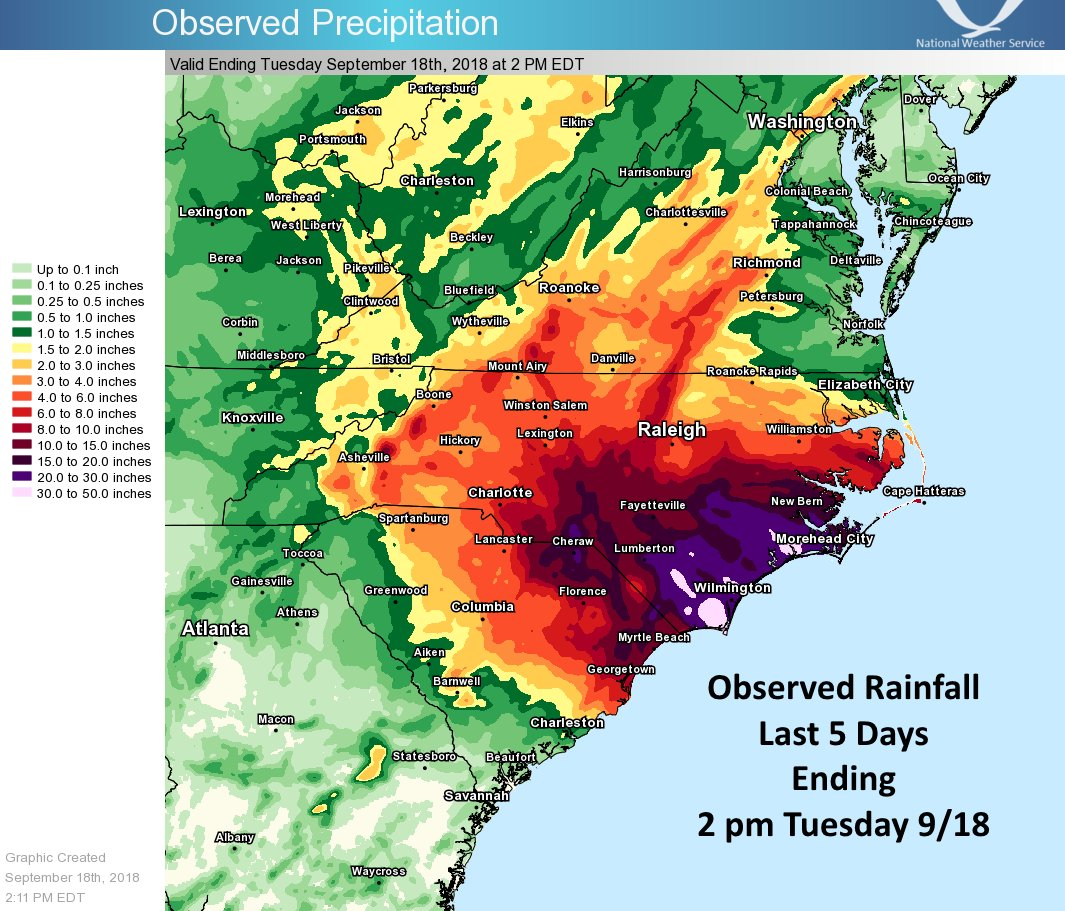
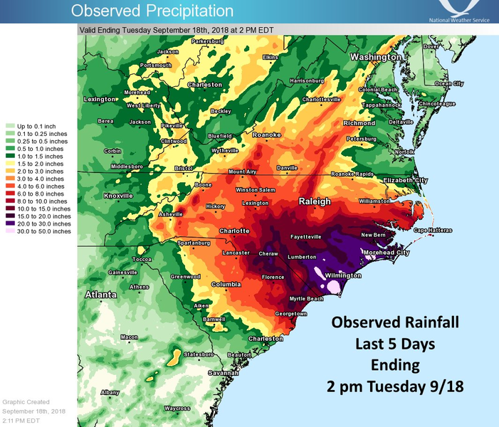
English: The latest observed rainfall map from Florence. Totals are from the last 5 days ending 2 pm this afternoon (Tuesday September 18th). |
| Date | |
| Source | https://twitter.com/NWSEastern/status/1041409747415691264 |
| Author | US National Weather Service Eastern Region Headquarters |
Licensing
This image is in the
public domain because it contains materials that originally came from the U.S.
National Oceanic and Atmospheric Administration, taken or made as part of an employee's official duties.
|
File history
Click on a date/time to view the file as it appeared at that time.
| Date/Time | Thumbnail | Dimensions | User | Comment | |
|---|---|---|---|---|---|
| current | 13:16, 19 September 2018 |
| 1,065 × 911 (1.21 MB) | Pierre cb | {{Information |description ={{en|1=The latest observed rainfall map from Florence. Totals are from the last 5 days ending 2 pm this afternoon (Tuesday September 18th).}} |date =2018-09-18 |source =https://twitter.com/NWSEastern/status/1041409747415691264 |author =US National Weather Service Eastern Region Headquarters }} Category:Hurricane Florence |
File usage
The following pages on the English Wikipedia use this file (pages on other projects are not listed):
Global file usage
The following other wikis use this file:
- Usage on ca.wikipedia.org
- Usage on fr.wikipedia.org
- Usage on pt.wikipedia.org