
Size of this preview:
800 × 600 pixels. Other resolutions:
320 × 240 pixels |
640 × 480 pixels |
1,024 × 768 pixels |
1,280 × 960 pixels |
2,560 × 1,920 pixels |
3,072 × 2,304 pixels.
Original file (3,072 × 2,304 pixels, file size: 614 KB, MIME type: image/jpeg)
| This is a file from the
Wikimedia Commons. Information from its
description page there is shown below. Commons is a freely licensed media file repository. You can help. |
Summary
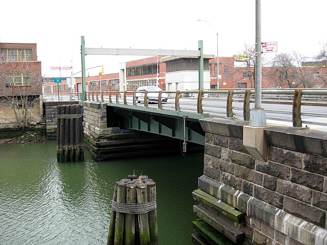
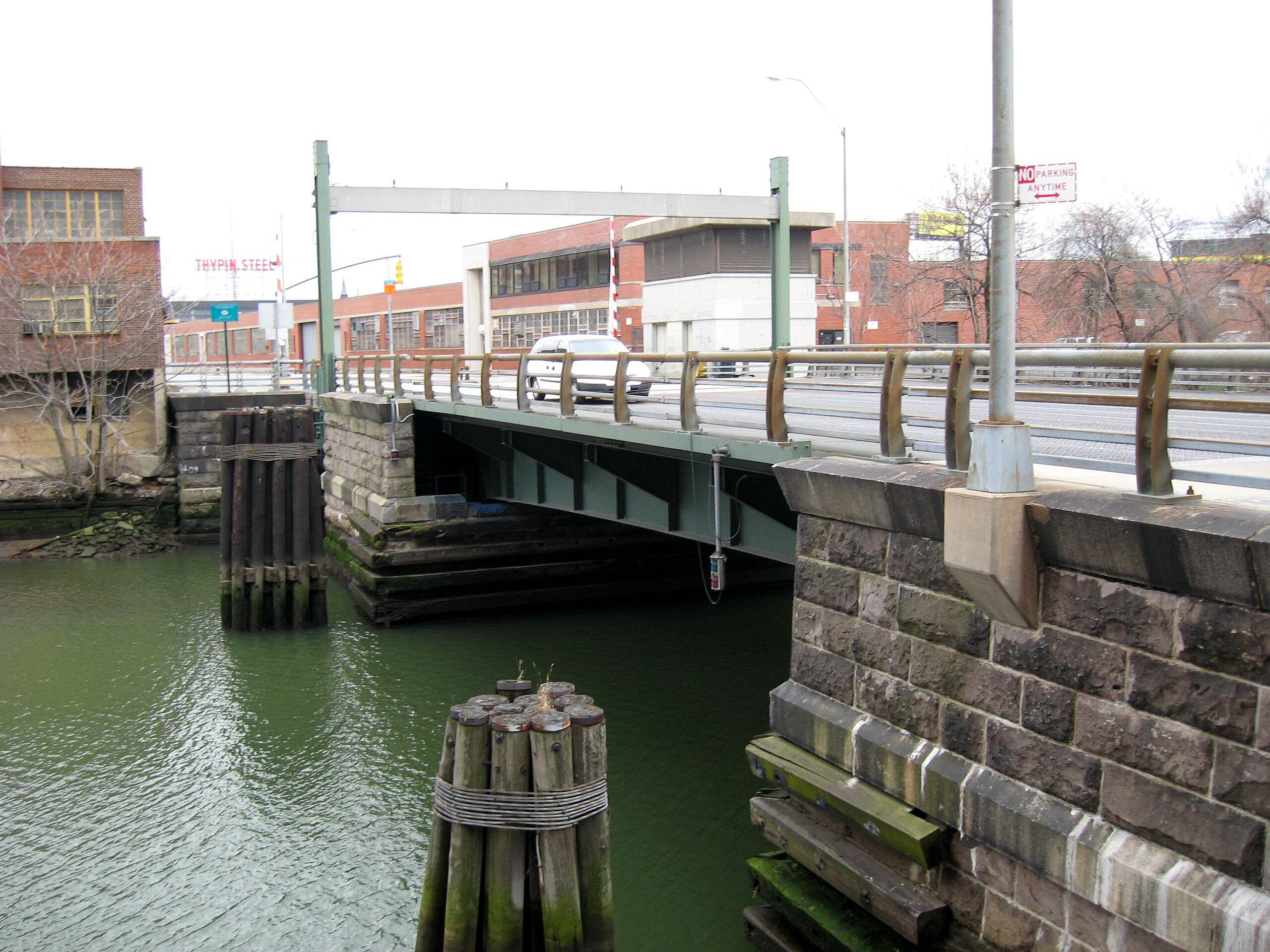
| Description | I stood on the upstream (north) side of Hunterspoint Avenue Bridge designed by en:Edward Abraham Byrne, right (west) bank of en:Dutch Kills on a cloudy afternoon in early Spring. |
| Date | |
| Source | Own work |
| Author | Jim.henderson |
| Permission ( Reusing this file) |
All |
| Camera location | | View this and other nearby images on: OpenStreetMap |
|
|---|
Licensing
| I, the copyright holder of this work, release this work into the
public domain. This applies worldwide. In some countries this may not be legally possible; if so: I grant anyone the right to use this work for any purpose, without any conditions, unless such conditions are required by law. |
File history
Click on a date/time to view the file as it appeared at that time.
| Date/Time | Thumbnail | Dimensions | User | Comment | |
|---|---|---|---|---|---|
| current | 01:29, 13 April 2008 |
| 3,072 × 2,304 (614 KB) | Jim.henderson | {{Information |Description=I stood on the downstream side of Hunterspoint Avenue Bridge designed by Edward Abraham Byrne, left bank of Dutch Kills on a cloudy afternoon in early Spring. |Source=self-made |Date=April 6, 2008 |Author= [[User:Jim.hen |
File usage
The following pages on the English Wikipedia use this file (pages on other projects are not listed):