Size of this preview:
601 × 599 pixels. Other resolutions:
241 × 240 pixels |
481 × 480 pixels |
699 × 697 pixels.
Original file (699 × 697 pixels, file size: 406 KB, MIME type: image/png)
| This is a file from the
Wikimedia Commons. Information from its
description page there is shown below. Commons is a freely licensed media file repository. You can help. |
Summary
| Description |
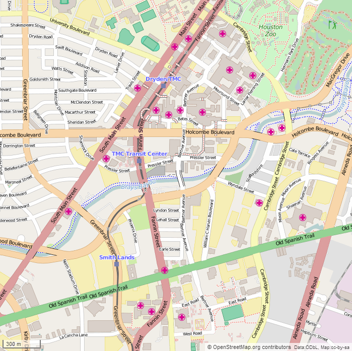
English: This map of the Houston Medical Center (Texas Medical Center) was created from OpenStreetMap project data, collected by the community. The image should remain clear of any additional edits. To annotate the map for an article, use the Infobox or Location Map template and reference the map using map module Houston Medical Center. This map may be incomplete, and may contain errors. Submit corrections to the below source link. Do not rely solely on the map for navigation.
Steven Driskell
|
| Date | |
| Source | http://www.openstreetmap.org/ |
| Author | OpenStreetMap contributors |
Licensing
This file is licensed under the
Creative Commons
Attribution-Share Alike 2.5 Generic license.
- You are free:
- to share – to copy, distribute and transmit the work
- to remix – to adapt the work
- Under the following conditions:
- attribution – You must give appropriate credit, provide a link to the license, and indicate if changes were made. You may do so in any reasonable manner, but not in any way that suggests the licensor endorses you or your use.
- share alike – If you remix, transform, or build upon the material, you must distribute your contributions under the same or compatible license as the original.
File history
Click on a date/time to view the file as it appeared at that time.
| Date/Time | Thumbnail | Dimensions | User | Comment | |
|---|---|---|---|---|---|
| current | 20:58, 20 February 2015 |
| 699 × 697 (406 KB) | SDriskell | User created page with UploadWizard |
File usage
The following pages on the English Wikipedia use this file (pages on other projects are not listed):
- Baylor College of Medicine
- Baylor St. Luke's Medical Center
- Ben Taub Hospital
- Gulf Coast Regional Blood Center
- Houston Methodist Hospital
- MD Anderson Cancer Center
- Memorial Hermann–Texas Medical Center
- Michael E. DeBakey Veterans Affairs Medical Center in Houston
- Shriners Hospital for Children (Houston)
- Texas Children's Hospital
- Module:Location map/data/Houston Medical Center
- Module:Location map/data/Houston Medical Center/doc
Global file usage
The following other wikis use this file:
- Usage on ar.wikipedia.org
- Usage on fa.wikipedia.org
- Usage on si.wikipedia.org