Size of this preview:
800 × 593 pixels. Other resolutions:
320 × 237 pixels |
640 × 474 pixels |
1,024 × 758 pixels |
1,280 × 948 pixels |
1,600 × 1,185 pixels.
Original file (1,600 × 1,185 pixels, file size: 1.88 MB, MIME type: image/jpeg)
| This is a file from the
Wikimedia Commons. Information from its
description page there is shown below. Commons is a freely licensed media file repository. You can help. |
Summary
| Camera location | | View this and other nearby images on: OpenStreetMap |
|
|---|
| Description |
日本語:
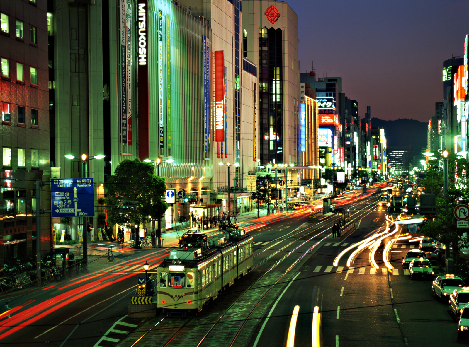
胡町駅。広島県広島市中区。三越広島店が見える。 English:
Ebisu-chō Station. Nederlands: Zelfgemaakte opname (gescande 6x7 dia) |
| Date | Taken in May 1999 |
| Source |
Transferred from
nl.wikipedia to Commons. |
| Author | (Original text: Charles Voogd) |
| Permission ( Reusing this file) |
Eigen werk |
Licensing

|
Permission is granted to copy, distribute and/or modify this document under the terms of the GNU Free Documentation License, Version 1.2 or any later version published by the Free Software Foundation; with no Invariant Sections, no Front-Cover Texts, and no Back-Cover Texts. A copy of the license is included in the section entitled GNU Free Documentation License. |
| This file is licensed under the Creative Commons Attribution-Share Alike 3.0 Unported license. | ||
| Attribution: Voogd075 | ||
| ||
| This licensing tag was added to this file as part of the GFDL licensing update. |
Original upload log
The original description page was
here. All following user names refer to nl.wikipedia.
- 2006-12-10 19:58 Voogd075 1600×1185×8 (1967993 bytes) {{Information| |Description=Zelfgemaakte opname (gescande 6x7 dia) |Source=Eigen werk |Date=mei 1999 |Author=Charles Voogd |Permission=Eigen werk |other_versions= }}
File history
Click on a date/time to view the file as it appeared at that time.
| Date/Time | Thumbnail | Dimensions | User | Comment | |
|---|---|---|---|---|---|
| current | 18:07, 19 March 2007 |
| 1,600 × 1,185 (1.88 MB) | SieBot | {{Information |Description=Zelfgemaakte opname (gescande 6x7 dia) |Source=Originally from [http://nl.wikipedia.org nl.wikipedia]; description page is/was [http://nl.wikipedia.org/?title=Image%3AHiroshimaNight.jpg here].<br/> (Original text : ' |
File usage
The following pages on the English Wikipedia use this file (pages on other projects are not listed):
Global file usage
The following other wikis use this file:
- Usage on ar.wikipedia.org
- Usage on bg.wikipedia.org
- Usage on ca.wikipedia.org
- Usage on ce.wikipedia.org
- Usage on eo.wikipedia.org
- Usage on es.wikipedia.org
- Usage on gag.wikipedia.org
- Usage on gl.wikipedia.org
- Usage on id.wikipedia.org
- Usage on it.wikipedia.org
- Usage on ja.wikipedia.org
- Usage on ko.wikipedia.org
- Usage on nl.wikipedia.org
- Usage on pnb.wikipedia.org
- Usage on pt.wikipedia.org
- Usage on ru.wikipedia.org
- Usage on sq.wikipedia.org
- Usage on tl.wikipedia.org
- Usage on www.wikidata.org
- Usage on zh.wikipedia.org