Size of this preview:
800 × 530 pixels. Other resolutions:
320 × 212 pixels |
640 × 424 pixels |
1,024 × 679 pixels |
1,280 × 848 pixels |
3,039 × 2,014 pixels.
Original file (3,039 × 2,014 pixels, file size: 4.2 MB, MIME type: image/jpeg)
| This is a file from the
Wikimedia Commons. Information from its
description page there is shown below. Commons is a freely licensed media file repository. You can help. |
Summary
| Description |
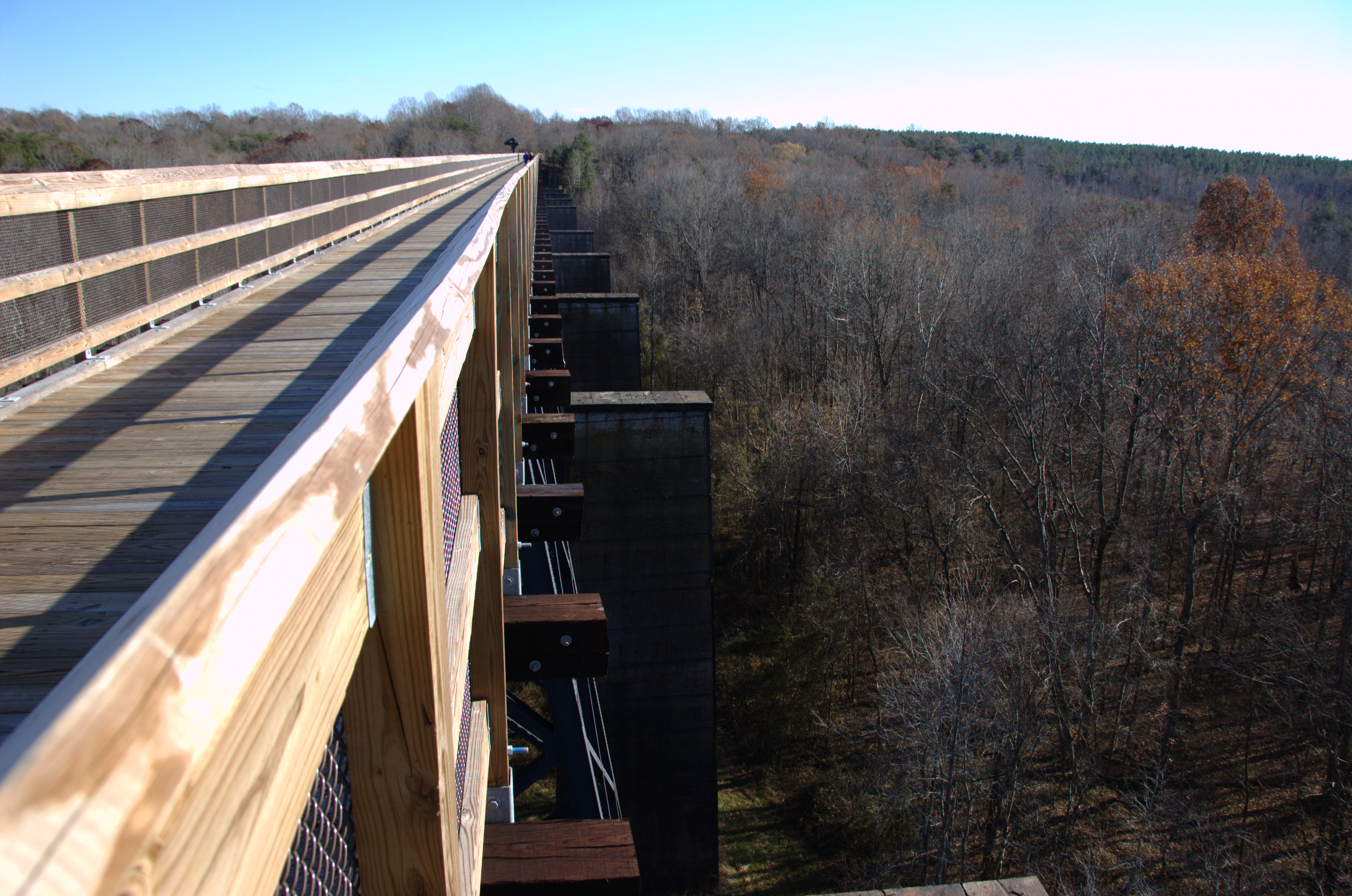
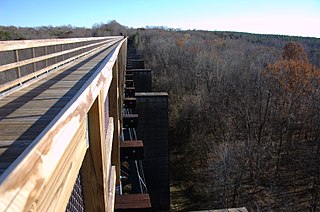
English: High Bridge at High Bridge Trail State Park, near Farmville, VA. Photograph taken 24 Nov. 2012 around 3 PM facing southeast. |
| Date | |
| Source | Own work |
| Author | Mark Turner |
| Camera location |
| View this and other nearby images on: OpenStreetMap |
|
|---|
Licensing
I, the copyright holder of this work, hereby publish it under the following license:
| I, the copyright holder of this work, release this work into the
public domain. This applies worldwide. In some countries this may not be legally possible; if so: I grant anyone the right to use this work for any purpose, without any conditions, unless such conditions are required by law. |
File history
Click on a date/time to view the file as it appeared at that time.
| Date/Time | Thumbnail | Dimensions | User | Comment | |
|---|---|---|---|---|---|
| current | 20:23, 25 November 2012 |
| 3,039 × 2,014 (4.2 MB) | Jmturner | User created page with UploadWizard |
File usage
The following pages on the English Wikipedia use this file (pages on other projects are not listed):
Global file usage
The following other wikis use this file:
- Usage on www.wikidata.org