
Size of this preview:
600 × 600 pixels. Other resolutions:
240 × 240 pixels |
480 × 480 pixels |
768 × 768 pixels |
1,024 × 1,024 pixels |
2,048 × 2,048 pixels |
4,000 × 4,000 pixels.
Original file (4,000 × 4,000 pixels, file size: 4.66 MB, MIME type: image/jpeg)
| This is a file from the
Wikimedia Commons. Information from its
description page there is shown below. Commons is a freely licensed media file repository. You can help. |
Summary
| Description |
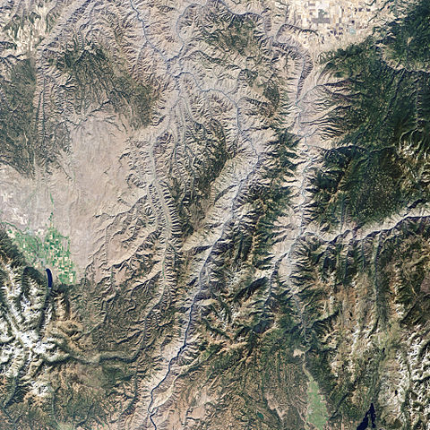
English: Satellite picture of
Hells Canyon National Recreation Area— in eastern
Idaho and western
Oregon.
|
| Date | acquired September 19, 2002 |
| Source | http://earthobservatory.nasa.gov/IOTD/view.php?id=37320 |
| Author | NASA image created by Jesse Allen, using Landsat data provided by the United States Geological Survey. Caption by Rebecca Lindsey. |
Licensing
| This file is in the public domain in the United States because it was solely created by NASA. NASA copyright policy states that "NASA material is not protected by copyright unless noted". (See Template:PD-USGov, NASA copyright policy page or JPL Image Use Policy.) | ||
 |
Warnings:
|
File history
Click on a date/time to view the file as it appeared at that time.
| Date/Time | Thumbnail | Dimensions | User | Comment | |
|---|---|---|---|---|---|
| current | 15:46, 8 March 2009 |
| 4,000 × 4,000 (4.66 MB) | Shizhao | {{Information |Description={{en|1=Hells Canyon National Recreation Area}} |Source=http://earthobservatory.nasa.gov/IOTD/view.php?id=37320 |Author=NASA image created by Jesse Allen, using Landsat data provided by the United States Geological Survey. Captio |
File usage
The following pages on the English Wikipedia use this file (pages on other projects are not listed):