
Size of this preview:
800 × 464 pixels. Other resolutions:
320 × 186 pixels |
640 × 371 pixels |
1,024 × 594 pixels |
1,704 × 988 pixels.
Original file (1,704 × 988 pixels, file size: 310 KB, MIME type: image/jpeg)
| This is a file from the
Wikimedia Commons. Information from its
description page there is shown below. Commons is a freely licensed media file repository. You can help. |
Summary
| Description | |
| Date | |
| Source | Own work |
| Author | GoddardRocket |
| Permission ( Reusing this file) |
I took this picture |
| Camera location | | View this and other nearby images on: OpenStreetMap |
|
|---|
Licensing
| I, the copyright holder of this work, release this work into the
public domain. This applies worldwide. In some countries this may not be legally possible; if so: I grant anyone the right to use this work for any purpose, without any conditions, unless such conditions are required by law. |
File history
Click on a date/time to view the file as it appeared at that time.
| Date/Time | Thumbnail | Dimensions | User | Comment | |
|---|---|---|---|---|---|
| current | 19:34, 27 October 2008 |
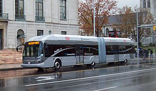
| 1,704 × 988 (310 KB) | GoddardRocket~commonswiki | {{Information |Description={{en|1=HealthLine Bus in Univeristy Circle (Corner of Euclid and Adelbert)}} |Source=Own work by uploader |Author= GoddardRocket |Date=10/27/2008 |Permission=I took this picture |other_versions= }} <!--{{I |
File usage
The following pages on the English Wikipedia use this file (pages on other projects are not listed):
Global file usage
The following other wikis use this file:
- Usage on es.wikipedia.org
- Usage on ja.wikipedia.org
- Usage on ko.wikipedia.org
- Usage on tr.wikipedia.org
- Usage on www.wikidata.org