
Size of this preview:
800 × 532 pixels. Other resolutions:
320 × 213 pixels |
640 × 425 pixels |
1,024 × 680 pixels |
1,252 × 832 pixels.
Original file (1,252 × 832 pixels, file size: 655 KB, MIME type: image/png)
| This is a file from the
Wikimedia Commons. Information from its
description page there is shown below. Commons is a freely licensed media file repository. You can help. |
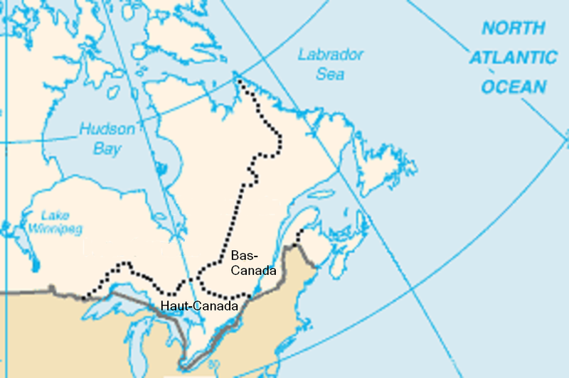
Image du Haut et du Bas-Canada lors de l'acte constitutionnel de 1791. Créée à partir d'une image de la CIA par Colocho
This image is in the
public domain because it contains materials that originally came from the United States
Central Intelligence Agency's
World Factbook.
|
 |
File history
Click on a date/time to view the file as it appeared at that time.
| Date/Time | Thumbnail | Dimensions | User | Comment | |
|---|---|---|---|---|---|
| current | 14:04, 18 July 2009 |
| 1,252 × 832 (655 KB) | Jeangagnon | fond |
| 13:54, 18 July 2009 |
 | 1,252 × 832 (655 KB) | Jeangagnon | Déplacement des mots: ''Haut-Canada'' et ''Bas-Canada'', pour mieux saisir l'emplacement exact. | |
| 02:46, 16 August 2005 |
 | 313 × 208 (21 KB) | Colocho | Image du Haut et du Bas-Canada lors de l'acte constitutionnel de 1791. Créée à partir d'une image de la CIA par Colocho {{PD-USGov-CIA-WF}} Category:Maps of Canada |
File usage
The following pages on the English Wikipedia use this file (pages on other projects are not listed):
Global file usage
The following other wikis use this file:
- Usage on az.wikipedia.org
- Usage on ca.wikipedia.org
- Usage on es.wikipedia.org
- Usage on fr.wikipedia.org
- Usage on it.wikipedia.org
- Usage on pl.wikipedia.org
- Usage on ro.wikipedia.org
- Usage on ru.wikipedia.org
- Usage on sv.wikipedia.org
- Usage on uk.wikipedia.org